
















September 14, 2004
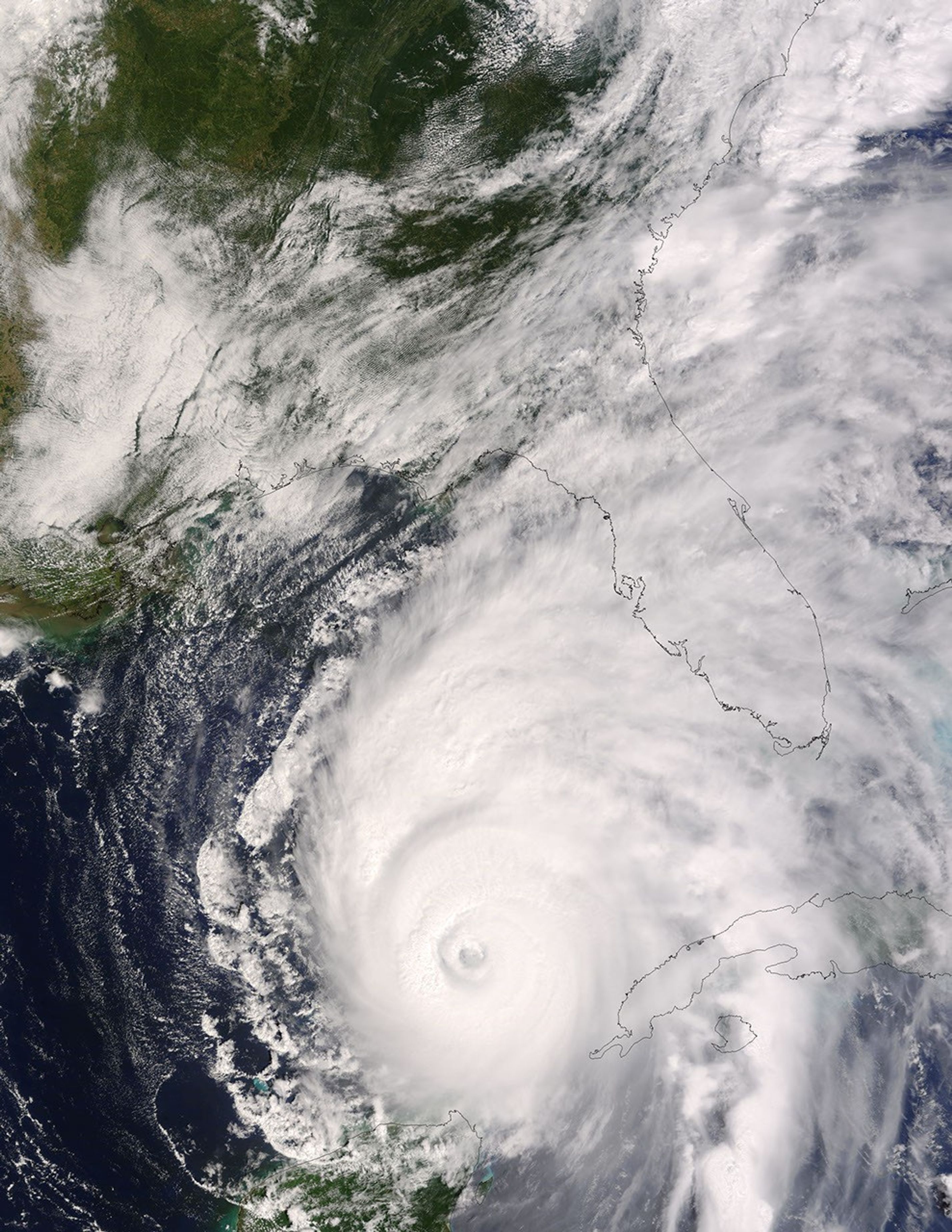
The MODIS instrument flying aboard NASA's Terra satellite captured this true-color image of Hurricane Ivan on September 14, 2004 at 16:35 UTC (12:35 PM EDT). At the time this image was taken Ivan was located approximately 405 miles south-southeast of the Mississippi River and was moving towards the north-northwest at 9 mph. Maximum sustained winds were near 140 mph with higher gusts. Hurricane warnings are expected to go up for portions of the Gulf Coast later today. The above image is available in multiple resolutions.
References & Resources
Image by Liam Gumley, Space Science and Engineering Center, University of Wisconsin-Madison