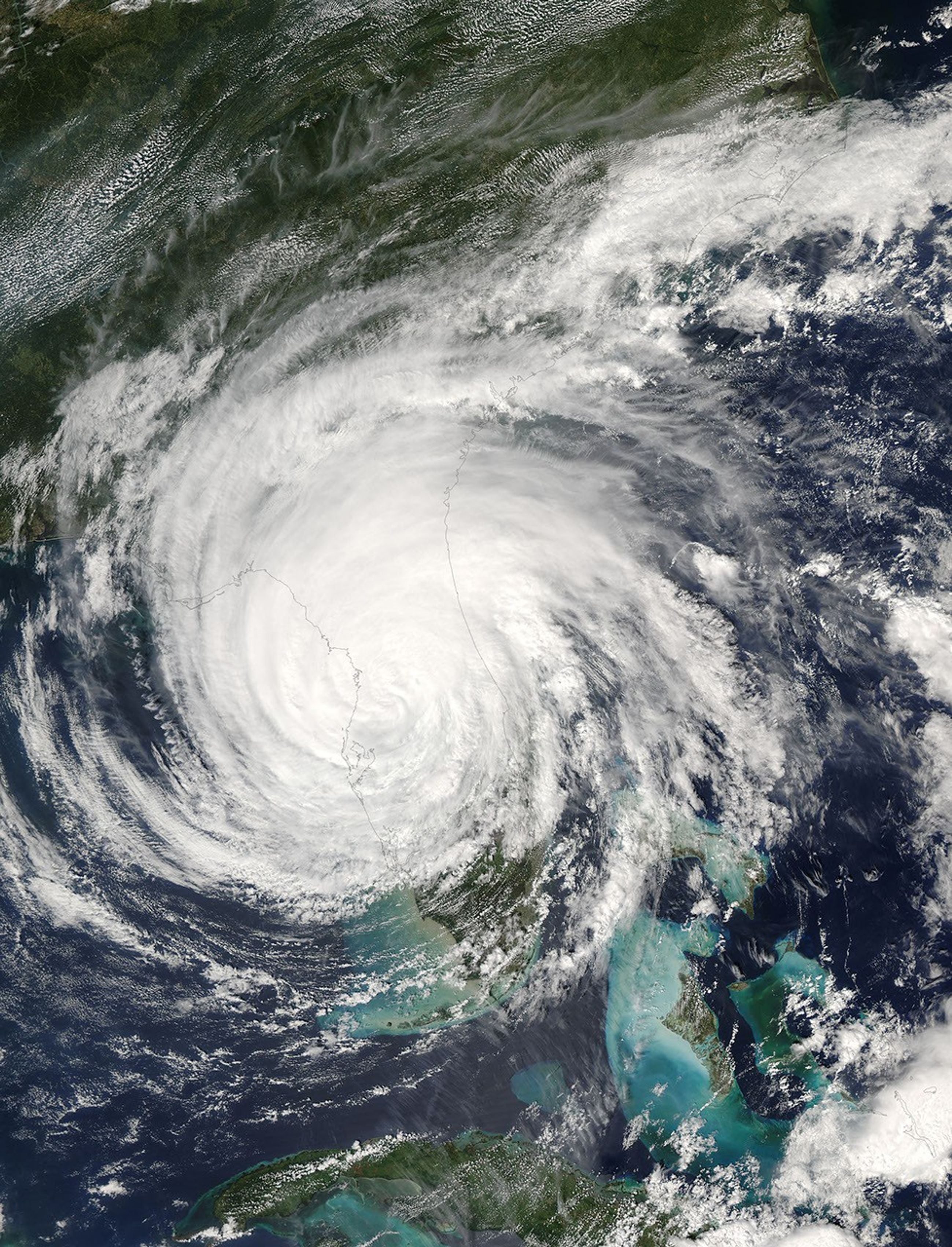
In the deep of night, as September 25 became September 26, 2004, Hurricane Jeanne began to move shore over Martin and St. Lucie counties in east central Florida. The storm packed winds of 185 kilometers per hour (115 mph) with stronger gusts. As the day wore on, Jeanne moved northwest across Florida, then arched north towards Georgia. When the Moderate Resolution Imaging Spectroradiometer (MODIS) on NASA’s Aqua satellite acquired this true color image at 12:35 p.m., EDT, the center of the storm was approaching Florida’s west coast near Crystal Bay. Jeanne was the fourth major hurricane (Category 3 or larger) to come ashore over Florida in the past six weeks.
The MODIS Rapid Response Team provides this image in additional resolutions.
References & Resources
NASA image courtesy Jacques Descloitres, MODIS Rapid Response Team at NASA GSFC