


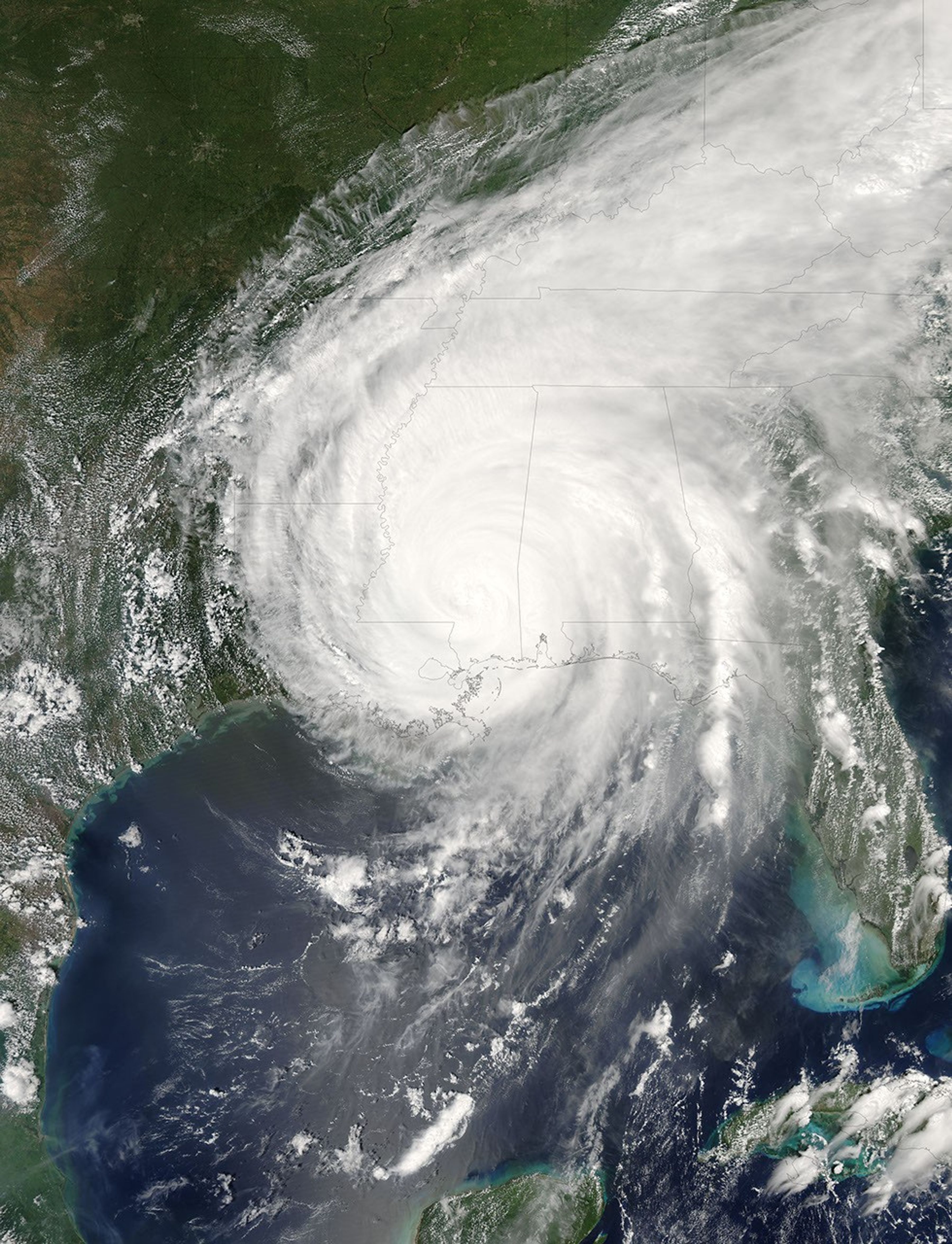
Hurricane Katrina was sprawled across all or part of 16 states at 2:15 p.m. CDT on August 29, 2005, when the Moderate Resolution Imaging Spectroradiometer (MODIS) on NASA’s Aqua satellite captured this image. After nearly eight hours over land, Katrina was still a Category 1 storm, with winds of 150 kilometers per hour (95 miles per hour) and stronger gusts. In this image, Katrina measures about 1,260 kilometers (780 miles) from east to west and about the same distance from north to south across its center. While most states under its clouds have only experienced rain so far, Louisiana, Mississippi, Alabama, and Florida have all been pummeled by furious winds, heavy rain, and a powerful storm surge. Katrina was a strong Category 3 storm when its eye moved ashore earlier in the day.
The large image provided above has a resolution of 500 meters per pixel. The MODIS Rapid Response Team provides the image in additional resolutions, including MODIS’ maximum resolution of 250 meters per pixel.
References & Resources
NASA image courtesy Jeff Schmaltz, MODIS Land Rapid Response Team at NASA GSFC


