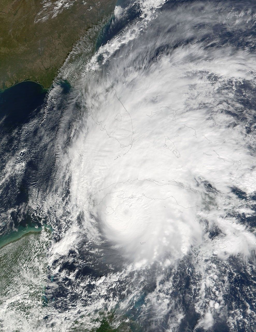
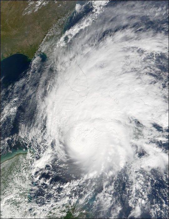
Hurricane Michelle made landfall in Cuba on Sunday, November 4, withsustained winds of 135 miles per hour. Cuban media reported that atleast 5 people died in the storm and more than 600,000 people wereevacuated, primarily in the Matanzas province near Pinar del Rio. Cubanofficials report severe damages to property and crops in the wake of thestorm.
This true-color image of Hurricane Michelle was acquired on November4 around 10:30 a.m. local time, just as the eye of the storm wasapproaching Cuba’s southwestern coast. The scene was captured by theModerate-resolution Imaging Spectroradiometer (MODIS), flying aboardNASA’s Terra satellite. The Sea-viewing Wide Field-of-view Sensor(SeaWiFS) also acquired a pair of scenes over the Gulf of Batabano,where the storm churned up a lot of sediment.
According to the National Weather Service, at 4 p.m. on November 5,Hurricane Michelle was located about 145 miles (230 km) east-northeastof Nassau in the Bahamas. The storm was moving away from the Bahamas aswas slowly weakening. At that time, its winds were about 75 miles perhour.
References & Resources
Image courtesy Jacques Descloitres, MODIS Land Rapid Response Team at NASA GSFC