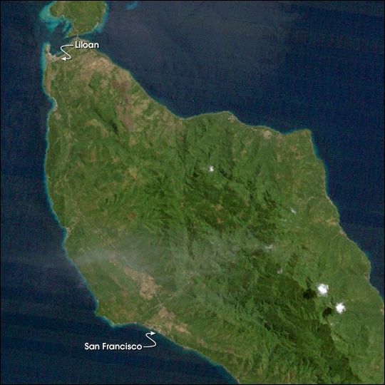
In mid-December of 2003, a series of landslides buried over 100 people in the Philippine province of Southern Leyte. Heavy rains saturated the soil on the region’s steep hillsides, which then collapsed, partially burying several towns. The majority of the victims were near Liloan and San Francisco. Local officials disagree on whether the slides were caused by illegal logging, rapid runoff from nearby coconut plantations, or solely the rain.
This image was acquired on June 29, 1992, by the Thematic Mapper instrument aboard NASA’s Landsat 5 satellite. Light areas in the image correspond to cleared land, green areas are vegetated, and the dark region (running from the center of the image to the lower right) is likely mature forest.
References & Resources
Image by Robert Simmon, based on data provided by the Global Land Cover Facility, University of Maryland.