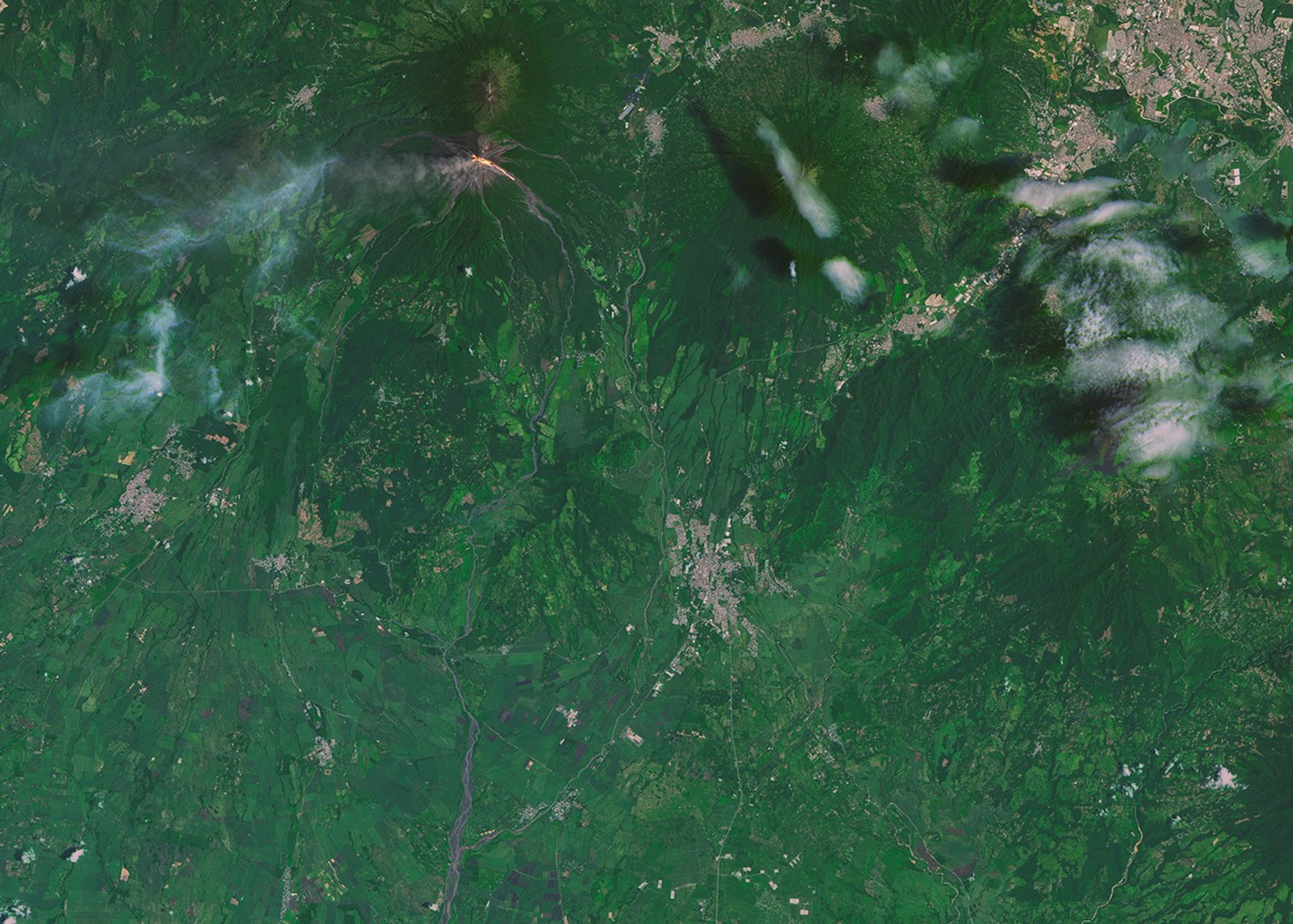

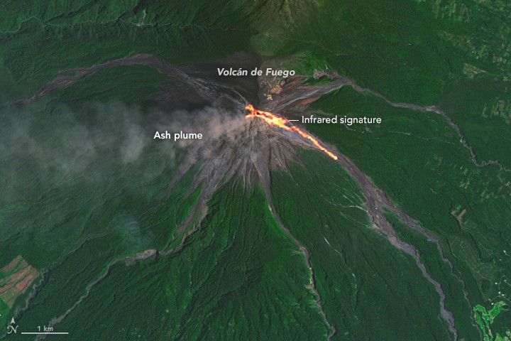
On September 7, 2016, the Operational Land Imager (OLI) on Landsat 8 captured this image of lava spilling down the slopes of Guatemala’s Volcán de Fuego, one of Central America’s most active volcanoes.
According to reporting from the Instituto Nacional de Sismologia, Vulcanologia, Meteorologia, e Hidrologia (INSIVUMEH), the latest bout of activity began on September 4, when lava rose as high as 200 meters (650 feet) above Fuego’s crater rim. Plumes of ash have reached heights of about 850 meters (2,800 feet).
The image is a composite of natural color (OLI bands 4-3-2) and shortwave Infrared (OLI band 7). Shortwave infrared light (SWIR) is invisible to the naked eye, but strong SWIR signals indicate increased temperatures.
The volcano is located about 70 kilometers (40 miles) west of Guatemala City, Guatemala.
References & Resources
- Global Volcanism Program (2016) Feugo. Accessed September 16, 2016.
- Volcano Discovery (2016, September 13) Fuego volcano (Guatemala). Accessed September 16, 2016.
- NASA Earth Observatory (2014, March 4) Why is that Forest Red and that Cloud Blue? How to Interpret a False-Color Satellite Image.
NASA Earth Observatory image by Joshua Stevens, using Landsat data from the U.S. Geological Survey . Thanks to Rüdiger Escobar Wolf for pointing out the image. Caption by Adam Voiland and Joshua Stevens.