


![Request for Information – Potential [Placeholder for Prize]](https://assets.science.nasa.gov/dynamicimage/assets/science/psd/solar/2023/09/s/solarsystem_0.jpg?w=1024)


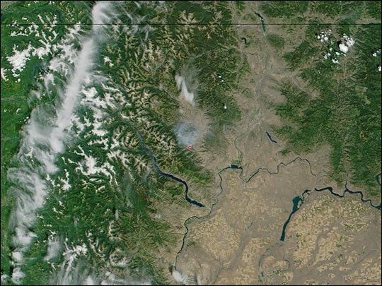
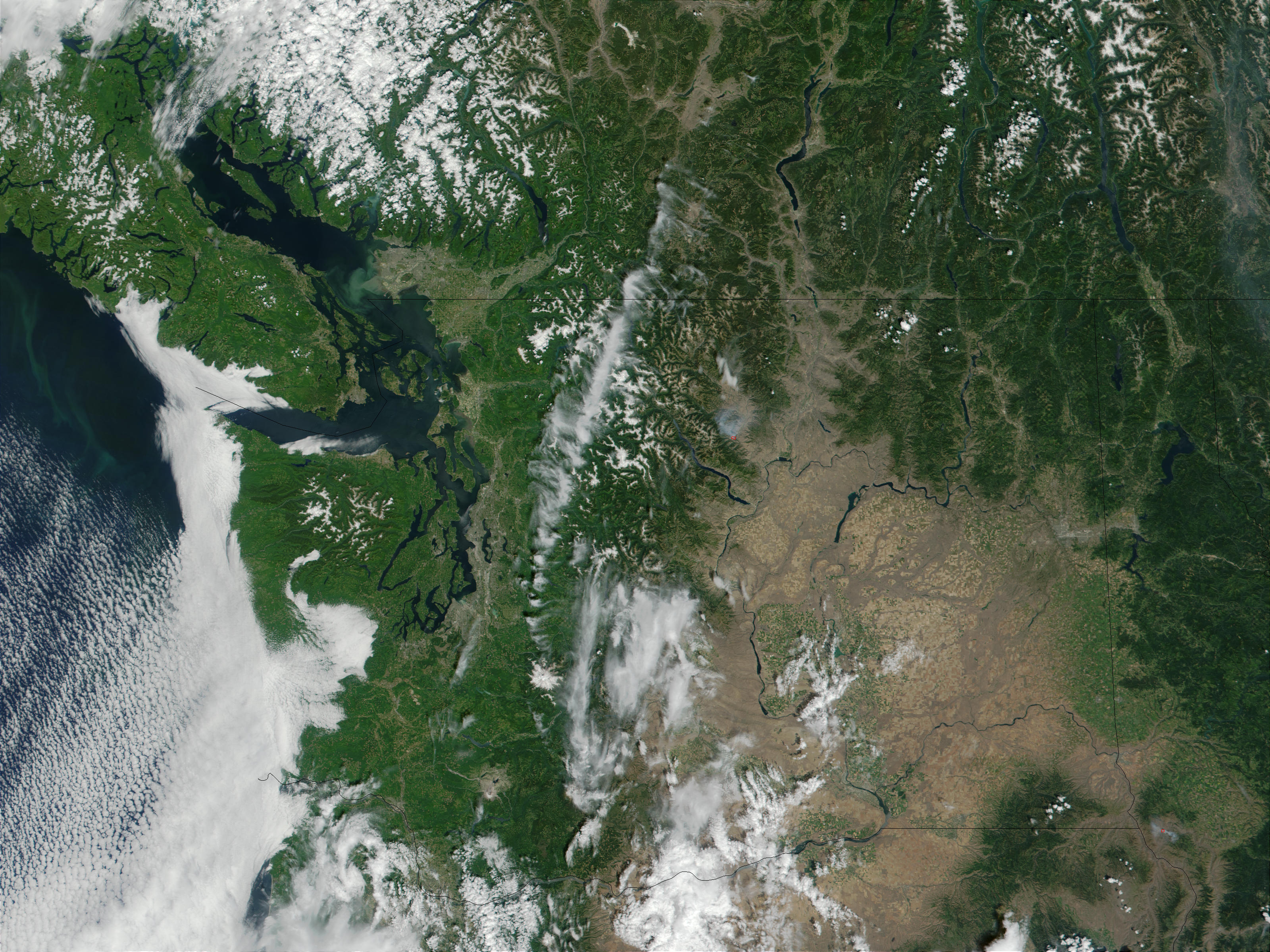
On July 9, 2001, a fire burned about 15 miles south of Twisp, Washington, that officials believe was caused by human error. NASA’s Moderate-resolution Imaging Spectroradiometer on the Terra satellite observed the fire, indicated with a red dot in this image, on July 10, after the fire had already consumed about 1,240 acres.
On July 10, another fire—called the Thirty Mile Fire—trapped 21 firefighters and 2 civilians in a narrow canyon in the Chewuch River Valley, north of Winthrop, WA. (That fire did not erupt until later in the day after this image was acquired and is therefore not visible.) Tragically, four firefighters were killed and six people were injured, including the two civilians. Rolling debris, rugged and steep terrain, and limited access are impeding efforts to contain the now 8,200-acre fire, which according to current fire incident reports, is completely uncontained.
Nearly all the areas in the full-size image, including Washington (center), Idaho (right), Oregon (bottom) are in a state of severe drought, which means the region could be in for another devastating fire season. Another fire is visible in Idaho in the full-size image just east of where Idaho borders with Washington and Oregon.
References & Resources
Image courtesy Jacques Descloitres, MODIS Land Rapid Response Team


