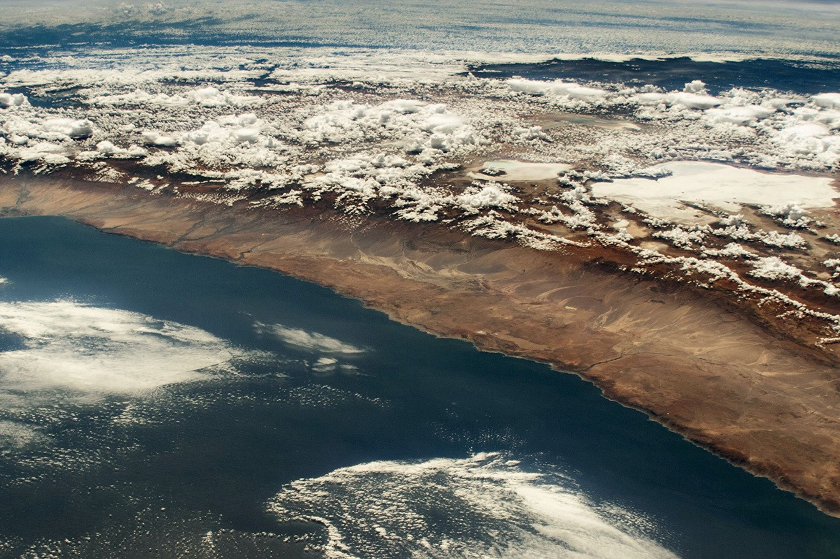

This oblique photograph of the Chilean Andes in South America was taken by an External High-Definition Camera (EHDC) on the International Space Station. These high-elevation mountains reach up to 6,962 meters (22,840 feet) above sea level (Mount Aconcagua) and serve as a natural border between Chile, Argentina, and Bolivia.
The Andes mountain chain causes a rain shadow effect that results in minimal precipitation in the Atacama region of Chile. This area—known as the Atacama Desert—is widely recognized as one of the driest places on Earth. Some areas of the Atacama are touched by rain only four times a century. Other areas have never received rainfall for as long as records have been kept.
Precipitation is more abundant toward the east, where moisture is carried by winds from the interior of South America toward the eastern slopes of the Andes. Notice the shift from the moist Amazon basin rainforest (dark green) at the top of the image to dry desert conditions (brown) approaching the coast.
The desert climate is conducive to the formation of salt flats, which are scattered throughout the landscape. Among them are Bolivia’s Coipasa and Uyuni Salt Flats (known as Salar de Coipasa and Salar de Uyuni). Uyuni is the world’s largest salt flat and spans about 9,600 square kilometers (3,700 square miles).
Uyuni and other Atacama salt flats contain high concentrations of minerals such as lithium, potassium, and magnesium in their brines. These brines are often mined for their minerals as resources for the medical, electronic, and renewable energy industries.
References & Resources
Astronaut photograph ISS069-E-65 was acquired on March 28, 2023, with a Nikon D4 digital camera using a focal length of 56 millimeters. It is provided by the ISS Crew Earth Observations Facility and the Earth Science and Remote Sensing Unit, Johnson Space Center. The image was taken by a member of the Expedition 69 crew. The image has been cropped and enhanced to improve contrast, and lens artifacts have been removed. The International Space Station Program supports the laboratory as part of the ISS National Lab to help astronauts take pictures of Earth that will be of the greatest value to scientists and the public, and to make those images freely available on the Internet. Additional images taken by astronauts and cosmonauts can be viewed at the NASA/JSC Gateway to Astronaut Photography of Earth. Caption by Amber Turner, Jacobs JETS Contract at NASA-JSC.