Suggested Searches

1 min read

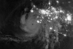
Low pressure off the northern California coast

Instruments:
2024-04-27 12:00:00
April 27, 2003

The Sea-viewing Wide Field-of-View Sensor (SeaWiFS), flying aboard the Orbview-2 satellite, captured this view of a massive low pressure system approaching the northern California coast. High winds, heavy rain, and significant snows (elevations above 6000 feet) are expected today as this strong storm spins onshore.

References & Resources

Provided by the SeaWiFS Project, NASA/Goddard Space Flight Center, and ORBIMAGE

You may also be interested in:

Stay up-to-date with the latest content from NASA as we explore the universe and discover more about our home planet.

Typhoon Jangmi
2 min read

The sprawling storm promised to deliver torrential rain across a wide swath of southern Japan.

Article
Tropical Storm Arthur
2 min read

The first named storm of the 2026 Atlantic hurricane season brought intense rainfall and the threat of flash flooding to…

Article
How the Tide Turns at the Mouth of the Elbe
4 min read

The ocean’s ebbs and flows reveal dynamic tidal flats and a well-traveled shipping route along the coast of Germany.

Article