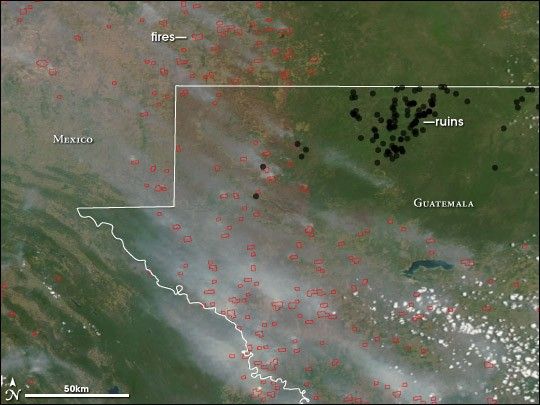
In the northeastern corner of Guatemala, ancient cities, mysteriously abandoned nearly 2,000 years ago, lie shrouded in green. The cities—El Mirador, Nakbe, Tintal, Wakna, Xulnal—are among the earliest major Mayan sites, and they contain some of the largest known Mayan structures. Once connected by a series of causeways, today, the cities and other ruins (black circles) are isolated in the largest remaining tract of virgin forest in Central America. Their isolation, however, may soon come to an end.
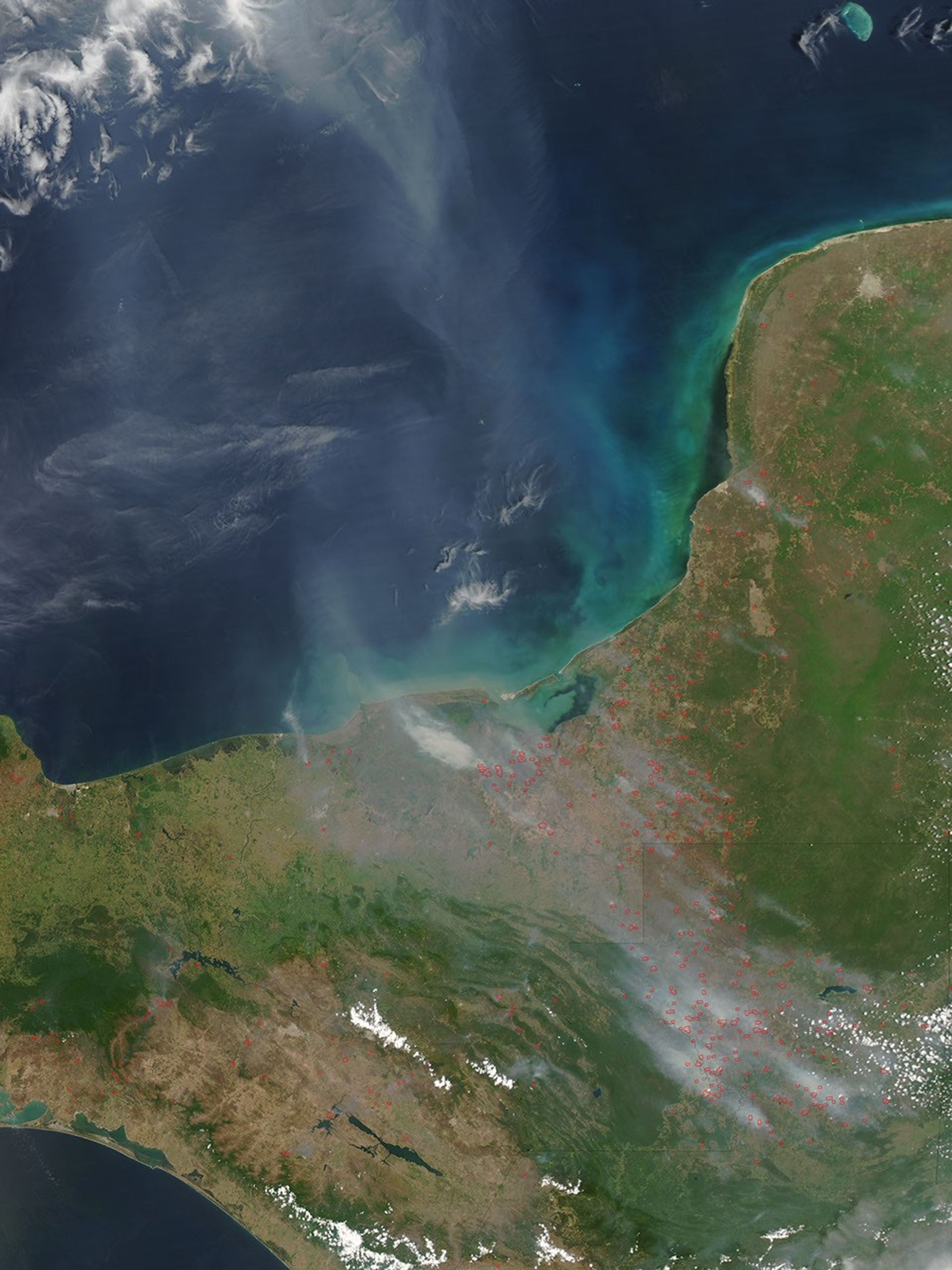
Clusters of fires, outlined in red, hem in the deep green Mirador Basin, where the ancient cities are located, in this photo-like image acquired by the Moderate Resolution Imaging Spectroradiometer (MODIS) on NASA’s Aqua satellite on April 10, 2005. Under the thick pall of smoke rising from the flames, the landscape is tan, stripped of the tropical forest that once covered it. By contrast, the forested Mirador Basin is dark green. The fires burn through forests as people clear the thick vegetation for ranching or farming. Sometimes fires in cropland or pastures spread accidentally into forests. Deforestation often happens when people follow logging roads into the forest; the roads provide access to previously remote areas. The areas that are not burning in the upper right side of this image are places where roads have not yet been built.
In 2002, Mayan expert Richard Hansen was studying the ancient cities when he first noticed the fires encroaching on the pristine basin. He began to track fires with daily MODIS images such as this one, and used them to mount a campaign to preserve the forest. He encourages local communities to develop facilities for ecotourism, which he argues has the potential to bring far more money into the local economy over the long term than logging and farming.
Hansen and colleagues at a conservation group called Global Heritage Fund keep tabs on fire activity near the Mirador Basin through email alerts from the MODIS-based Fire Information for Resource Management System at the University of Maryland. Whenever MODIS detects a fire near the basin, the group receives an email alert with the fire’s location, which they can send to local authorities. So far, fire has not touched the Mirador Basin, but fires in the surrounding areas keep Hansen and the Global Heritage Fund vigilant.
To read more about how MODIS fire alerts are being used to monitor the Mirador Basin, please see Fire Alerts Go Global and the accompanying feature article, Fire Alarms from Orbit,on the Earth Observatory.
References & Resources
NASA image by Jeff Schmaltz and Robert Simmon, based on data from MODIS Rapid Response and the Global Heritage Fund.