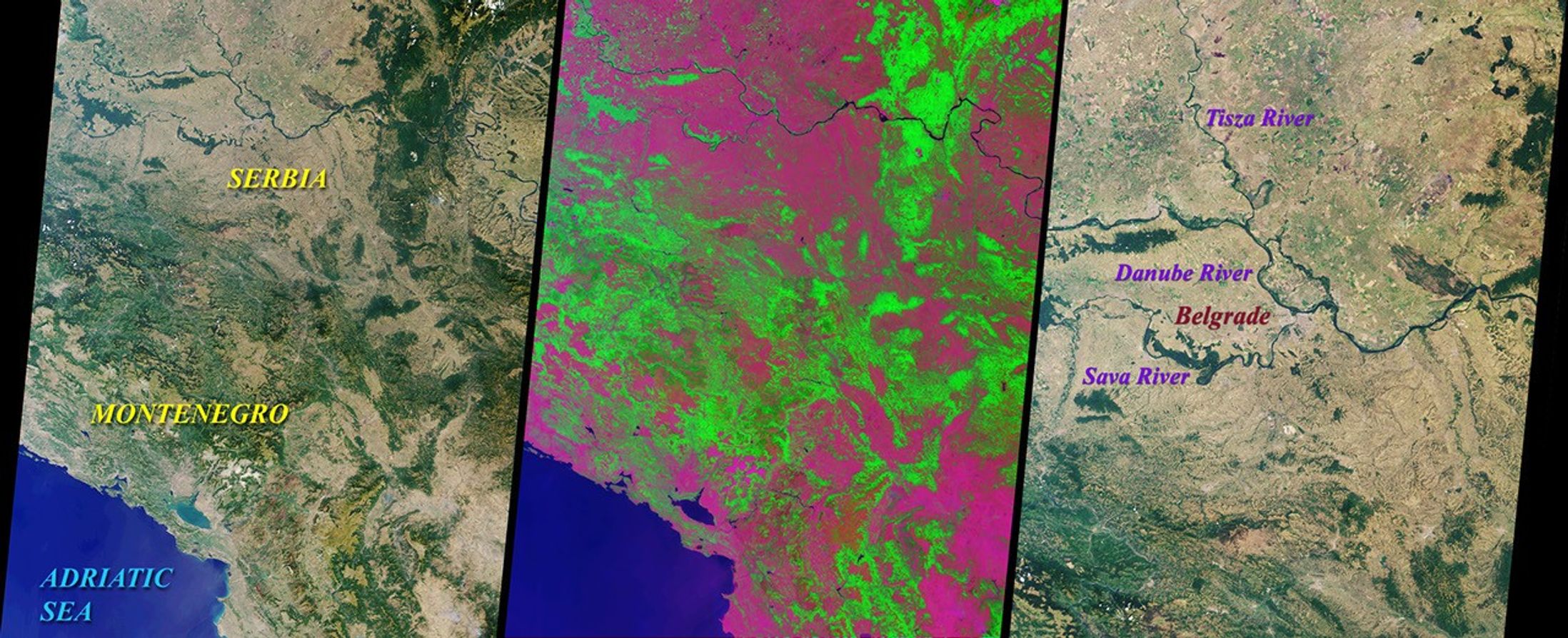

These Multi-angle Imaging Spectroradiometer (MISR) nadircamera images of Yugoslavia were acquired on July 28,2000 during Terra orbit 3248. On the upper left left is a 'true color' (blue,green, red) image. Vegetation, which covers much of the land area,appears green because chlorophyll molecules absorb more blue and redlight than green light. An independent method of detecting vegetation isto use the ratio of brightness in the near-infrared, where vegetation istypically bright as a result of reflection from the plants' cell walls,to the brightness in the red. In the upper right 'false color' image, thisratio has been substituted for the green band data, resulting in arepresentation that accentuates the land's vegetation.
Yugoslavia is comprised of the Republics of Serbia and Montenegro.Serbia is over six times larger than Montenegro, and together they coveran area roughly comparable to the state of Kentucky. The northern partof Serbia contains fertile plains and a temperate continental climate,with gradual transitions between the seasons. Montenegro is moremountainous, and can experience heavy snowfall during the cold winters.About 10 kilometers from the Adriatic coast is Lake Skadar, the largestlake in the Balkans. Two-thirds of this lake belongs to Montenegro andone-third to Albania.
The lower image is a higher resolution view of the region aroundthe Yugoslavian capital city of Belgrade, highlighting some of the majorrivers in the area. The international roads and railways passing throughYugoslavia's river valleys constitute the shortest link between Westernand Central Europe on the one side, and the Middle East, Asia, andAfrica on the other. Hence the geopolitical importance of this country'sterritory. The geopolitical changes throughout its history have putYugoslavia in the worldwide spotlight, culminating most recently in apopular uprising and a newly elected government.
References & Resources
NASA/GSFC/JPL, MISR Science Team.