


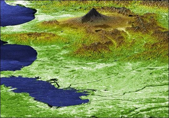
This Advanced Spaceborne Thermal Emission and Reflection Radiometer (ASTER)image of Mt. St. Helens volcano in Washington State was acquired onAugust 8, 2000 and covers an area of 37 by 51 km. Mount Saint Helens, avolcano in the Cascade Range of southwestern Washington that had beendormant since 1857, began to show signs of renewed activity in early1980. On 18 May 1980, it erupted with such violence that the top of themountain was blown off, spewing a cloud of ash and gases that rose to analtitude of 19 kilometers. The blast killed about 60 people anddestroyed all life in an area of some 180 square kilometers (some 70square miles), while a much larger area was covered with ash and debris.It continues to spit forth ash and steam intermittently. As a result ofthe eruption, the mountain's elevation decreased from 2,950 meters to2,549 meters.
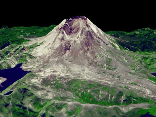
The simulated fly-over was produced by draping ASTERvisible and near infrared image data over a digital topography model,created from ASTER’s 3-D stereo bands. The color was computer enhancedto create a “natural” color image, where the vegetation appears green.The topography has been exaggerated 2 times to enhance the appearance ofthe relief.
Landsat7 aquired an image of Mt. St. Helens on August 22, 1999.
References & Resources
Image and animation courtesy NASA/GSFC/MITI/ERSDAC/JAROS, and U.S./Japan ASTER Science Team.


