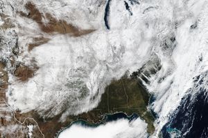
A slow moving winter storm settled over the northeastern UnitedStates Sunday evening (March 4, 2001), merging one system that broughtplenty of moist air from the Gulf of Mexico with another system thatbrought frigid temperatures southward from Canada. Today (March 5)these merging systems formed a low-pressure trough off the New Jerseycoast, drawing in a new influx of moisture from the Atlantic andsweeping it inland in a large-scale counter-clockwise pattern, thusintensifying the strength of the storm. Officials across all NewEngland states are now braced for what could become a major winterstorm, dumping as much as 2 feet of snow in some areas over the next 48hours.
This false-color composite image shows the western half of the winterstorm over the northeastern United States. This scene was acquired at11:46 a.m. EST today (March 5) by the Moderate-resolution ImagingSpectroradiometer (MODIS), flying aboard NASA's Terra spacecraft, andprocessed by the University of Wisconsin-Madison's MODIS directbroadcast receiving facility. In this scene, there appears to be coldair moving in from the northwest, as the system as a whole moves towardthe northeast while being fed with moisture and energy from the AtlanticOcean. The feature in the top center of the image appears to be a largejet of moisture wrapping around the back side of the storm system.
At visible wavelengths of light (e.g., 0.66 microns), snow cover isas bright as clouds and is therefore difficult to distinguish from cloudcover. However, at near-infrared wavelengths (e.g., 1.6 microns), snowcover absorbs sunlight and therefore appears much darker than clouds.This allows MODIS to discriminate between snow cover and clouds veryeffectively. In this scene, land surfaces are green, water surfaces areblack, snow cover is red, and clouds are white. Those clouds thatcontain a significant fraction of ice and snow particles appear pinkishand progressively more red the greater the snow and ice content.
References & Resources
Image courtesy Liam Gumley, MODIS Atmosphere Team, University of Wisconsin-Madison Cooperative Institute for Meteorological Satellite Studies

