Suggested Searches

1 min read

Pacaya Volcano

Instruments:
Topics:
2014-03-02 00:00:00
March 2, 2014

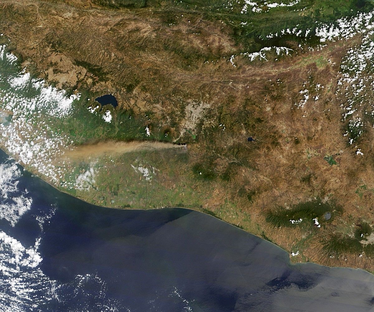
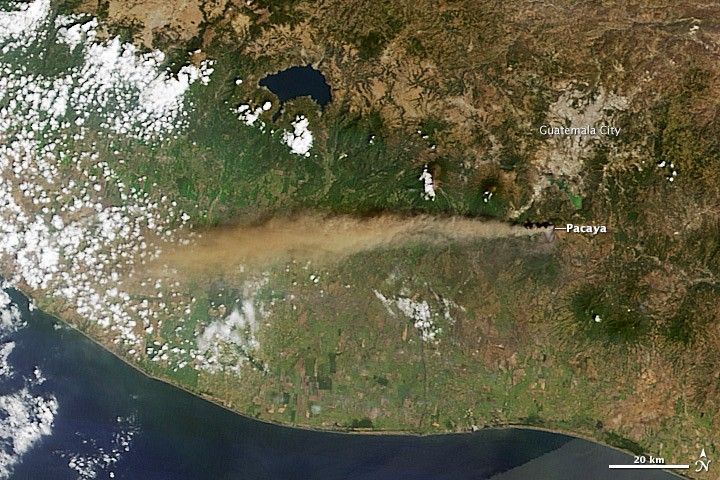
Pacaya Volcano, about 25 kilometers (16 miles) from the center of Guatemala City, erupted on March 2, 2014. This natural-color satellite image was collected on the morning of the eruption by the Moderate Resolution Imaging Spectroradiometer (MODIS) aboard the Terra satellite.

References & Resources

NASA image courtesy Jeff Schmaltz LANCE/EOSDIS MODIS Rapid Response Team, GSFC. Caption by Robert Simmon.

You may also be interested in:

Stay up-to-date with the latest content from NASA as we explore the universe and discover more about our home planet.

Hayli Gubbi’s Explosive First Impression
4 min read

In its first documented eruption, the Ethiopian volcano sent a plume of gas and ash drifting across continents.

Article
More Lava Fills Kilauea Crater
2 min read

The latest in a string of episodic eruptions produced voluminous fiery flows at the Hawaiian volcano’s summit.

Article
Krasheninnikova Remains Restless
3 min read

The volcano on Russia’s Kamchatka Peninsula continues to erupt after centuries of quiescence.

Article