


large images:
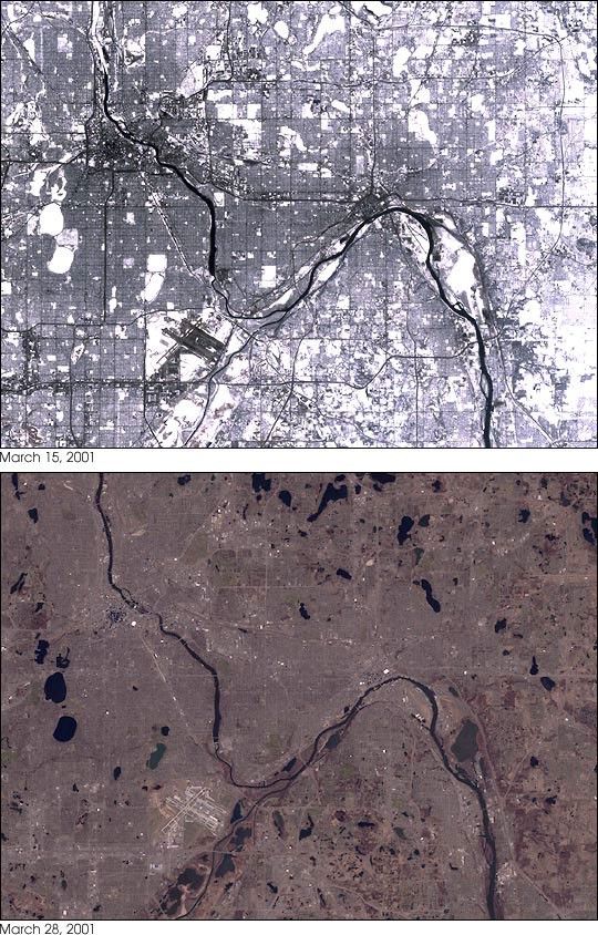
March 15, 2001
March 28, 2000
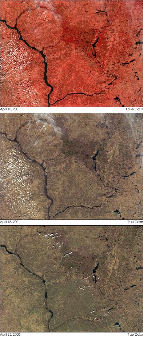
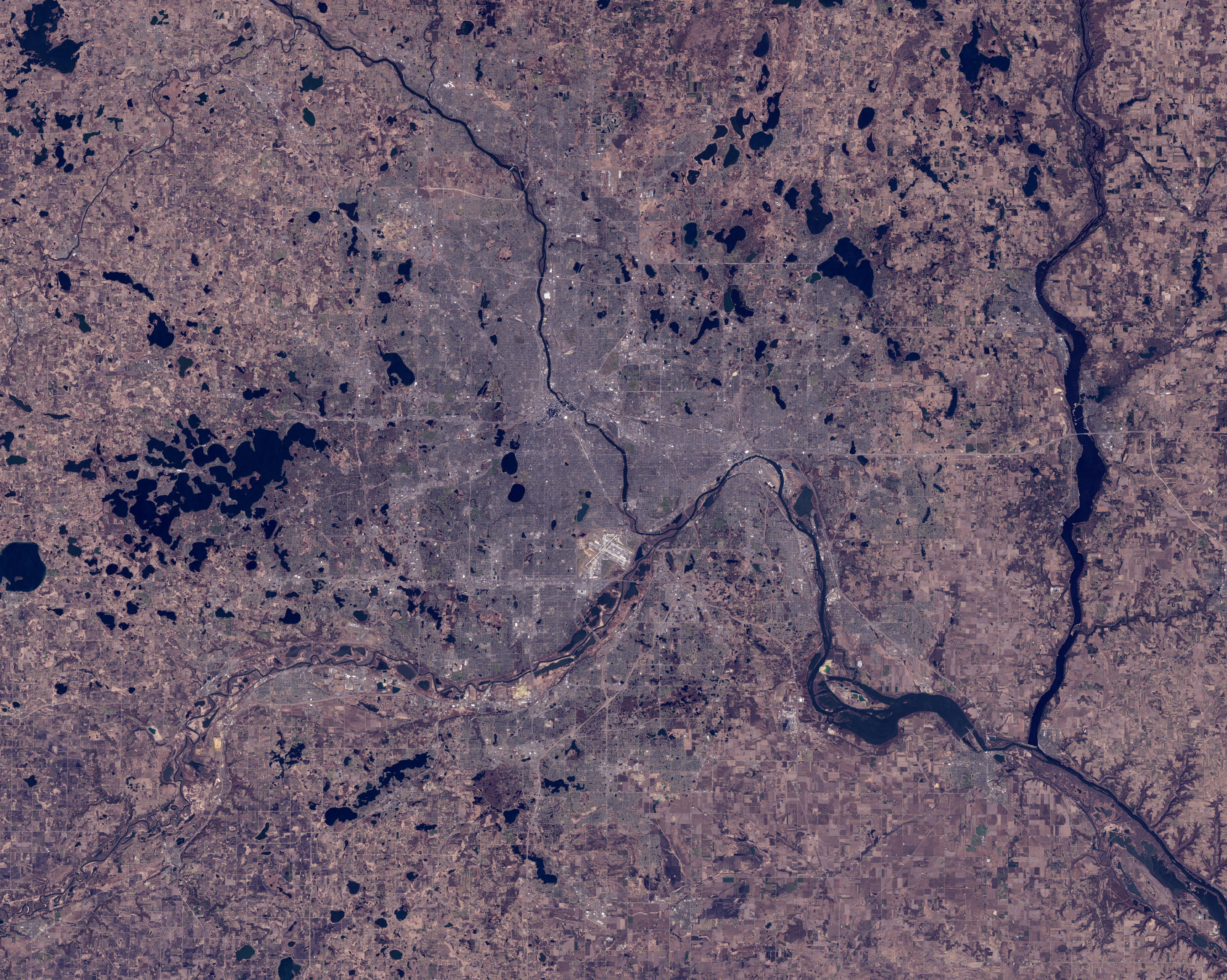
The recent (April 2001) flooding along the MississippiRiver in the Upper Midwest was partially due to an unusualamount of spring snow cover. The pair of images above showthe cities of Minneapolis and St. Paul, Minnesota in March of2001 (top) and 2000 (bottom). Taken by the Enhanced ThematicMapper Plus aboard NASA's Landsat satellite, the large imagesshow details as small as 30 meters across. In the spring of2001 melting snow saturated the ground with water, so thewater from a series of rainstorms quickly ran off, swellingthe Mississippi and its tributaries. As a result citiessuch as Minneapolis, Minnesota, La Crosse, Wisconsin, and Davenport,Iowa experienced near-record floods.
References & Resources
Image courtesy EROS Data Center and the Landsat 7 science team.
None


