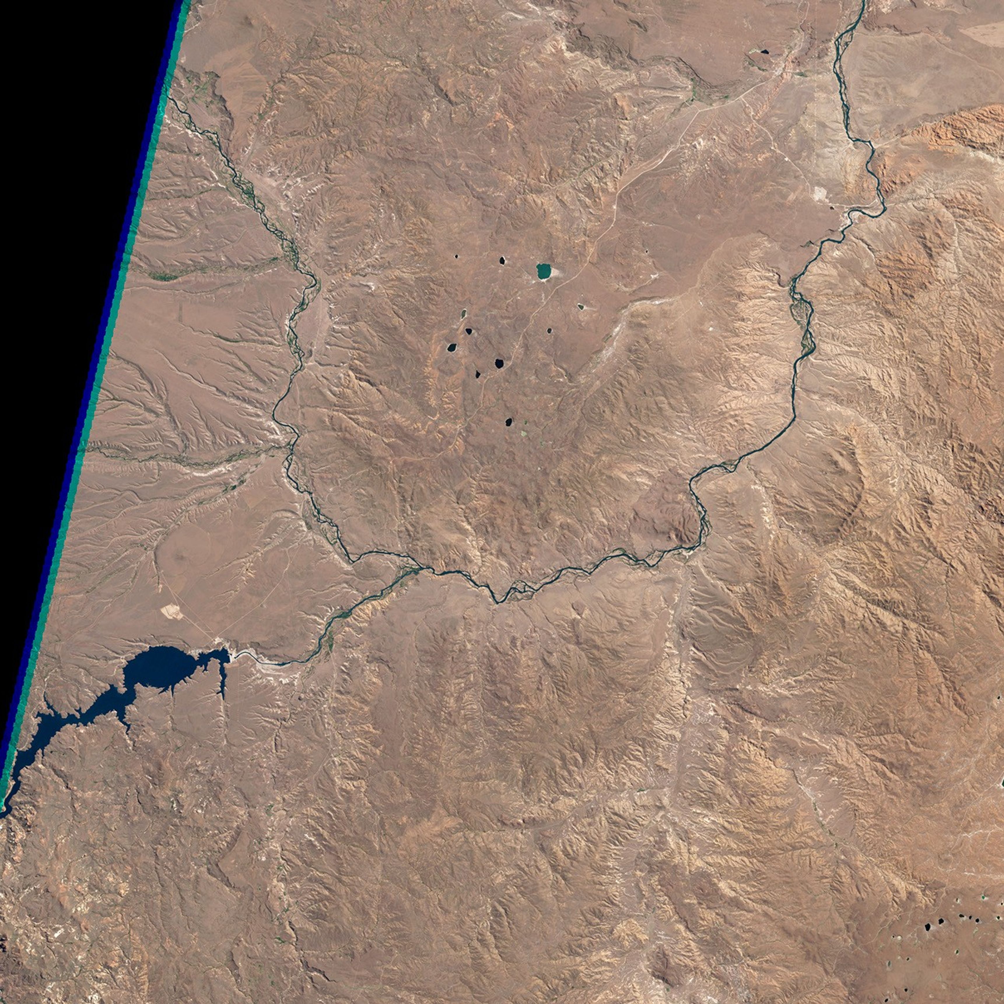

October 29, 1986
Piedra del Águila Dam Reshapes the Limay River
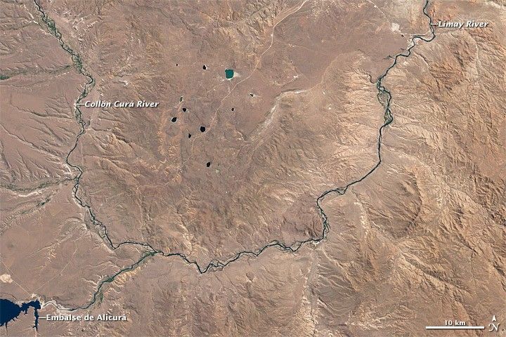
The Limay River originates at the eastern end of Nahuel Huapi Lake and flows northeastward through Argentina until it joins the Río Negro. Human intervention has significantly reshaped the Limay River over the past few decades, namely through the construction of dams such as Piedra del Águila (“Stone of the Eagle”).
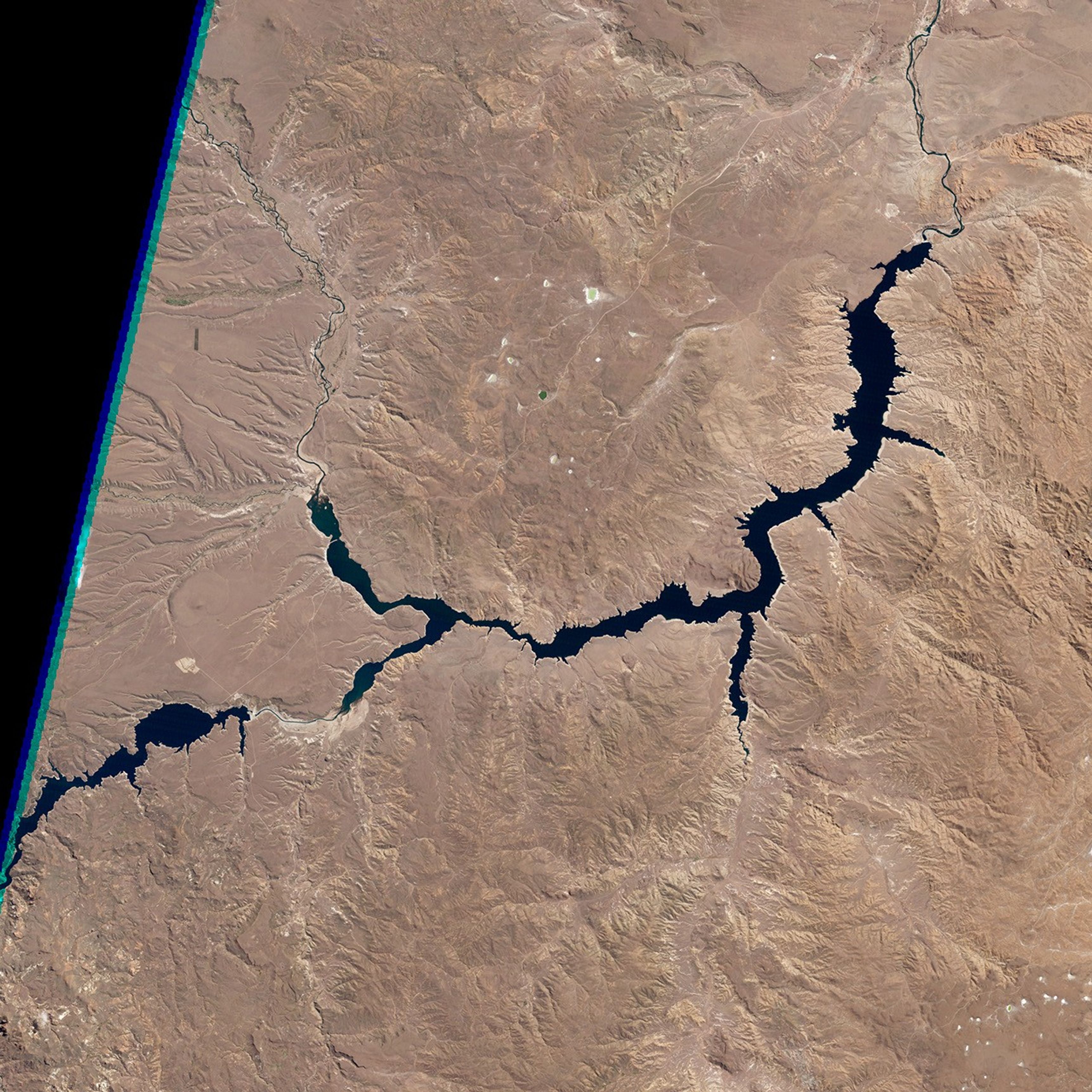
Acquired by the Thematic Mapper on the Landsat 5 satellite, these natural-color images compare the Limay River before and after completion of the dam. The top image shows the region on October 29, 1986, and the bottom image shows the same region on October 14, 1998. The manmade Piedra del Águila Reservoir covers roughly 300 square kilometers (100 square miles) and extends partway up the tributaries feeding the Limay River, including the Collón Curá River.
The dam generates roughly 24 percent of Argentina’s hydroelectric energy, according to a 2012 study. The creation of the dam and reservoir did, however, have an effect on the indigenous Mapuche Indians. About 150 of the 500 people living in the Pilquiniyeu del Limay reservation had to relocate their homes.
The ecosystem surrounding Piedra del Águila Reservoir is arid—a scrubby steppe shaped by dry weather and wind. A study published in 2007 suggested that water might become even more scarce in a warming climate. The analysis found that warming temperatures could decrease precipitation along the Limay watershed, reducing stream flow and available hydropower. Water stored in regional snow and ice cover might buffer the effects.
References & Resources
- Bartolome, L.J., Danklmaier, C.M. (2012) Hydrodevelopment and population displacement in Argentina. Impacts of Large Dams: A Global Assessment, 123–152.
- Inter-American Development Bank. (1980) Limay River Hydroelectric Studies. AidData. Accessed August 10, 2012.
- Mazzoni, E., Rabassa, J.O. (2007) Volcanic landscapes of Patagonia: A geomorphological map of the Piedra del Águila volcanic plateau, Province of Neuquén, Argentina. Journal of Maps, 3(1), 311–322.
- Seoane, R., López, P. (2007) Assessing the effects of climate change on the hydrological regime of the Limay River basin. Geojournal, 70(4), 251–256.
- World Lake Database. (1999) Piedra del Águila Reservoir. International Lake Environment Committee Foundation. Accessed August 10, 2012.
NASA Earth Observatory image created by Robert Simmon, using Landsat data provided by the United States Geological Survey. Caption by Michon Scott.