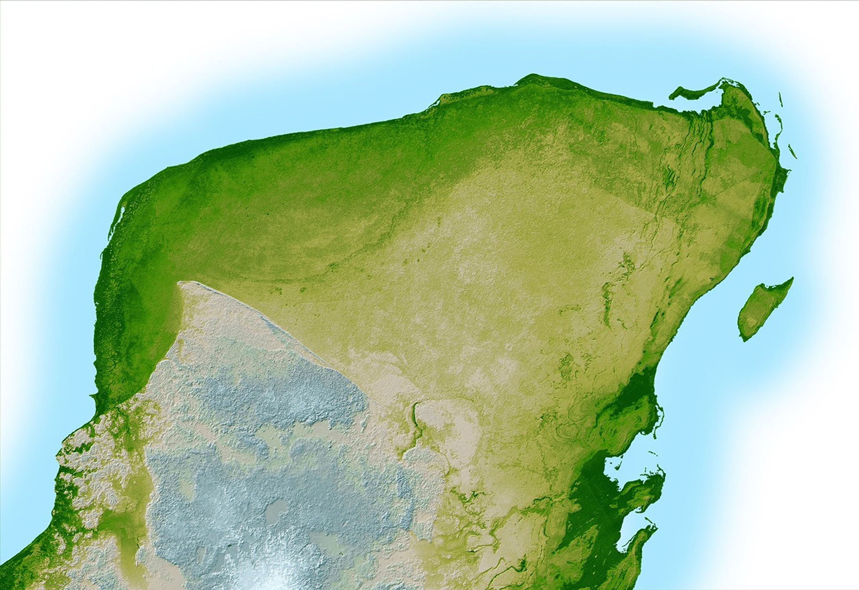
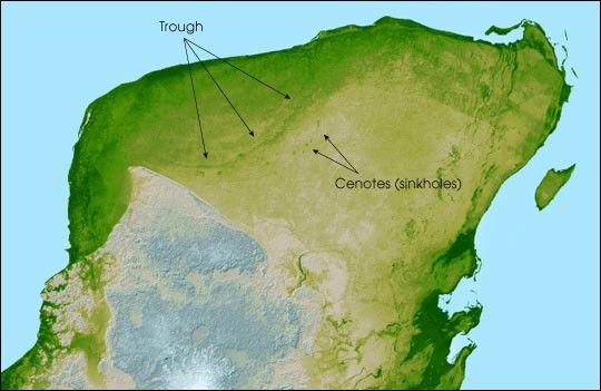
This shaded relief image of Mexico’s Yucatan Peninsula show asubtle, but unmistakable, indication of the Chicxulub impact crater.Most scientists now agree that this impact was the cause of theCretaceous-Tertiary Extinction, the event 65 million years ago thatmarked the sudden extinction of the dinosaurs as well as the majority oflife then on Earth.
Most of the peninsula is visible here, along with the island ofCozumel off the east coast. The Yucatan is a plateau composed mostly oflimestone and is an area of very low relief with elevations varying byless than a few hundred meters (about 500 feet.) In thiscomputer-enhanced image the topography has been greatly exaggerated tohighlight a semicircular trough, the darker green arcing line at theupper left corner of the peninsula. This trough is only about 3 to 5meters (10 to 15 feet) deep and is about 5 km. wide (3 miles), so subtlethat if you walked across it you probably would not notice it, and is asurface expression of the crater’s outer boundary. Scientists believethe impact, which was centered just off the coast in the Caribbean,altered the subsurface rocks such that the overlying limestonesediments, which formed later and erode very easily, wouldpreferentially erode on the vicinity of the crater rim. This formed thetrough as well as numerous sinkholes (called cenotes) which are visibleas small circular depressions.
Two visualization methods were combined to produce the image: shadingand color coding of topographic height. The shade image was derived bycomputing topographic slope in the northwest-southeast direction, sothat northwestern slopes appear bright and southeastern slopes appeardark. Color coding is directly related to topographic height, with greenat the lower elevations, rising through yellow and tan, to white at thehighest elevations.
Location: 20.8 degrees North latitude, 89.3 degrees West longitude
Orientation: North toward the top, Mercator projection
Image Data: shaded and colored SRTM elevation model
Original Data Resolution: SRTM 1 arcsecond (about 30 meters or 98 feet)
Date Acquired: February 2000
References & Resources
Image Courtesy SRTM Team NASA/JPL/NIMA