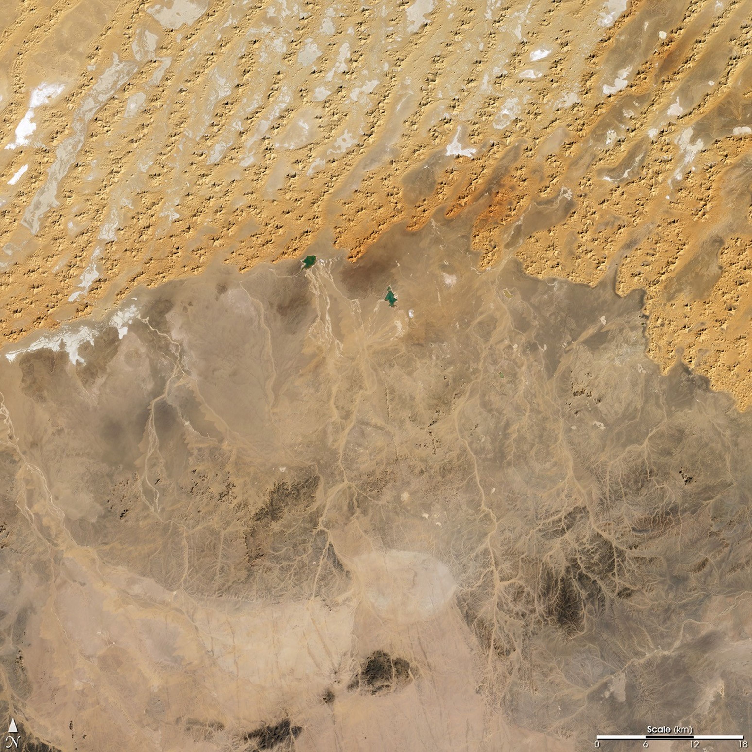
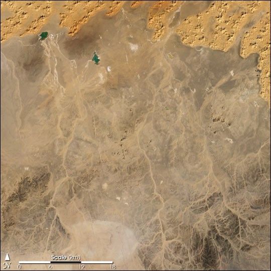
The Sahara Desert covers most of the North African country of Algeria.Rainfall is scarce, and it comes and goes rapidly, flowing through channelscalled wadis. When dry, as they are in this true-color Landsat ThematicMapper image from January 1, 1987, the wadis are revealed as pale tracingsacross the darker brown and gray shades of the desert landscape. In manycases, these wadis end in small pools which have no outlet. The water flowsin from the wadis and gradually evaporates, leaving behind salts and other minerals which appear white in this image. At the upper leftof the image, a few pools of bright blue-green water are hanging on despitethe aridity, their greenish color probably due to high salt and mineralcontent, or perhaps the growth of algae.
Wadis are prime breeding locations for populations of the desert locust,which inhabits vast desert areas across northern Africa, Arabia andsouthwest Asia. Moisture initiates the hatching of the locusts’ eggsand also brings a bloom of fresh vegetation, which provides food and a placefor the insects to hide from predators. Normally, the locust prefers asolitary existence, but when suitable habitat is confined to small areas,such as narrow wadis, large numbers of locusts may be forced to congregate.Close physical contact flips a biological switch in the locusts’metabolism and behavior that makes them more tolerant of each other andenhances swarming. Locust swarms can migrate hundreds of miles and devourall vegetation in their path. Monitoring desert habitat for changes invegetation using satellite data gives scientists the opportunity toanticipate where swarms might be forming and to direct ground-based surveycrews with increased efficiency.
References & Resources
(Image by Robert Simmon, NASA GSFC, based on Landsat Thematic Mapper data archived by the Global Land Cover Facility )