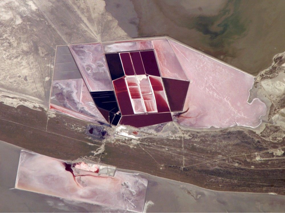
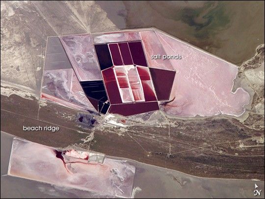
This detailed astronaut photograph shows the salt ponds of one of Africa’s major producers of soda ash (sodium carbonate) and salt. Soda ash is used for making glass, in metallurgy, in the detergent industry, and in chemical manufacture. The image shows a small part of the great salt flats of central Botswana known as the Makgadikgadi Salt Pans. The soda ash and salt are mainly exported (since 1989) to countries in southern and central Africa. Salt water from just beneath the pan floor is evaporated to produce the soda ash and salt—a process for which the semiarid climate of Botswana is ideal. Red, salt-loving algae in the ponds indicate that the salinity of the evaporating water is medium to high.
The salt pans of Botswana—an easily recognizable visual feature for astronauts aboard the ISS—lie at the low point of a vast, shallow continental basin. Rivers draining from as far away as central Angola, more than 1000 kilometers (621 miles) away, supply water to the pans. During several wet climatic phases in the recent geological past, the pans were filled with water for thousands of years, only to dry out when climates fluctuated to drier conditions. During dry phases, water only reaches the pans underground. This underground, salty water supports the ash and salt industry. During wet phases, when open water exists, waves build up beach ridges. One of these ridges crosses the lower part of the view.
Additional astronaut imagery shows another prominent set of salt ponds, near the Dead Sea.
References & Resources
The featured astronaut photograph ISS014-E-15732 was acquired March 1, 2007, with a Kodak 760C digital camera using an 800 mm lens, and is provided by the ISS Crew Earth Observations experiment and the Image Science & Analysis Laboratory, Johnson Space Center. The image in this article has been cropped and enhanced to improve contrast. The International Space Station Program supports the laboratory to help astronauts take pictures of Earth that will be of the greatest value to scientists and the public, and to make those images freely available on the Internet. Additional images taken by astronauts and cosmonauts can be viewed at the NASA/JSC Gateway to Astronaut Photography of Earth.