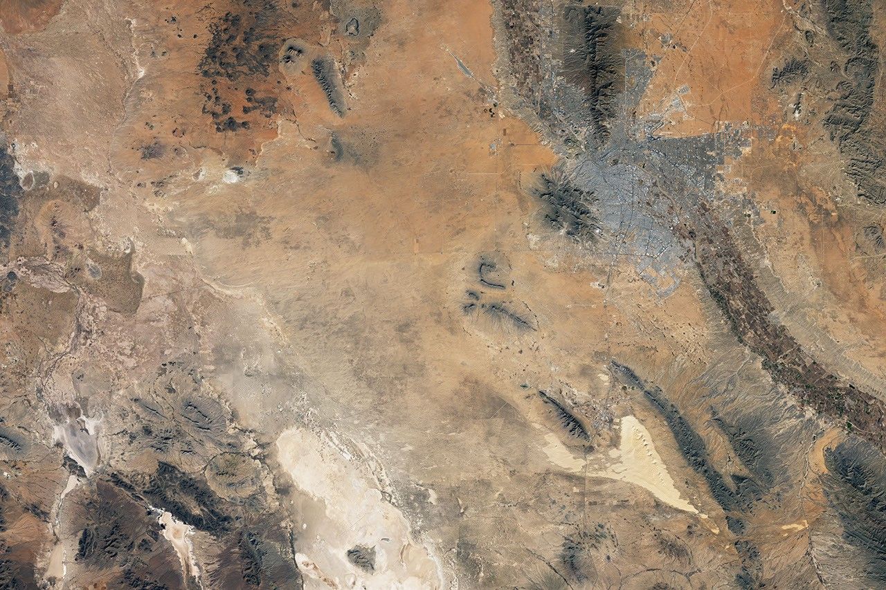
When sheets of ice spread across North America during the Pleistocene Epoch, many pluvial lakes formed well beyond the edge of the ice sheets. Lake Bonneville in northern Utah and Lake Lahontan in northern Nevada are the largest and most famous examples, but pluvial lakes covered landscapes much farther to south, in areas that are now quite dry.
spread across 9,000 square kilometers (3,500 square miles) of what is now the Chihuahua desert in northern Mexico. Like other pluvial lakes, it dried up as the climate changed and the ice retreated during
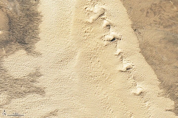
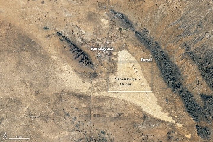
. Yet evidence of its sandy shoreline remains today as the Samalayuca dune field.
The Operational Land Imager (OLI) on Landsat 8 acquired this image of the area on January 27, 2018. The sand, almost pure silica, was originally deposited by the Rio Grande when the river used to flow into the prehistoric lake. More recently, winds have pushed the sand eastward to its present location near the town of Samalayuca.
The dune field has long been an imposing barrier for people traveling the trade route from Santa Fe to Mexico City. During the Mexican-American war, Colonel Alexander Doniphan reported several deaths as troops and mules regularly sank waist-deep into the white sand. John Russell Bartlett, commissioner of the United States and Mexican Boundary Survey, barely made it across with his team of geographers in 1850, despite devoting 12 to 15 oxen to each wagon.
More recently, the dunes have become a place of recreation for people from nearby Ciudad Juárez. Outdoor adventurers like the area for sand surfing and driving all-terrain vehicles on the dunes.
The dune field also has attracted the interest of sand mining interests. With silica-content of 90 to 95 percent, Samalayuca’s sand is nearly pure enough to be used by the glass and ceramics industries, though it would need to be treated to achieve a purity of 98 percent for many applications.
References & Resources
- American Ceramic Society Use of Samalayuca Dune Sand on Glass and Ceramics Processes. Accessed March 22, 2018.
- BBC (2018, January 7) Samalayuca dunes: From no-go area to hot destination. Accessed March 22, 2018.
- Dominguez, M. (2008) Geomorphology of the Samalayuca Dunes Northern Chihuahua, Mexico. Accessed March 22, 2018.
- Reeves, C. (1969) Pluvial Lake Palomas, Northwestern Chihuahua, Mexico and Pleistocene Geologic History of South-Central New Mexico. Accessed March 22, 2018.
- Schmidt, R. & Marston, R. (1981) Los medanos de Samalayuca, Chihuahua, Mexcio. Accessed March 22, 2018.
- ThoughtCo (2017, March 7) Pluvial Lakes. Accessed March 22, 2018.
NASA Earth Observatory images by Joshua Stevens, using Landsat data from the U.S. Geological Survey . Story by Adam Voiland.