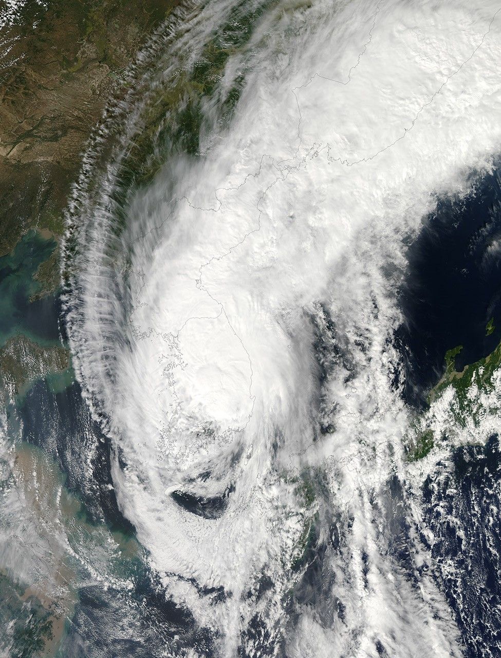
When Sanba made landfall in South Korea on September 17, 2012, it brought heavy rains and high winds, downed power lines, grounded hundreds of flights, and halted ferry services. One person was killed and another was injured in landslides caused by the storm.
The Moderate Resolution Imaging Spectroradiometer (MODIS) on NASA’s Aqua satellite captured this natural-color image on September 17, when Sanba’s clouds engulfed the Korean Peninsula. The same day, the U.S. Navy’s Joint Typhoon Warning Center reported that the storm’s sustained winds had dropped to 45 knots (85 kilometers per hour). The projected storm track showed Sanba continuing to move toward the China-Russia border.
References & Resources
- Joint Typhoon Warning Center. (2012, September 17) Super Typhoon 17W (Sanba) Warning. [Online] URL: http://www.usno.navy.mil/NOOC/nmfc-ph/RSS/jtwc/warnings/wp1712web.txt. Accessed September 17, 2012.
- Park, S. (2012, September 17) Typhoon Sanba grounds flights, disrupts power in South Korea. Bloomberg. Accessed September 17, 2012.
- Unisys Weather. (2012, September 17) Sanba Tracking Information. Accessed September 17, 2012.
NASA image courtesy Jeff Schmaltz, LANCE MODIS Rapid Response Team at NASA GSFC. Caption by Michon Scott.