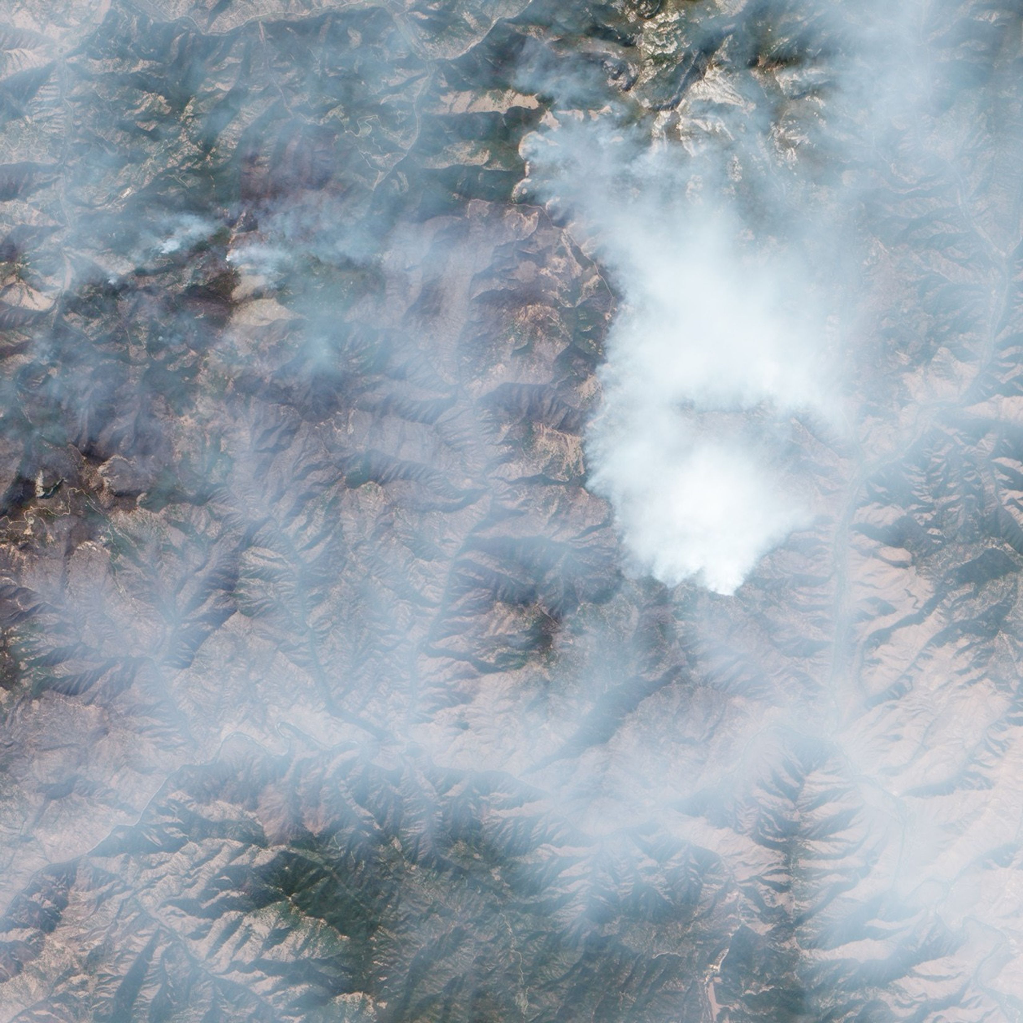
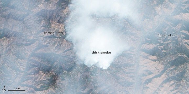
Severe wildfires can create clouds of smoke so thick that they are hard to see through even with satellite sensors. That’s the kind of visibility problem that residents of Salmon, Idaho, and other towns faced in the summer of 2012 while living downwind of the large Mustang Complex fire in Salmon-Challis and Bitterroot National Forests.
Sparked by lightning on July 30, 2012, the Mustang Complex was just one of numerous wildfires burning through dense stands of ponderosa pine forests in central Idaho in September. At times, the smoke was so heavy that authorities were forced to close roads because of poor visibility.
This natural-color image (top) of the Mustang Complex fire, which is based on data from the visible portion of the electromagnetic spectrum, is a good example of how thick smoke can obscure a satellite’s view of the surface. The image was acquired on September 18, 2012, by the Advanced Land Imager (ALI) on NASA’s Earth Observing 1 (EO-1) satellite. It shows thick smoke near the fire’s flaming front that completely conceals the rugged terrain below.
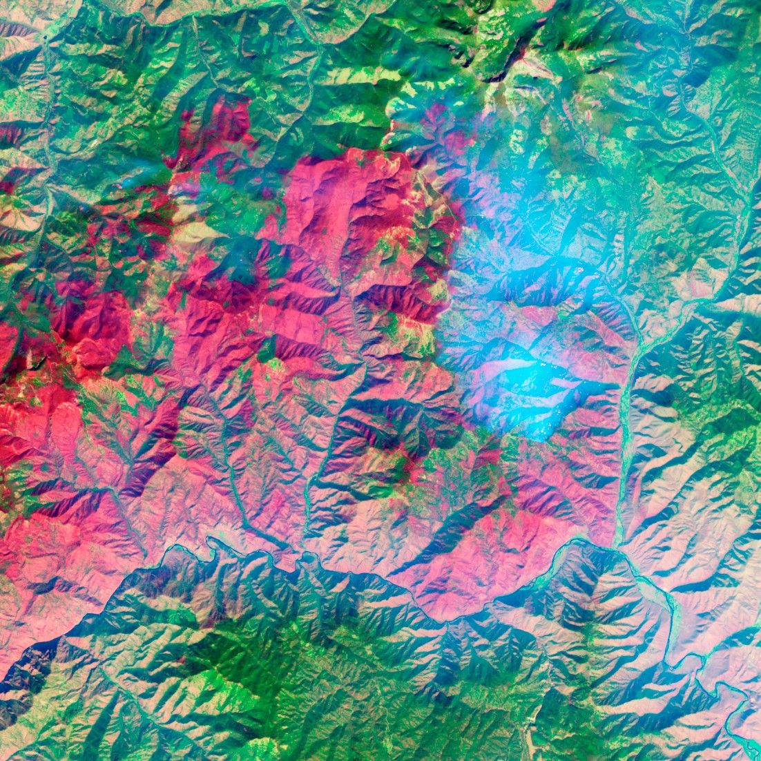
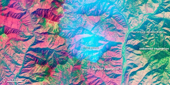
However, ALI detects radiation in more than just visible wavelengths. The instrument also can sense wavelengths in the infrared portion of the spectrum. The bottom image—made from a combination of visible, near-infrared, and shortwave-infrared light—provides a clearer view of the burn scar. Severely burned areas appear brick red; partly-burned areas are pink, and unburned areas are green. Thick smoke is light blue. While many areas have burned severely, the fire left some vegetation unscathed, particularly at the bottom of valleys and along some ridges.
References & Resources
- Inciweb. (n.d.) Mustang Complex fire. Accessed September 20, 2012.
- 8KPAX. (September 14, 2012). Pilot cars being used to escort traffic through Mustang Complex fire zone. Accessed September 20, 2012.
NASA Earth Observatory image by Jesse Allen and Robert Simmon, using EO-1 ALI data from the NASA EO-1 team. Caption by Adam Voiland.