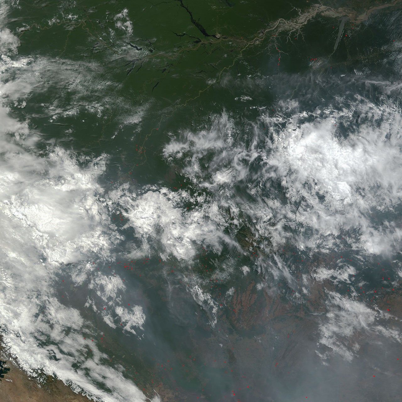
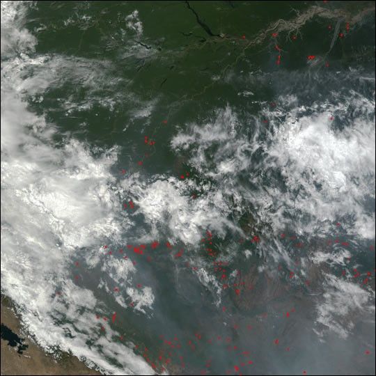
Suggested Searches

1 min read

Slash and Burn Agriculture in Brazil

Instruments:
2002-09-08 00:00:00
September 8, 2002

From the rainforests around the Amazon River (top) in Brazil, through the central highlands and into Bolivia to the southwest, numerous fires were burning throughout the region on September 8, 2002. The fires were detected by the Moderate Resolution Imaging Spectroradiometer (MODIS) on NASA’s Terra satellite, and their locations are marked with red dots in this true-color image. Thick smoke and clouds are shrouding the highlands in the southern portion of the image. At bottom left, a portion of Lake Titicaca can be seen.

References & Resources

Image by Jesse Allen, based on data from the MODIS Rapid Response Team at NASA-GSFC

You may also be interested in:

Stay up-to-date with the latest content from NASA as we explore the universe and discover more about our home planet.

B.C. Wildfires Send Smoke Skyward
2 min read

Lightning likely ignited several large fires that sent smoke pouring over the Canadian province in early September 2025.

Article
Smoky Skies in the Pacific Northwest
3 min read

Smoke filled river valleys in northeastern Washington and parts of British Columbia.

Article
Cooper Creek Replenishes Lake Eyre
3 min read

Another major tributary reached the Australian outback lake in 2025, extending the months-long flood of the vast, ephemeral inland sea.

Article