August 17, 2014
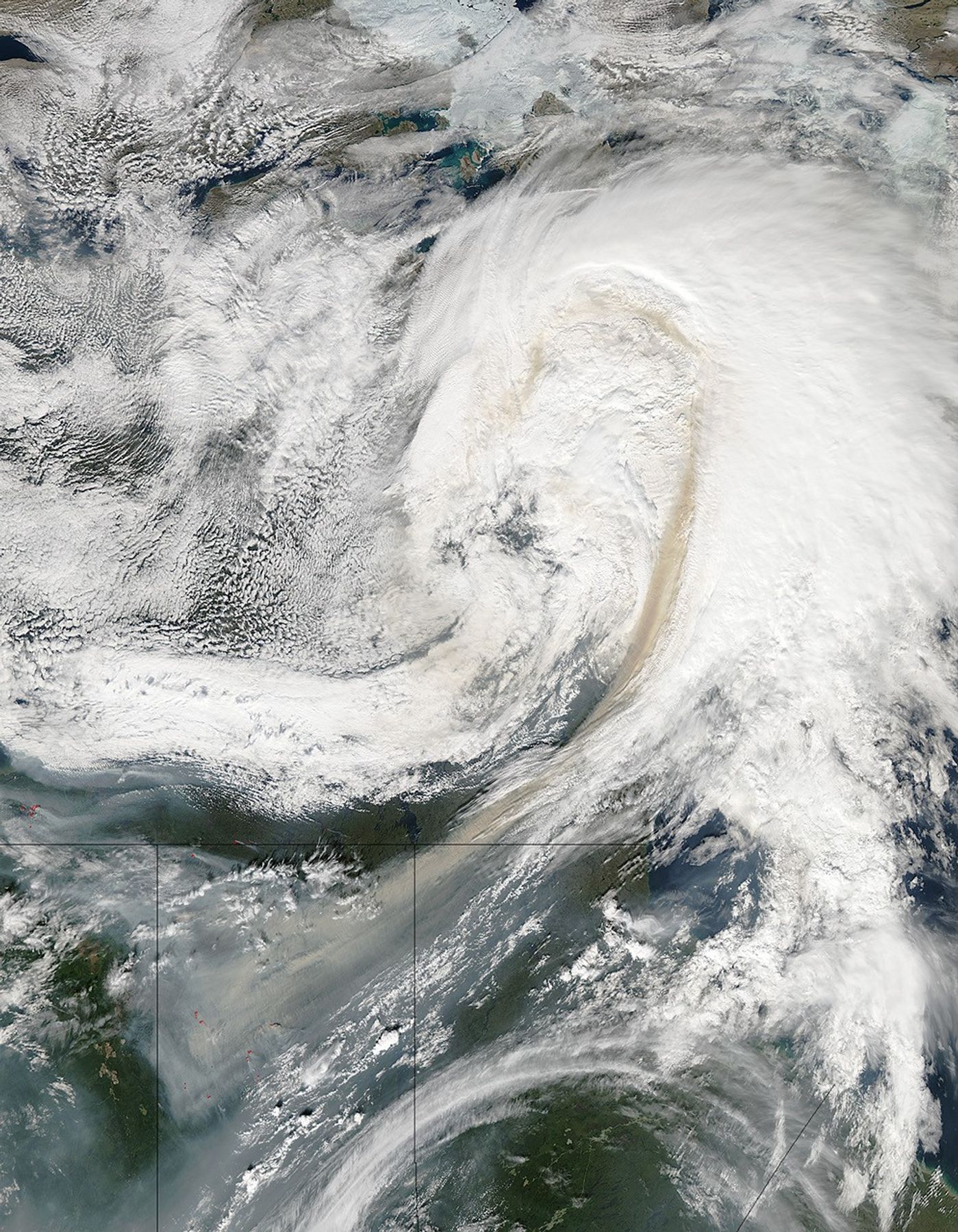
In August 2014, several larges fires were burning in Canada’s Saskatchewan province. The Moderate Resolution Imaging Spectroradiometer (MODIS) on NASA’s Aqua satellite acquired this image on August 17, 2014. The fires are outlined in red. Winds pushed long streams of smoke northeast into Manitoba and Northwest Territories.
In the summer, fires are common in the boreal forests in northern Saskatchewan. According to Saskatchewan authorities, more than 40 large fires were burning in the province on August 19, 2014. For perspective on historical fire activity in Saskatchewan from 1945-2014, see this map.
References & Resources
- Encyclopedia of Earth (2014, May 9) Midwestern Canadian Shield forests. Accessed August 20, 2014.
- Metro News (2014, August 19) Average wildfire season allows Saskatchewan to help neighbours. Accessed August 20, 2014.
- Government of Saskatchewan (2014, August 19) Daily Wildfire Report. Accessed August 20, 2014.
- Government of Saskatchewan (2014, August 19) Wildfire History 1945-2013. Accessed August 20, 2014.
- Government of Saskatchewan (2014, August 19) Forests. Accessed August 20, 2014.
NASA image courtesy Jeff Schmaltz, LANCE/EOSDIS MODIS Rapid Response Team at NASA GSFC. Caption by Adam Voiland.