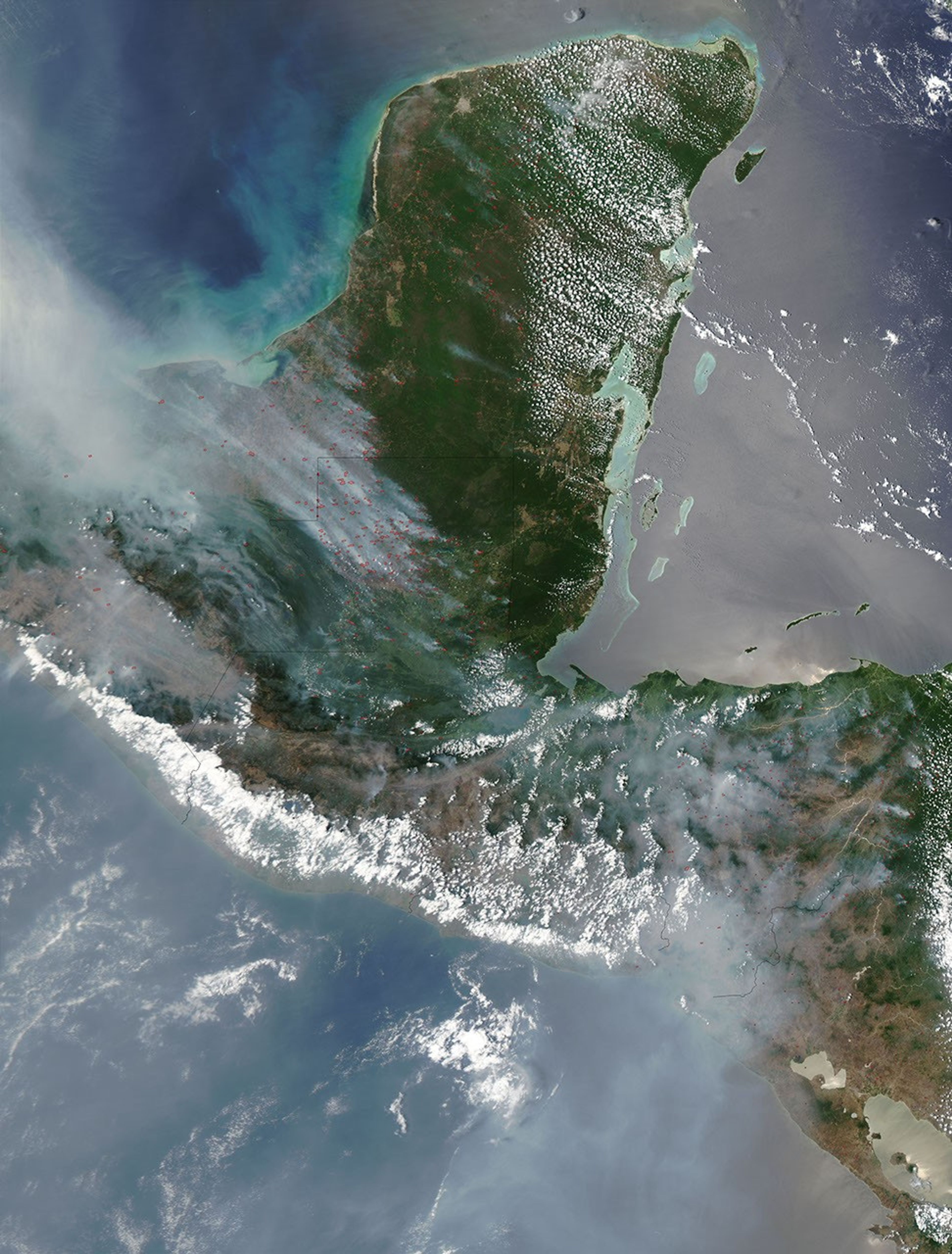
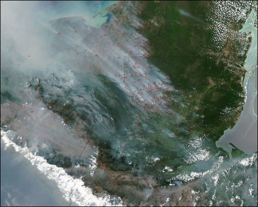
On April 20, 2003, the Moderate Resolution Imaging Spectroradiometer(MODIS) on the Aqua satellite captured this image of fires burningacross the Yucatan Peninsula and Central America. The fires, marked inred, are billowing thick smoke, which has pooled into the nooks andcrannies of the rugged terrain. The smoke is stretching northward overthe Gulf of Mexico.
During the spring of 1998 smoke from fires in the region spread allthe way to Texas and Oklahoma, causing health warnings. The fires wereassociated with droughts caused by the veryintense El Niño that occured the previous winter.
References & Resources
Image courtesy Jacques Descloitres, MODIS Land Rapid Response Team at NASA GSFC