


February 16, 2014
Somerset Levels Swamped
A low-lying tract of land in southwestern England known as the Somerset Levels stands just a few meters above sea level; some of the lowest parts even dip below sea level. A natural marshland, the Levels were drained and reclaimed for agriculture over the past few hundred years. However, the marshy character of the land still reasserts itself on occasion.
In December 2013 and January 2014, a series of storms dropped 372 millimeters (15 inches) of rain on southern England, making that two-month period the wettest on record since 1910. The storms and rain have continued into February. Since January, both the River Parrett and River Tone spilled over their banks and flooded sections of the Levels. By mid-February, an estimated 17,000 hectares (66 square miles) and 150 homes were swamped.
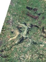
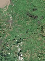
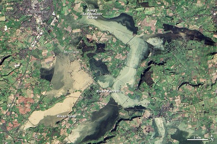
The Advanced Land Imager (ALI) on NASA’s Earth-Observing-1 satellite acquired this image on February 16, 2014. For comparison, the lower image shows Somerset Levels as seen by Landsat 8 on November 4, 2013.
On February 16, brown, sediment-laden water covered large tracts of farmland. While the town of Bridgewater was still dry, villages such as Moorland, Westonzoyland, Burrowbridge, and Othery were either flooded or nearly so. Neither the King’s Sedgemoor Drain nor pumping efforts by the British government could slow the rising waters enough to prevent severe flooding.
Although the Somerset Levels have a long history of flooding, this latest round has reignited a debate about the usefulness of dredging, a process that involves deepening and widening river channels by removing silt. Some observers argue that dredging the river more regularly would prevent damaging floods from occurring. Others say that regular dredging does little to prevent floods, causes ecological damage to ecosystems, and is too expensive to pursue.
References & Resources
- The Atlantic (2014, February 15) Flooding in Southwest England. Accessed February 17, 2014.
- BBC (2014, February 15) Extreme weather: 24 hours on the Somerset Levels. Accessed February 17, 2014.
- Buzzfeed (2014, February 9) 27 Staggering New Pictures of the Somerset Levels Floods. Accessed February 17, 2014.
- Bridgewater Mercury (2014, February 16) Floods latest: Water levels on Somerset Levels set to rise further, fund reaches ã350,000. Accessed February 17, 2014.
- Environment Agency (2014, January 28) Addressing flooding and dredging on the Somerset Levels. Accessed February 17, 2014.
- The Guardian (2014, February 13) Flood simple: the UK flooding crisis explained. Accessed February 17, 2014.
- Met Office (2014, January 30) Record wet January for parts of southern Britain. Accessed February 17, 2014.
- The Bath Chronicle (2014, February 13) Floods timeline: Water levels and tensions are still rising. Accessed February 17, 2014.
- The Telegraph (2014, February 17) How Somerset Levels river flooded after it was not dredged for decades. Accessed February 17, 2014.
NASA Earth Observatory images by Jesse Allen and Robert Simmon, using EO-1 ALI data provided courtesy of the NASA EO-1 team and Landsat data from the U.S. Geological Survey. Caption by Adam Voiland.