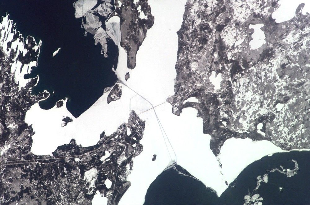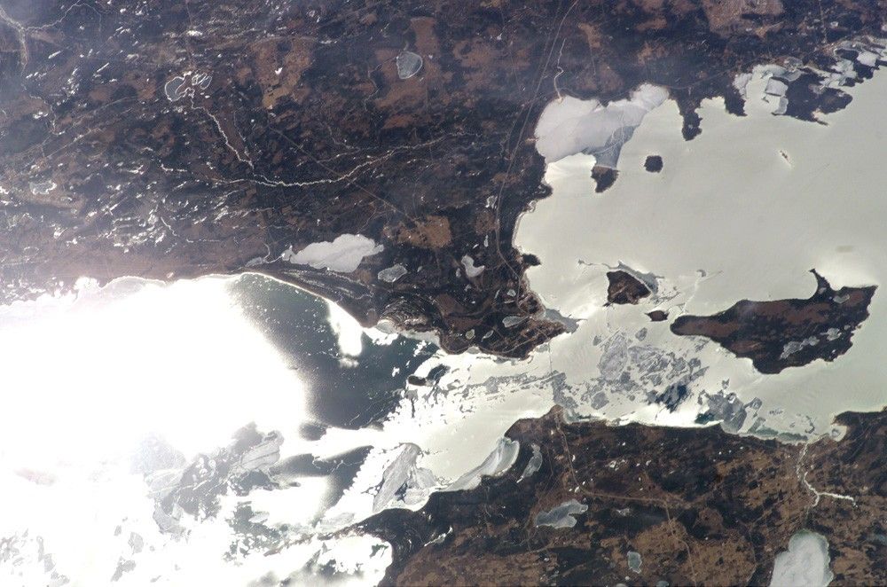

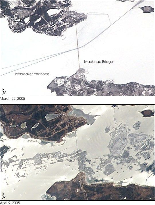
The Mackinac Bridge spans a stretch of water five miles wide between Michigan’s lower and upper peninsulas. The strait connects Lakes Michigan (left) and Huron (right). The bridge is a combination of pier-supported spans with a high, central suspension sector that allows passage of lake steamers. The suspension sector is the longest in the Americas (8, 614 feet or 1.6 miles). Prior to construction of the bridge, the only passage across the straits was by ferryboat.
This pair of images shows the Mackinac Straits while they were still frozen (top) and as they began to thaw (below). The March 22 view shows shipping lanes opened by ice breakers. A narrow passage connects the cleared shipping channel to the small town of St. Ignace at the north end of the bridge (Mackinaw City appears at the south end). The April view shows the ice broken into a series of irregular rafts that appear gray against bright water. The whitish appearance of the water is not snow or ice, but instead is sunlight glinting off the water back to camera. The shipping channel is maintained even through remnants of the ice mass, but the ice ridges can be hazardous to shipping until the last of the ice breaks up.
References & Resources
Astronaut photographs ISS010-E-20813 and ISS010-E-23748 were acquired March 22, 2005 and April 9, 2005, with Kodak 760C digital cameras with 180 mm lenses. The images are provided by the ISS Crew Earth Observations experiment and the Image Science & Analysis Group at the Johnson Space Center. The International Space Station Program supports the laboratory to help astronauts take pictures of Earth that will be of the greatest value to scientists and the public, and to make those images freely available on the Internet. Additional images taken by astronauts and cosmonauts can be viewed at the NASA/JSC Gateway to Astronaut Photography of Earth.