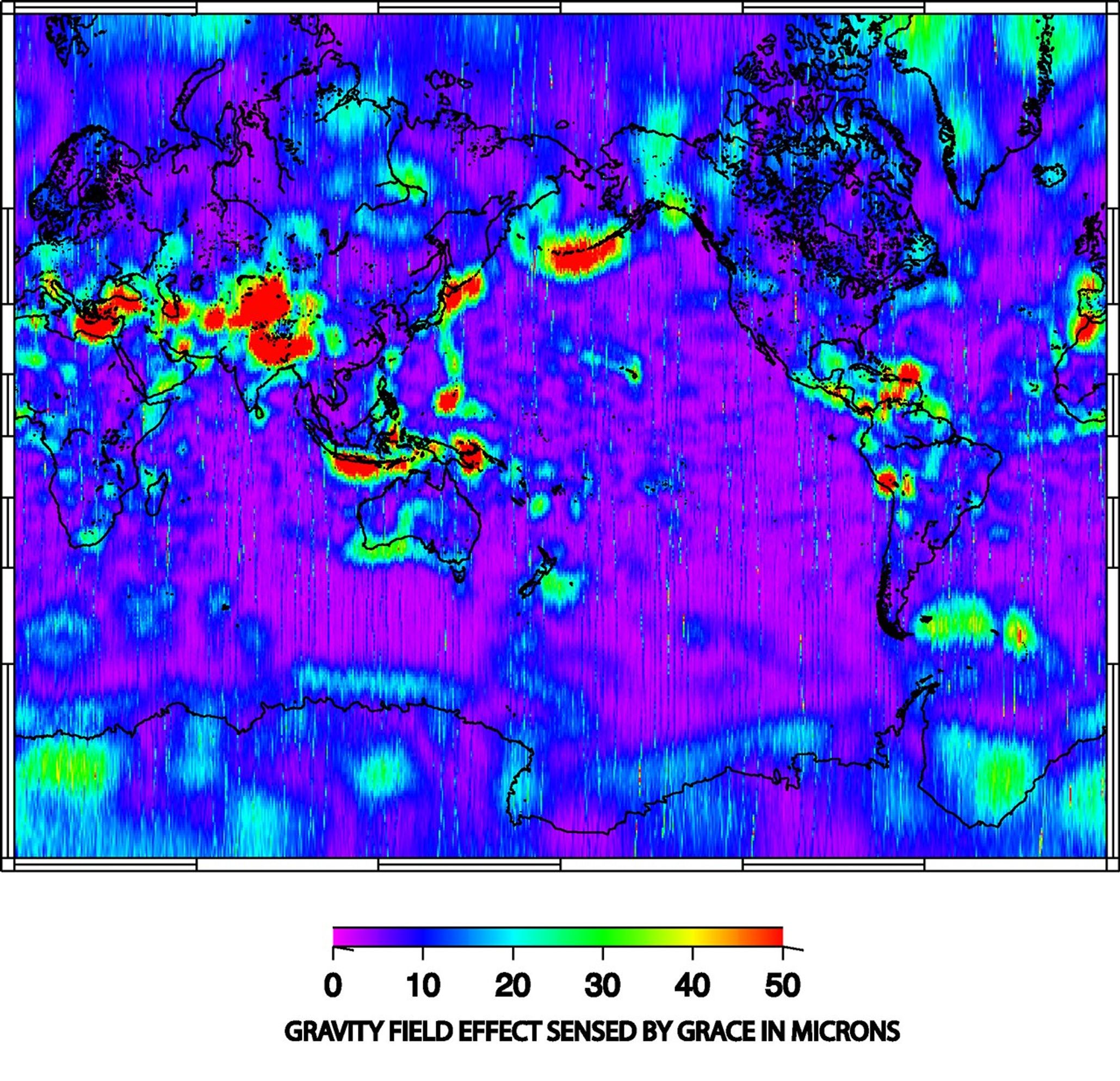
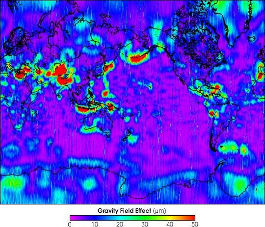
The first image released from the Gravity Recovery and ClimateExperiment (GRACE), a joint NASA-German Aerospace Center mission,graphically illustrates the sensitivity of the mission’s twin spacecraftto changes in Earth’s gravity.
Color gradations in the image measure changes in the distancebetween the GRACE spacecraft as they orbit overhead approximately 220kilometers (137 miles) apart. Such variations are caused as thespacecraft fly over Earth’s uneven gravity field, for example, whenGRACE travels over mountain ranges or undersea trenches. Earth’s largestspatial features (those covering the largest areas of Earth) have beenremoved from this image so that such smaller features can behighlighted. GRACE’s extremely sensitive microwave ranginginstrumentation is capable of measuring variations at the micron, ormillionth of a meter, level.
The data for this and similar images will be processed by the GRACEscience team to produce precise maps of Earth’s gravity field.Preliminary maps of Earth’s geoid, or mean gravity field, are expectedto be available to researchers in the spring of 2003.
For more information, read:
NASA’s First Gravity Mission Image Depicts a Bumpy Ride
GRACE fact sheet
References & Resources
Image courtesy GRACE Science Team NASA, German Aerospace Center, University of Texas Center for Space Research, and GeoForschungsZentrum Potsdam.