

June 7, 2013
Surging Elbe in Wittenberg
Unprecedented rainfall and flooding continued to plague central Europe in mid-June 2013, causing billions of dollars in damage. The Elbe, Danube, Saale, and other river systems rose well above their banks and breached flood defenses in Germany, Austria, the Czech Republic, Hungary, and Slovakia. Many news outlets and some government sources were describing it as the worst flooding since medieval times, surpassing the devastating floods of 2002 in many areas.
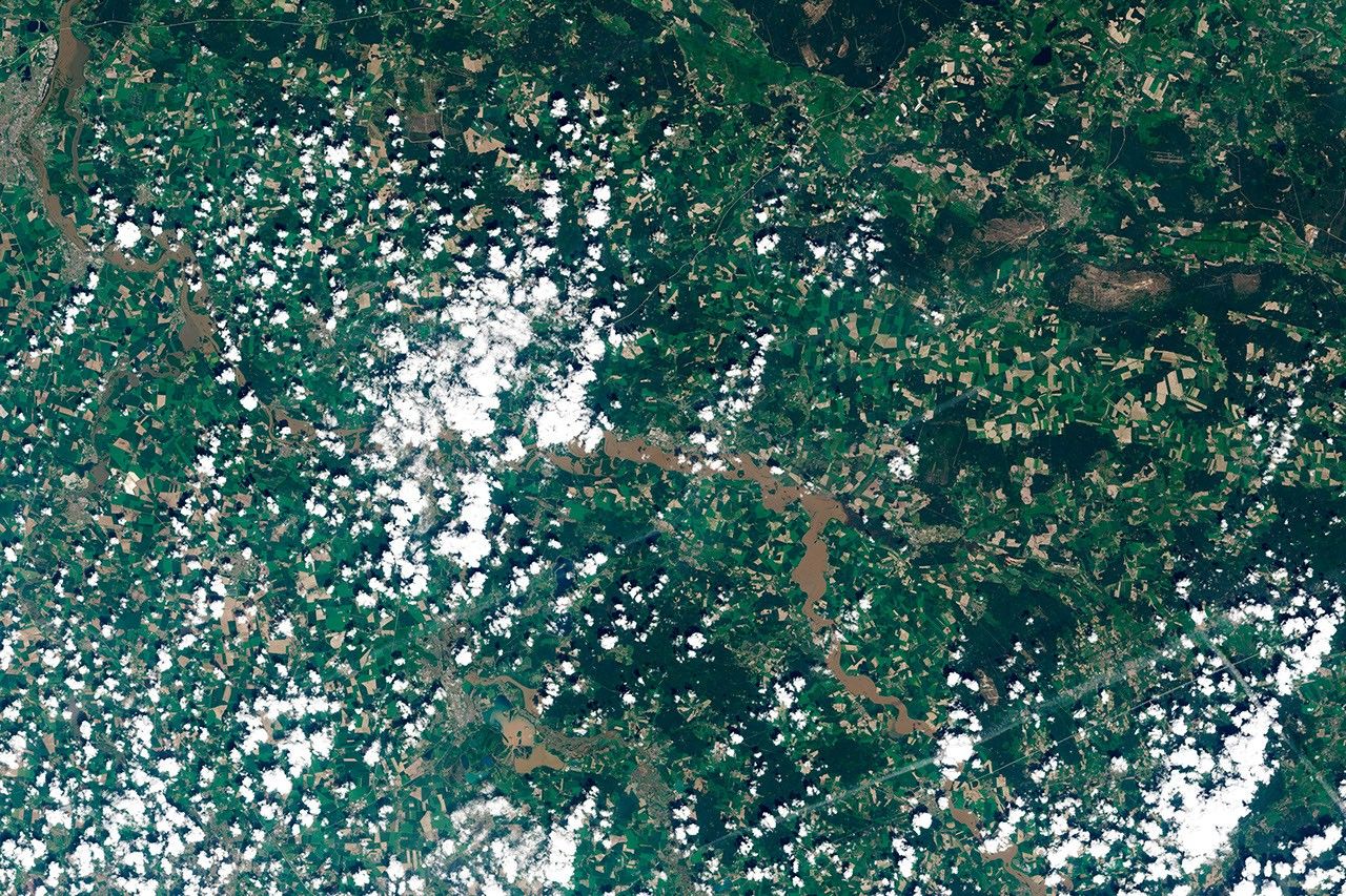
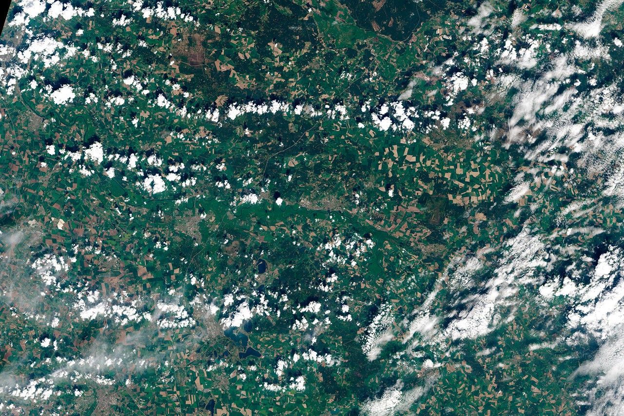
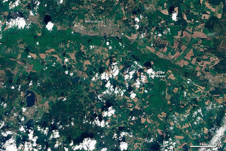
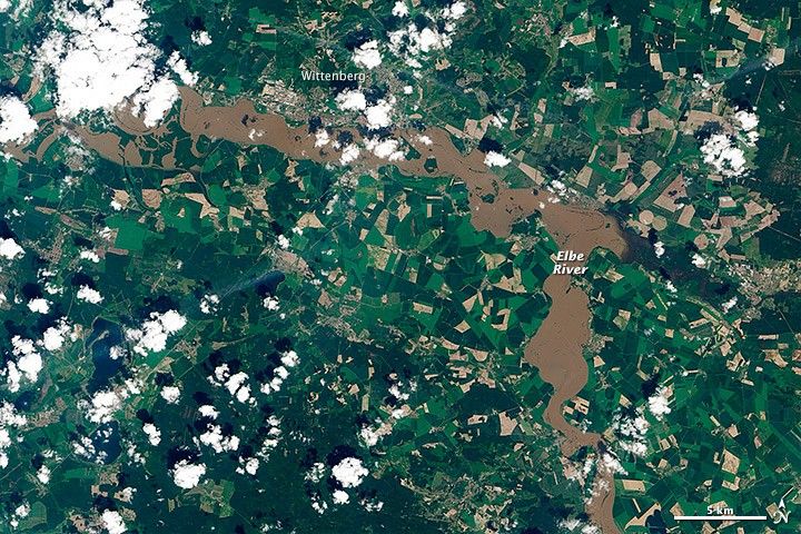
On June 7, 2013, the Operational Land Imager on Landsat 8 captured a natural-color image (top) of flooding near Wittenberg, in the German state of Saxony-Anhalt. For comparison, the lower image shows the same area on May 6. Note how the green floodplain around the river in the May image is completely inundated with muddy water in the June image. Puffs of white cumulus clouds are sprinkled across each image.
At the time of the June 7 image, the river stage stood at 6.7 meters (about 22 feet) in Wittenberg. On June 11, 2013, police shut down the center of Wittenberg as crews worked to shore up sandbag dikes and other defenses. The Elbe River was expected to crest again near the city, following another rainfall over the weekend. Downstream in Magdeburg, the surging river had already burst a dam and forced evacuations.
According to the Austrian Meteorological Agency (ZAMG) and meteorologist Jeff Masters, several months worth of typical rainfall soaked southern Germany and western Austria between May 29 to June 6. That precipitation landed on soil that was already soaked from above-average spring rains.
“The primary cause of the torrential rains over Central Europe during late May and early June was a large loop in the jet stream that developed over Europe and got stuck in place,” Masters wrote. “A blocking high set up over Northern Europe, forcing two low pressure systems to avoid Northern Europe and instead track over Central Europe. The extreme kink in the jet stream ushered in a strong southerly flow of moisture-laden air from the Mediterranean Sea over Central Europe, which met up with colder air flowing from the north due to the stuck jet stream pattern.”
References & Resources
- CNN (2013, June 11) Flood misery as surging Elbe breaches defenses in Germany. Accessed June 11, 2013.
- Deutsche Welle (2013, June 8) Volunteers mount flood-prevention efforts. Accessed June 11, 2013.
- Deutsche Welle (2013, June 8) Germany fights back floods. Accessed June 11, 2013.
- Dr. Jeff Masters WunderBlog on Weather Underground (2013, June 11) Extreme Jet Stream Pattern Triggers Historic European Floods. Accessed June 11, 2013.
- Hochwasser portal Landesbetrieb für Hochwasserschutz und Wasserwirtschaft. Accessed June 11, 2013.
NASA Earth Observatory images by Jesse Allen, using data provided by the U.S. Geological Survey. Caption by Michael Carlowicz.