


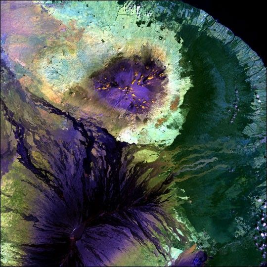
The lava-coated summits of Mauna Loa (bottom) and Mauna Kea (top) are colored deep purple in this false-color Landsat image of the Hawaii’s Big Island. Along the bottom edge, the crater of Kilauea—the world’s most active volcano— is visible as well. East of the big volcanoes is the island’s wet side. On the lower slopes of the volcanoes, vegetation in shades of green reclaims the terrain, and Hawaii’s lush tropical forests appear as a broad, blue-green expanse. Development along the coastline is light blue, and an electric blue strip of sand rings the island (most visible at the higher resolution).
This image was acquired byLandsat 7’s Enhanced Thematic Mapper plus(ETM+) sensor on January 6, 2001. This is a false-color composite image made usingthe infrared, near-infrared, and green wavelengths.
References & Resources
Image provided by the USGS EROS Data Center Satellite Systems Branch. This image is part of the Landsat Earth as Art series.


