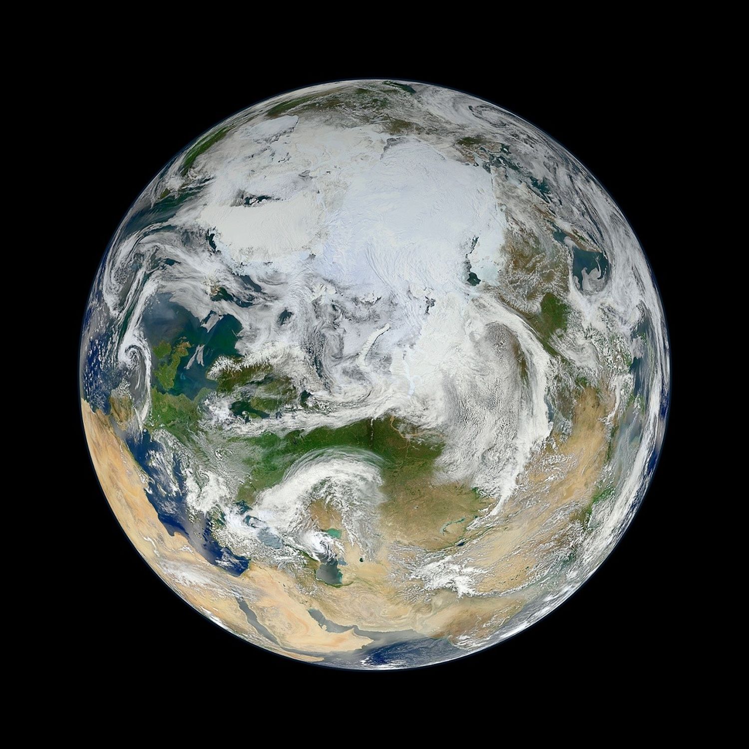
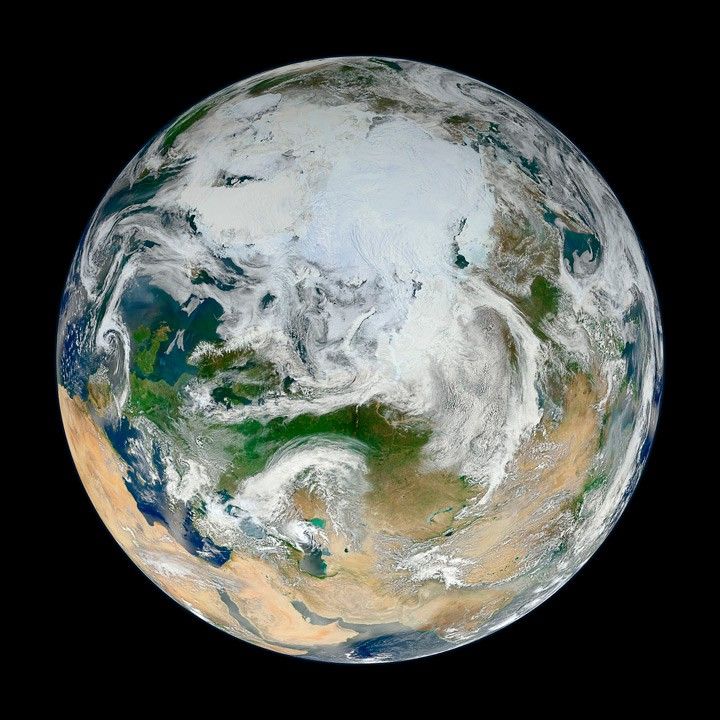
There have been many images of the full disc of Earth from space—a view often referred to as “the Blue Marble”—but few have looked quite like this. Using natural-color images from the Visible/Infrared Imaging Radiometer Suite (VIIRS) on the recently launched Suomi-NPP satellite, a NASA scientist has compiled a new view showing the Arctic and high latitudes.
Ocean scientist Norman Kuring of NASA’s Goddard Space Flight Center pieced together this composite image of Europe, Asia, North Africa, and the entire Arctic. It was compiled from 15 satellite passes made by Suomi-NPP on May 26, 2012. The spacecraft circles the Earth from pole to pole at an altitude of 824 kilometers (512 miles), so it takes multiple passes to gather enough data to show an entire hemisphere without gaps in the view.
Kuring stitched the image swaths together and then set up this view looking down from 70 degrees North, 60 degrees East. (That is, the view is artificial, as the satellite does not see the full disc at one time.) He was able to show the Arctic in this image because northern hemisphere spring spreads enough sunlight over the North Pole to allow a natural-light view.
VIIRS is a scanning radiometer that acquires data in 22 spectral bands, covering visible, near-infrared, and thermal infrared regions of the electromagnetic spectrum. It was designed to extend and improve upon the measurements of land masses, oceans, ice, and the atmosphere made over the past two decades by the Advanced Very High Resolution Radiometer (AVHRR) and the Moderate Resolution Imaging Spectroradiometer (MODIS).
References & Resources
- NASA Suomi NPP Images and Data.
- NASA Earth Observatory Earth, Behind the Scenes.
- NASA Ocean Color Web.
Image by Norman Kuring, NASA/GSFC/Suomi NPP. Caption by Michael Carlowicz. Suomi NPP is the result of a partnership between NASA, NOAA and the Department of Defense.