


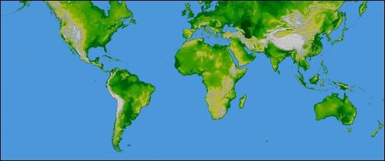
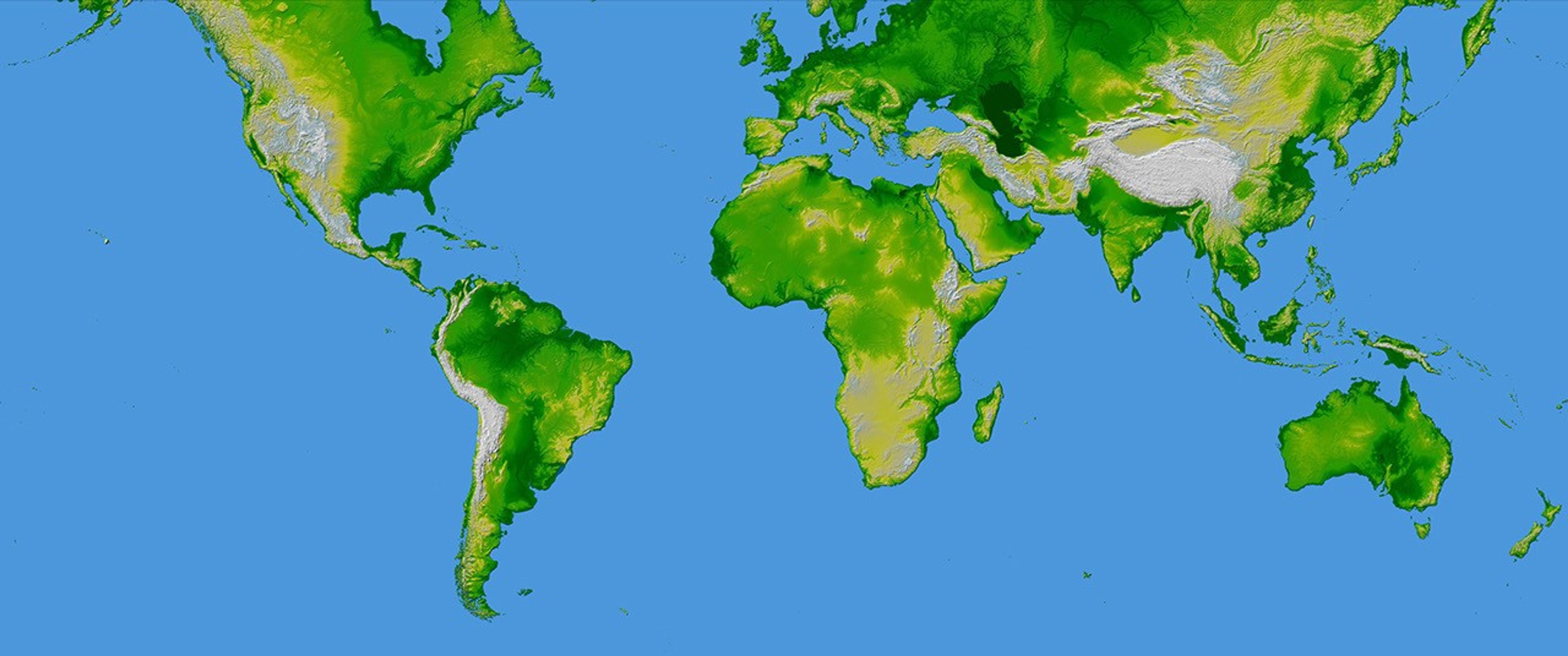
This image of the world was generated with data from the Shuttle Radar Topography Mission (SRTM). The SRTM Project has recently released a new global data set called SRTM30, where the original one arcsecond of latitude and longitude resolution (about 30 meters, or 98 feet, at the equator) was reduced to 30 arcseconds (about 928 meters, or 3045 feet.) This image was created from that data set and shows the world between 60 degrees south and 60 degrees north latitude, covering 80% of the Earth’s land mass. The image is in the Mercator Projection commonly used for maps of the world.
Two visualization methods were combined to produce the image: shading and color coding of topographic height. The shade image was derived by computing topographic slope in the northwest-southeast direction, so that northwest slopes appear bright and southeast slopes appear dark. Color coding is directly related to topographic height, with green at the lower elevations, rising through yellow and tan, to white at the highest elevations.
- Orientation: north toward the top
- Image Data: shaded and colored SRTM elevation model
- Original Data Resolution: 1 arcsecond [about 30 meters (98 feet)]
- Date Acquired: February 2000
- High Resolution Images:
- mercator projection (17 MB JPEG)
- mercator projection (128 MB TIFF)
- globes (6.7 MB JPEG)
- globes (357 MB TIFF)
References & Resources
Image Courtesy SRTM Team NASA/JPL/NIMA


