


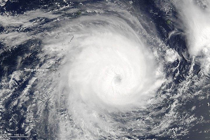
Packing sustained winds of 230 kilometers (145 miles) per hour, tropical cyclone Gita slammed into the island nation of Tonga on February 12, 2018. According to initial reports, the category 4 storm caused widespread damage in Tongatapu, the largest and most densely populated of the kingdom’s 169 islands. It struck the Samoan Islands as a category 3 storm the day before.
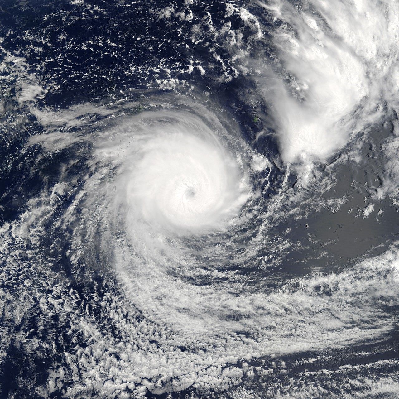
The Moderate Resolution Imaging Spectroradiometer (MODIS) on NASA’s Terra satellite captured this image as the storm bore down on Tonga on February 11, 2018. Forecasters expect Gita to move toward Fiji next. Though it may strengthen more, the storm should pass well south of Fiji’s largest islands.
It is rare for a powerful tropical cyclone to hit Tonga. Only one other Category 4 has passed within 200 nautical miles of Tonga’s capital, according to a historical database of tropical cyclones maintained by NOAA.
References & Resources
- Fiji Meteorological Service (2018, February 12) Tropical Cyclone. 3-Day Outlook. Accessed February 12, 2018.
- RNZ (2018, February 12) Cyclone Gita: Homes destroyed as storm hits. Accessed February 12, 2018.
- The Washington Post (2018, February 12) Tropical Cyclone Gita is a monster Category 4, and it’s hammering Tonga. Accessed February 12, 2018.
- The Weather Channel (2018, February 12 Tropical Cyclone Gita Hammers Tonga as Category 4. Accessed February 12, 2018.
- U.S. Joint Typhoon Warning Center (2018, February 12) Tropical Cyclone 09P (Gita). Accessed February 12, 2018.
NASA Earth Observatory images by Jeff Schmaltz, using MODIS data from LANCE/EOSDIS Rapid Response . Caption by Adam Voiland.


