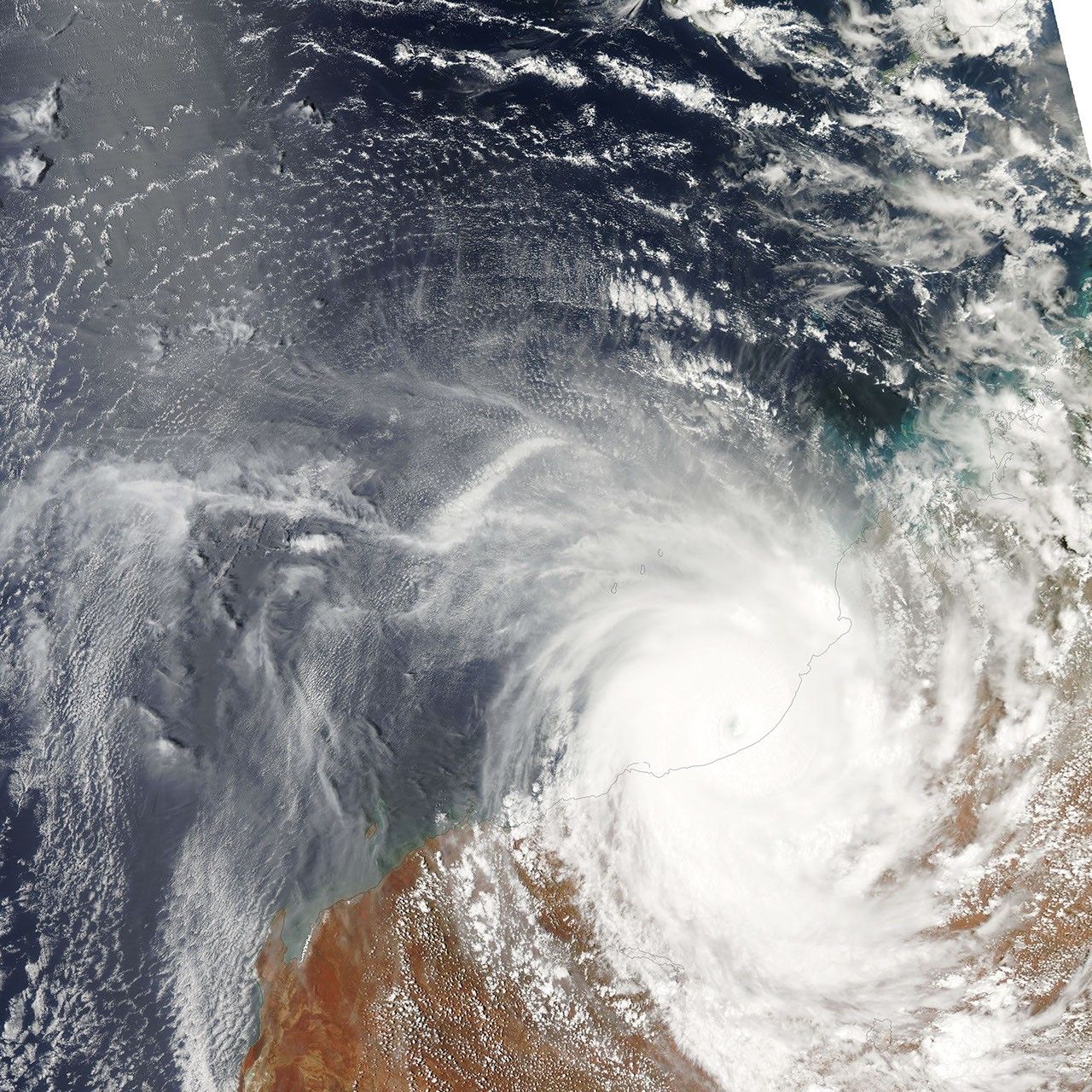


Tropical Cyclone Laurence made its second landfall over Western Australia on December 21, 2009. The Moderate Resolution Imaging Spectroradiometer (MODIS) on NASA’s Aqua satellite captured this image a short time before the eye went ashore.
Laurence was a Category 4 storm (on the Saffir-Simpson scale) with winds of 115 knots (213 kilometers per hour or 132 miles per hour) at its height on December 15, the day before it went ashore the first time, according to the Joint Typhoon Warning Center. It degraded into a tropical storm over land, re-emerged over the Indian Ocean and grew into a Category 3 cyclone with winds of 100 knots (185 km/hr or 115 mph) on December 21. The storm was weakening as it went ashore the second time. When Aqua MODIS acquired this photo-like image at 2:00 local time (6:00 UTC), it was somewhere between a Category 3 and Category 1 storm.
Laurence was clearly a mature, well-developed cyclone on December 21. A cloudy eye is distinctly visible as a shadowed dimple in the center of the tightly packed bands of spiraling clouds. The storm is circular, undistorted by the upper-level winds that tear cyclones apart.
The storm’s powerful winds caused significant damage to buildings along the coast, said ABC News. No injuries had been reported, though damage assessments were just beginning on the morning of December 22, when the storm had moved well inland.
References & Resources
- Australian Broadcasting Corporation News. (2009, December 22). Authorities to assess cyclone damage. Accessed December 21, 2009 (US Eastern Standard Time).
- Joint Typhoon Warning Center. (2009, December 21). Cyclone-4 Laurence. Published on Unisys Weather, 2009 Hurricane/Tropical Data for Southern Indian Ocean. Accessed December 21, 2009.
NASA Earth Observatory image created by Jesse Allen, using data provided courtesy of the MODIS Rapid Response team. Caption by Holli Riebeek.