






























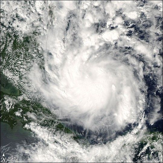
The 23rd storm of the 2005 Atlantic hurricane season formed off the coast of Panama late on October 26, 2005. Dubbed “Beta” after the National Hurricane Center ran out of names, the storm set a new record for the number of tropical cyclones to form in the Atlantic during a single year. The Moderate Resolution Imaging Spectroradiometer (MODIS) on NASA’s Aqua satellite captured this photo-like image of the storm at 2:50 p.m. Eastern Daylight Time on October 27, 2005. At the time, Beta had winds of 95 kilometers per hour (60 miles per hour). It was expected to strengthen into a hurricane on its slow course north. The National Hurricane Center predicted that the storm would make landfall in Nicaragua on October 29, potentially causing deadly landslides in the steep mountains of Nicaragua and Honduras. Early in October, a glancing blow from Hurricane Stan triggered landslides across Central America, leaving thousands dead.
The large image provided above has a resolution of 500 meters per pixel. It is available in additional resolutions from the MODIS Rapid Response Team.
References & Resources
NASA image courtesy Jeff Schmaltz, MODIS Rapid Response Team at NASA GSFC








