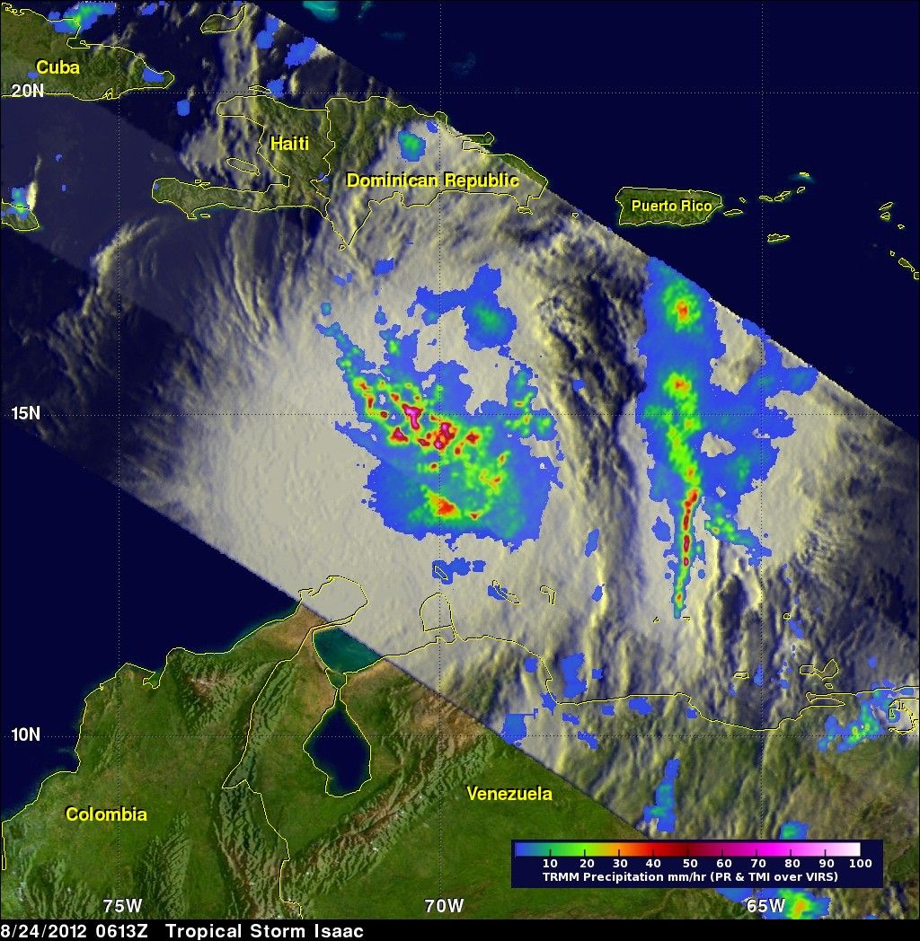
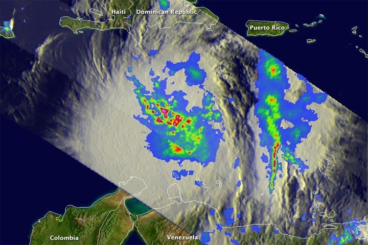
The Tropical Rainfall Measuring Mission (TRMM) satellite flew above tropical storm Isaac in the center of the Caribbean Sea on Friday August 24, 2012, at 0613 UTC (2:13 a.m. Eastern Daylight Time). Isaac had become better organized. An analysis of rainfall from TRMM’s Microwave Imager (TMI) and Precipitation Radar (PR) showed an increase in intensity of rainfall in a large area around Isaac’s center of circulation. TRMM detected rain rates of over 90 millimeters (about 3.5 inches) per hour within several strong convective storms.
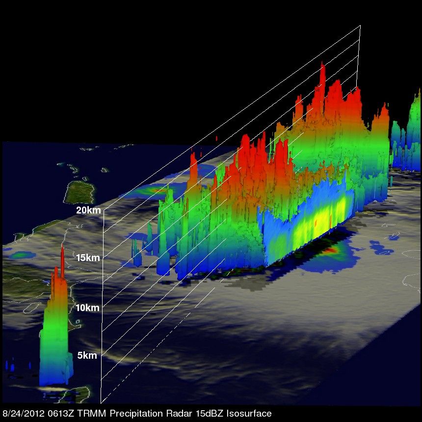
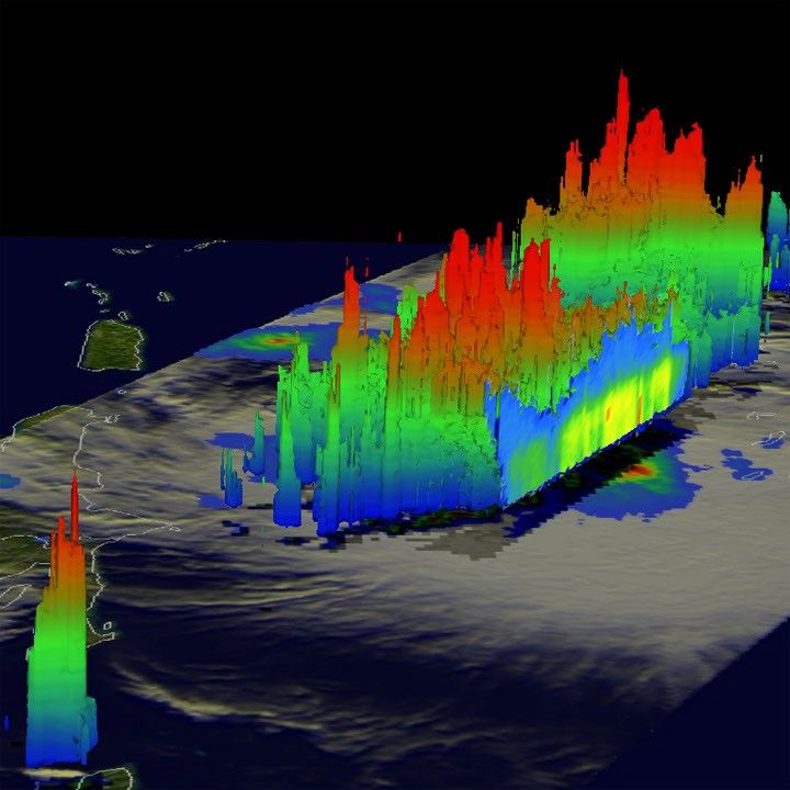
TRMM Precipitation Radar (PR) data were used to make a three-dimensional view of Isaac’s structure. This view revealed that some storms near Isaac’s center were reaching heights of about 16 kilometers (10 miles). These towers contained Isaac’s heaviest rains and acted to energize the core of the storm.
The U.S. National Hurricane Center predicted that Isaac would intensify while moving northwestward toward Hispaniola on August 24, 2012.
References & Resources
Image produced by Hal Pierce (SSAI/NASA GSFC) and caption by Steve Lang and Hal Pierce (SSAI/NASA GSFC).