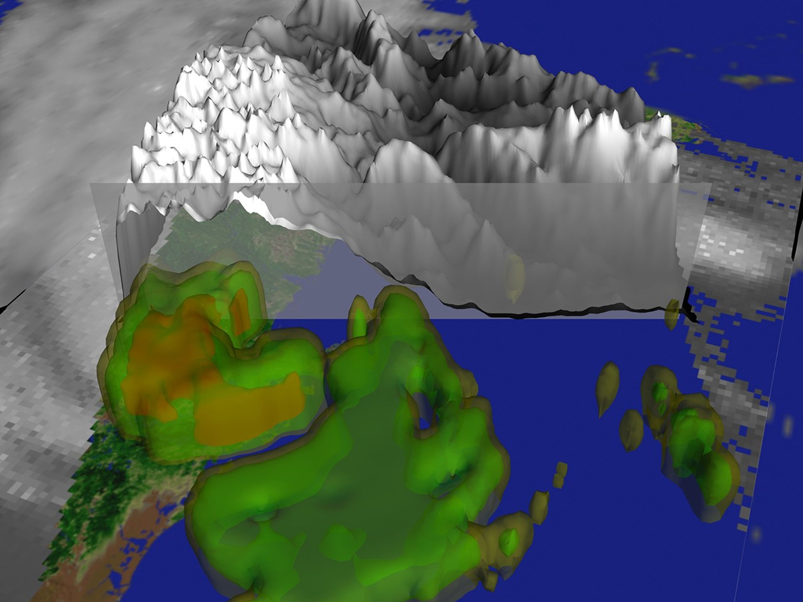
Tropical Storm Isidore blew ashore early Thursday morning packing winds just below hurricane strength. At 11 am (EST) Isidore's center was 60 miles north-northeast of New Orleans and just west of Poplarville, Mississippi. It was moving north-northeast at 17 mph. Tornado warnings and flood watches wereposted from the Louisiana coast to the Florida panhandle. The storm has brought two days of steady downpours with 10-12 inch accumulations.This cutaway image and animation of Isidore's clouds reveals the rain structure as measured by the TRMM Microwave Imager (TMI). Green colors indicate light rain, while orange shadings indicate moderate to heavy intensity rains. As Isidore made landfall, only the broken remnants of a large, open eye remain. However, the numerous spiral rainbands shown produced flooding rains in excess of several inches per hour.
References & Resources
A 3 MB MPEG animation is also available. Image by Lori Perkins, NASA Goddard Space Flight Center Scientific Visualization Studio.