


![Request for Information – Potential [Placeholder for Prize]](https://assets.science.nasa.gov/dynamicimage/assets/science/psd/solar/2023/09/s/solarsystem_0.jpg?w=1024)


- Large images
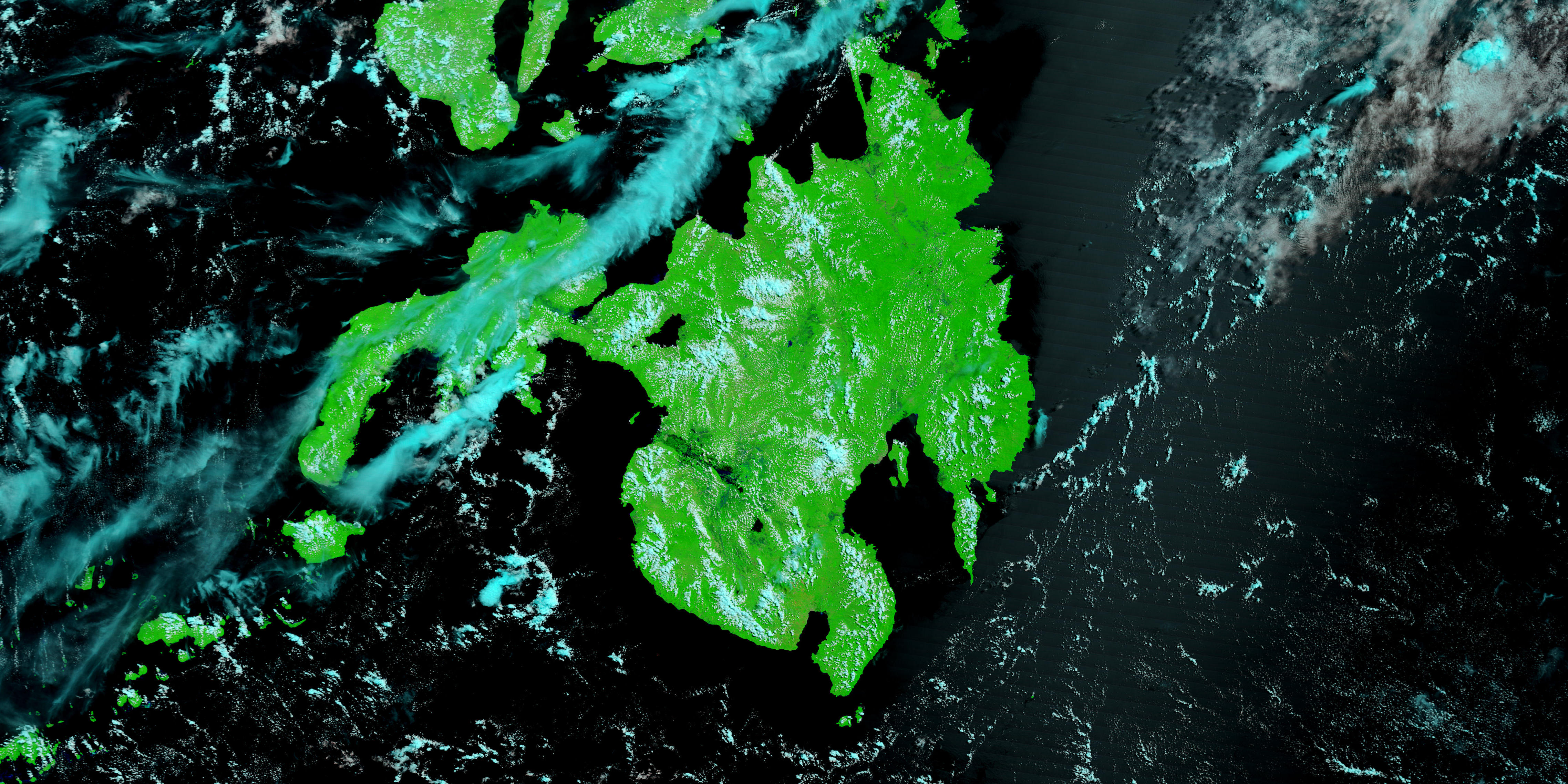
- July 12, 2008 (2.1 MB JPEG)
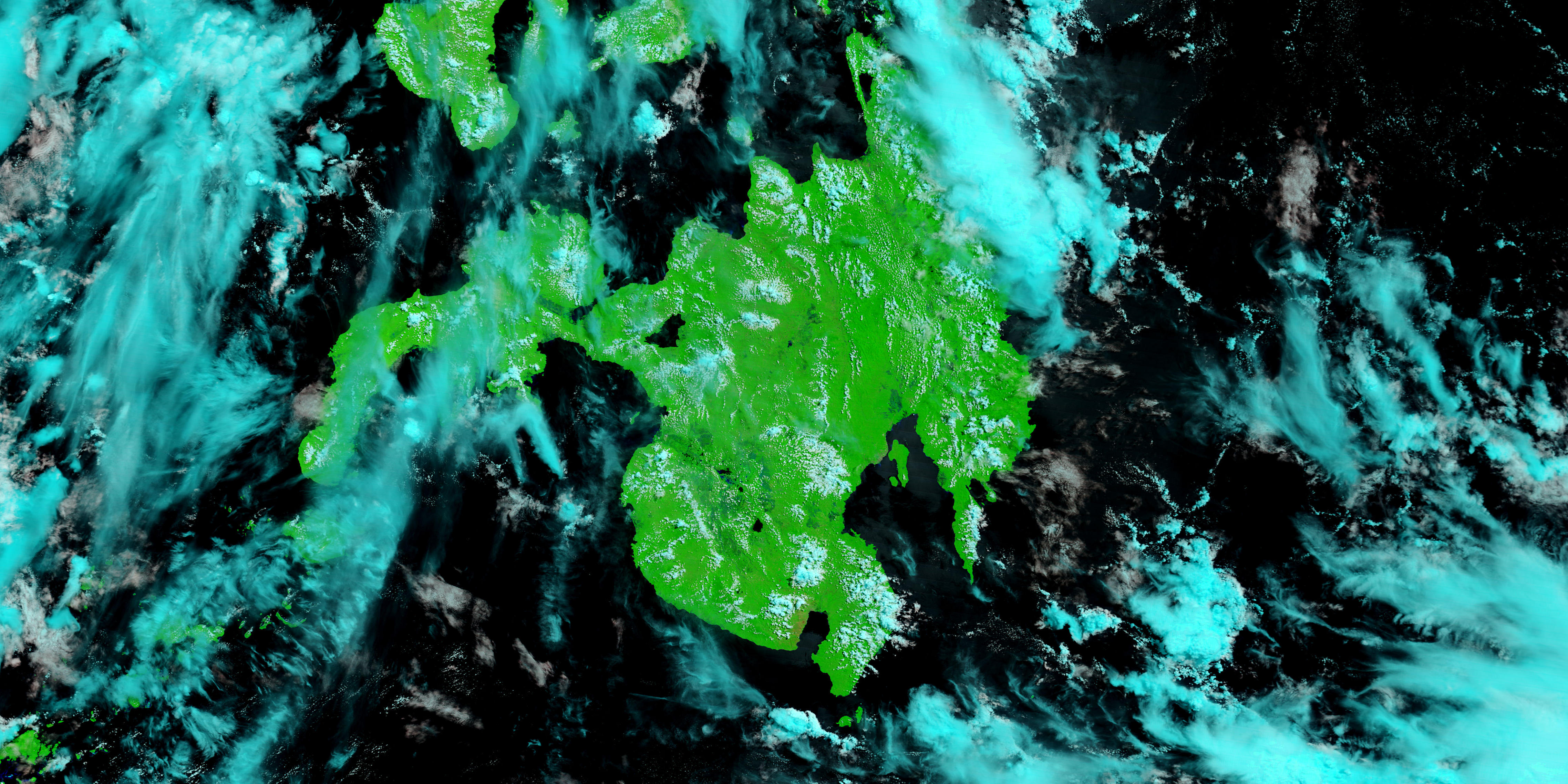
- June 17, 2008 (1.9 MB JPEG)
A disaster like a typhoon does not necessarily unfold all at once. It comes with a blast of wind and a downpour of torrential rain and then leaves, but its effects linger or even build into a new disaster. Such was the case with Typhoon Fengshen. The deadly storm swept over the northern and central Philippines between June 20 and June 23, 2008, creating dangerous seas, floods, and landslides that killed more than 1,000 people.
Though the southern island of Mindanao was spared a direct hit, the next phase of the disaster unfolded there. During the storm, heavy rain fell on the island. The excess water drained through a vast web of streams and rivers that converge to form the Rio Grande de Mindanao. The floods that started in the wake of the storm built until, by July 8, nearly 75 percent of the city of Cotabato, near the mouth of the river, was under water, according to local news reports.
When the Moderate Resolution Imaging Spectroradiometer (MODIS) on NASA’s Terra satellite captured the top image on July 12, 2008, the river was still swollen. The lower image shows the river as viewed by Terra MODIS on June 17, 2008. Both images were made with a combination of infrared and visible light to increase the contrast between land and water. Water is black or dark blue, while plant-covered land is bright green. The streets and buildings of Cotabato are gray, and the ever-present clouds that dot the tropical skies are pale blue and white. A comparison between the two images shows that the river has inundated low-lying spots along its banks. Flooded, the river resembles a wetland with no distinct channel.
The floods occurred, said local news reports, because silt and water lilies clogged the river channel. With no clear path to the sea, the excess water flowed into low-lying areas like parts of Cotabato. The flood had largely receded from Cotabato by July 13 after volunteers and government workers cleared a channel in the river.
References & Resources
- References
- AFP. (2008, July 10). UN agency makes extra rice grants to Philippines weather victims. Accessed July 14, 2008.
- GMANews.TV. (2008, July 8). Overflowing river floods Cotabato City. Yahoo News Philippines. Accessed July 14, 2008.
- Maulana, N. and Fernandez, E. (2008, July 13). Floods start to recede from Cotabato City streets. Inquirer.net. Accessed July 14, 2008.
NASA images courtesy the MODIS Rapid Response Team at NASA GSFC. Caption by Holli Riebeek.


