May 19, 2004
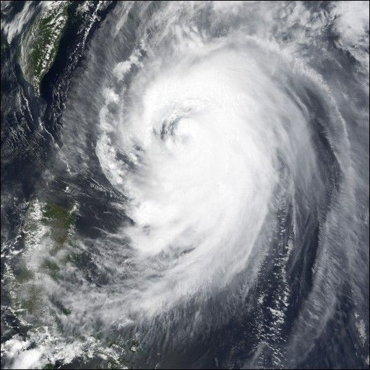
The MODIS instrument onboard NASA's Terra satellite captured this true-color image of Super Typhoon Nida at 2:25 UTC on May 19. In this image, Nida was located approximately 450 miles south-southwest of Okinawa, Japan and was packing sustained winds of 105 mph with higher gusts to 120 mph. Nida was moving to the northeast at 12 mph prompting the Japan Meteorological Agency to issue warnings in the Kanto region. Nida is expected to bring strong winds, heavy rains, and high waves to southern Japan.
References & Resources
Image courtesy Jesse Allen, NASA Earth Observatory, based on data from the MODIS Rapid Response Team at NASA GSFC.