


- October 20 (450 KB)
- October 23 (432 KB)
Typhoon Nock-ten left four people dead and 1 missing this past week after hittingthe northeastern coast of Taiwan. Most of the deaths were a result of landslides.The Tropical Rainfall Measuring Mission (TRMM) satellite has been collecting uniqueimages and valuable data of tropical cyclones since its launch in November of 1997.TRMM captured these images of Nock-ten as it was approaching Taiwan.
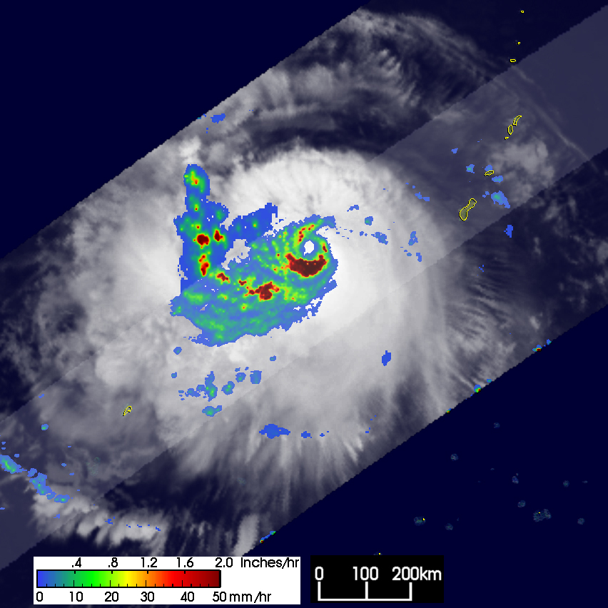
According to the Joint Typhoon Warning Center, at the time of the first TRMM overpassat 18:09 UTC on the 20th of October 2004, Nock-ten was already a Category 2 typhoonpacking winds of 95 knots (109 mph). The first image shows a horizontal map of thenear surface rainfall intensity obtained from that overpass. Rain rates in the centerpart of the swath are from the TRMM Precipitation Radar or PR, while rain rates in theouter part of the swath are from the TRMM Microwave Imager or TMI. The rainfall ratesare overlaid on infrared (IR) data from the TRMM Visible Infrared Scanner (VIRS).A well-defined eye is apparent in the center of the cloud mass. A substantial areaof intense rain is just south of the center with rain rates on the order of 2 inchesper hour (dark red areas). The overall rain area is asymmetrical with the bulk of therain occurring west of the center including additional areas of heavy rain (red areas).At the time of this image, Nock-ten was already west-southwest of Guam and was movingnorthwest.
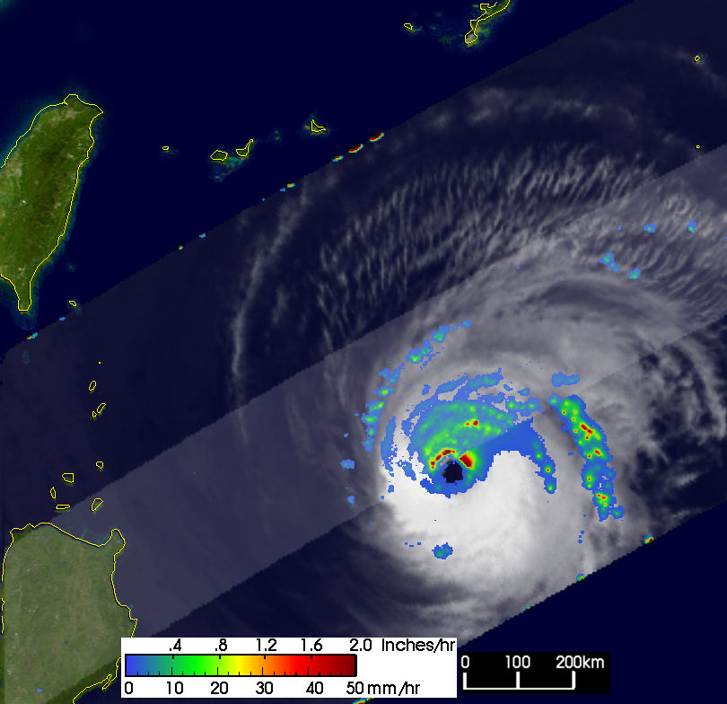
The second image was taken three days later on the 23rd of October at 18:35 UTC andshows Nock-ten near its peak intensity. The storm was now a Category 3 storm withmaximum sustained winds estimated at 105 knots (121 mph) as it approached Taiwan.Nock-ten still has a well-defined eye with heavy (red) to intense (dark red) rain inthe northern half of the eye wall. The bulk of the rain is now skewed to the north ofthe center. A large area of white cloudy wisps show the storm's outflow to the north.Nock-ten would remain a Category 3 typhoon for 1 more day before weaking to a Category2 storm as it passed Taiwan. The system then quickly decayed into a tropical stormbefore dissipating just north of Taiwan. Nock-ten means bird in Laotian.
TRMM is a joint mission between NASA and the Japanese space agency JAXA.
References & Resources
NASA images produced by Hal Pierce (SSAI/NASA GSFC) and caption by Steve Lang (SSAI/NASA GSFC), NASA's Tropical Rainfall Measuring Mission.


