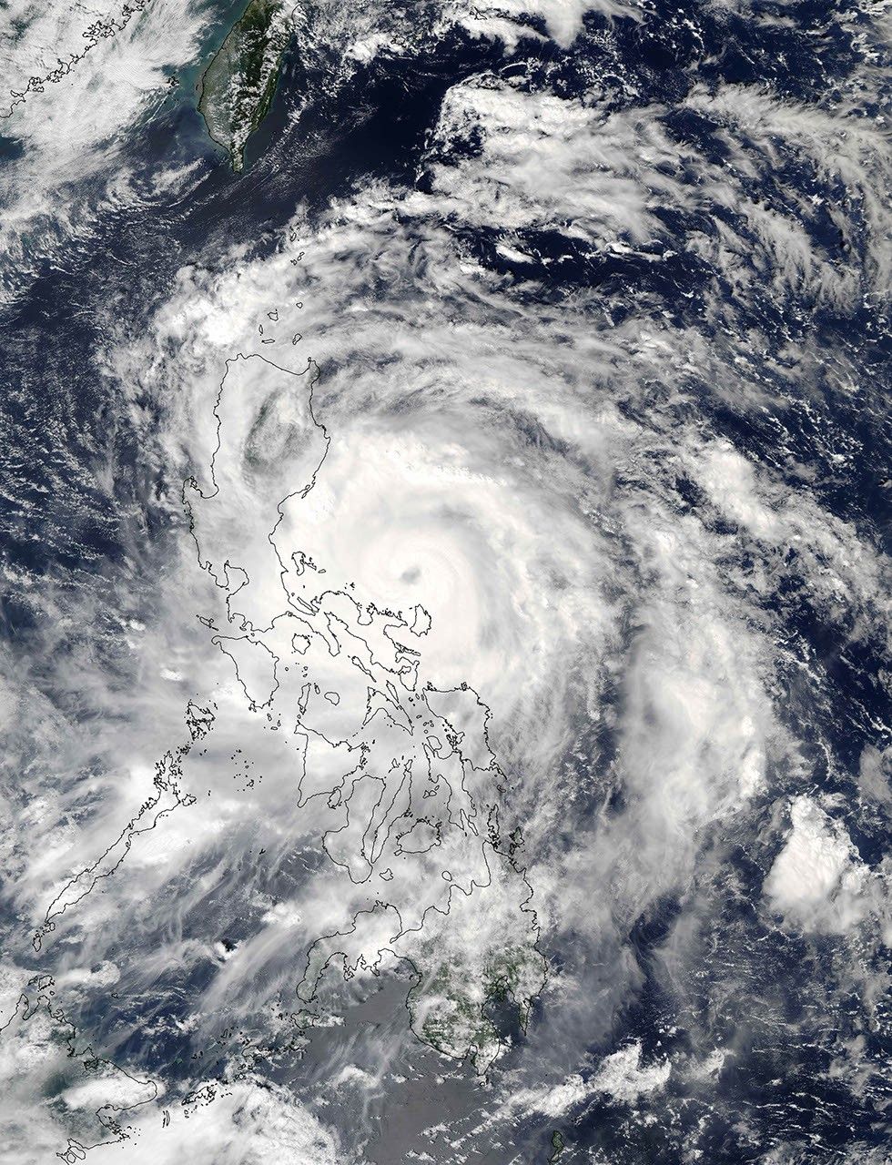
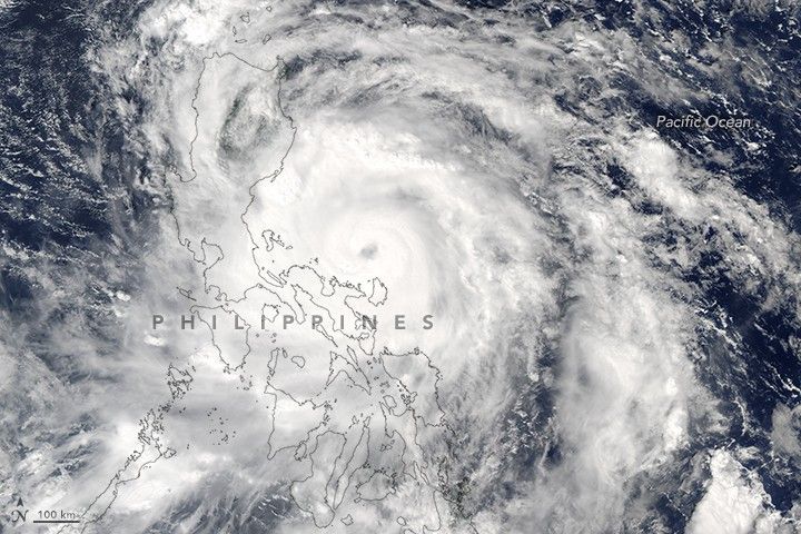
At 1:10 p.m. local time (05:10 Universal Time) on October 15, 2016, the Moderate Resolution Imaging Spectroradiometer (MODIS) on NASA’s Aqua satellite captured this image of Typhoon Sarika bearing down on the Philippines. At the time, Sarika was a category 2 storm with top sustained winds of about 170 kilometers (105 miles) per hour. The storm made landfall the next morning over the eastern part of Central Luzon. By that time, it was a category 4 storm with top sustained winds of 210 kilometers (130 miles) per hour.
Typhoon Sarika was expected to make landfall again, reaching the Chinese island of Hainan and then northern Vietnam. According to news reports, flooding from heavy rains in Vietnam preceding the arrival of Sarika has killed dozens of people.
Meanwhile, people in the Philippines braced for a second powerful storm to hit within the span of one week. Forecasts called for Typhoon Haima to make landfall in northern Luzon on October 19 (local time).
References & Resources
- Unisys Weather (2016, October 17) Typhoon-4 SARIKA. Accessed October 17, 2016.
- United Press International (2016, October 17) Vietnam flooding kills 25 ahead of Typhoon Sarika arrival. Accessed October 17, 2016.
- Weather Underground's WunderBlog (2016, October 17) Twin Typhoons in Philippines; Nicole of the North; Hundred-Degree Heat in Plains. Accessed October 17, 2016.
NASA image by Jeff Schmaltz, LANCE/EOSDIS Rapid Response. Caption by Kathryn Hansen.