On January 6, 2016, lightning triggered the Waroona fire in the Lane Poole Reserve of Western Australia. The blaze spread rapidly, moving southwest until it overran Yarloop, a small town about 120 kilometers south of Perth. In the process, the fire destroyed 162 homes and 18 other structures, including bridges and community buildings, according to the Department of Fire and Emergency Services. Two Yarloop residents were killed and four firefighters were injured. In all, the fire charred more than 69,000 hectares (276 square miles).
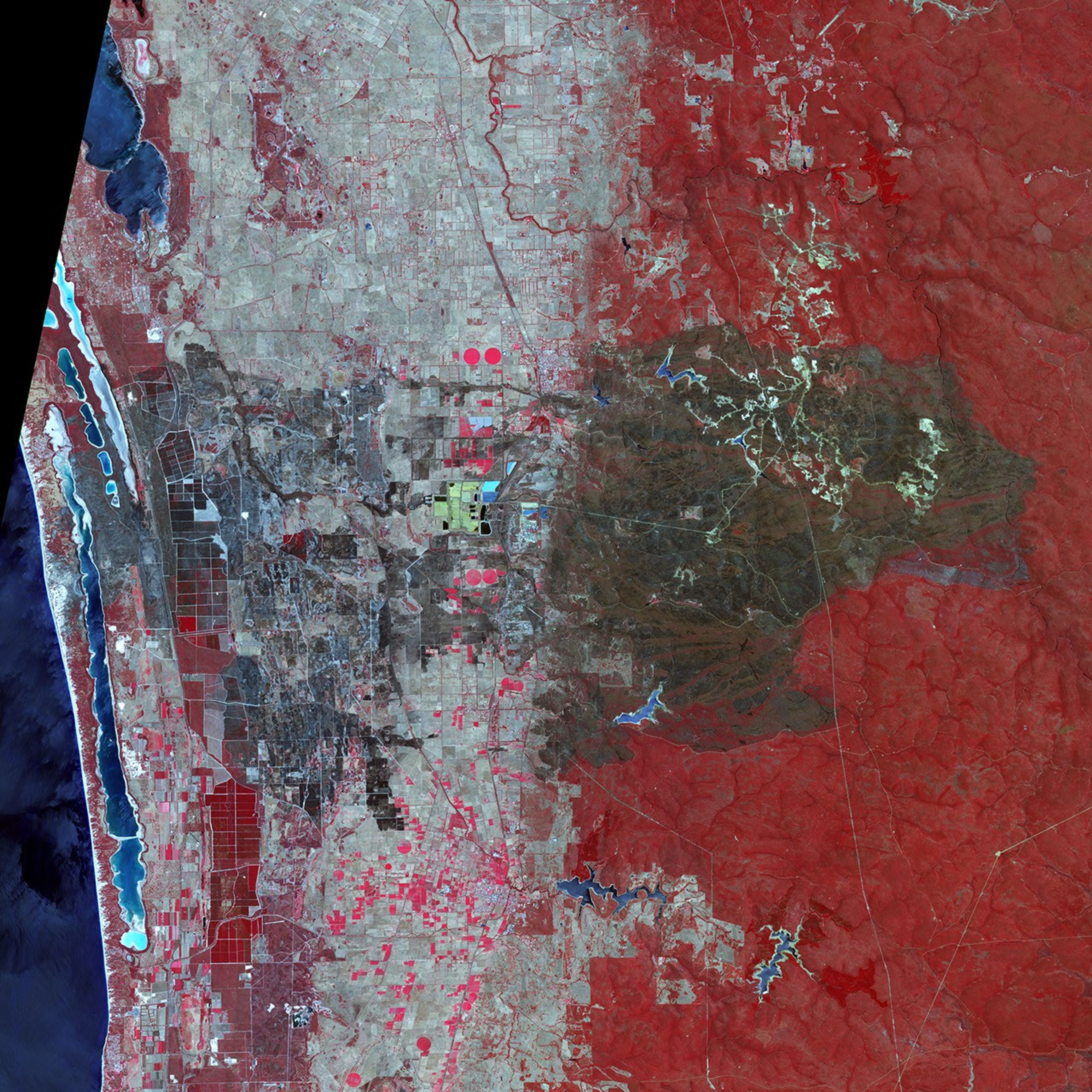
The Advanced Spaceborne Thermal Emission and Reflection Radiometer (ASTER) on the Terra satellite acquired this false-color view of the burn scar on January 16, 2016. Unburned vegetation appears red; burned vegetation appears brown. Buildings, roads, and other developed areas appear light gray and white.
References & Resources
- Government of Western Australia (2016) Bushfire ADVICE for Waroona and Harvey and surrounding areas in the Shires of Harvey and Waroona. Accessed January 19, 2016.
- NASA (2016, January 11) PyroCb over Australia. Accessed January 19, 2016.
- The Australian (2016, January 11) ‘Drying climate’ increases chance of deadly bushfires. Accessed January 19, 2016.
- WAToday (2016, January 19) WA fires: firefighters want a review into deadly blaze that destroyed Yarloop. Accessed January 19, 2016.
- The West Australian (2016, January 19) Forrest offers help to get town rebuilt. Accessed January 19, 2016.
NASA Earth Observatory image by Jesse Allen, using data from NASA/GSFC/METI/ERSDAC/JAROS, and U.S./Japan ASTER Science Team. Caption by Adam Voiland.