


September 10, 2022
Western Smoke Rides the Winds
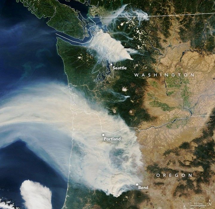
In late summer 2022, nearly 100 large wildland fires burned in the U.S. West. Almost two dozen of those burned Washington and Oregon alone, filling the air with smoke. Plumes from two of the fires on September 10, 2022, were especially pronounced.
The Moderate Resolution Imaging Spectroradiometer (MODIS) on NASA’s Terra satellite acquired this image in the late morning on September 10, 2022. Smoke blanketed Puget Sound and wafted out over the Pacific Ocean.
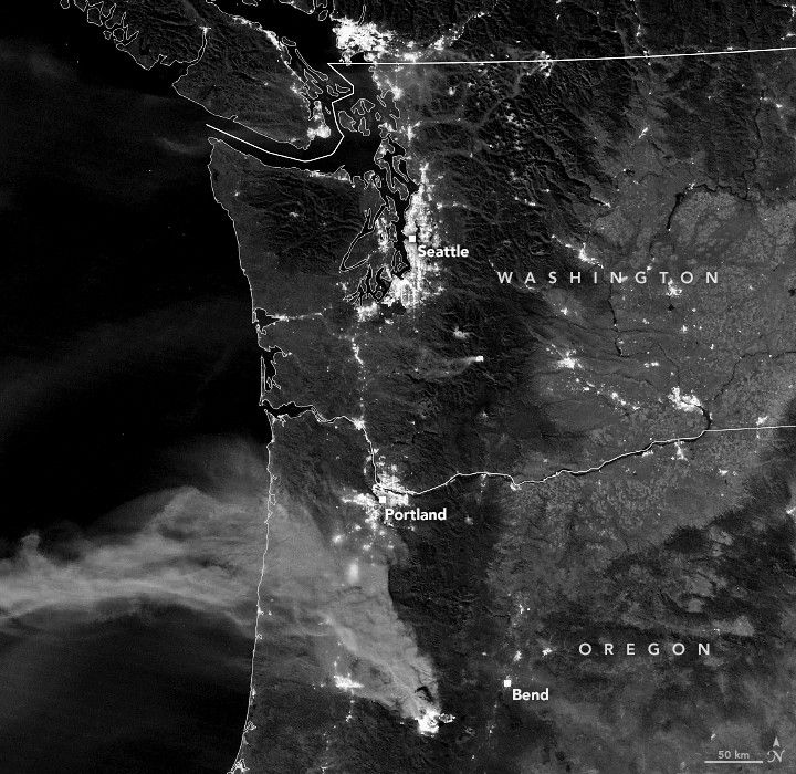
In Washington, the newly ignited Bolt Creek Fire burned in the western foothills of the Cascade Mountains, leading to the evacuation of the town of Index. Strong winds from the east carried smoke toward Seattle, causing poor air quality across parts of western Washington.
In Oregon, the Cedar Creek Fire continued to burn in the Willamette National Forest on the western slopes of the Cascade Range. The smoke also blew north-northwest, turning skies orange in Portland and reducing air quality to “very unhealthy” levels. Some of the smoke, however, rose higher in the atmosphere, where winds carried it toward the east.
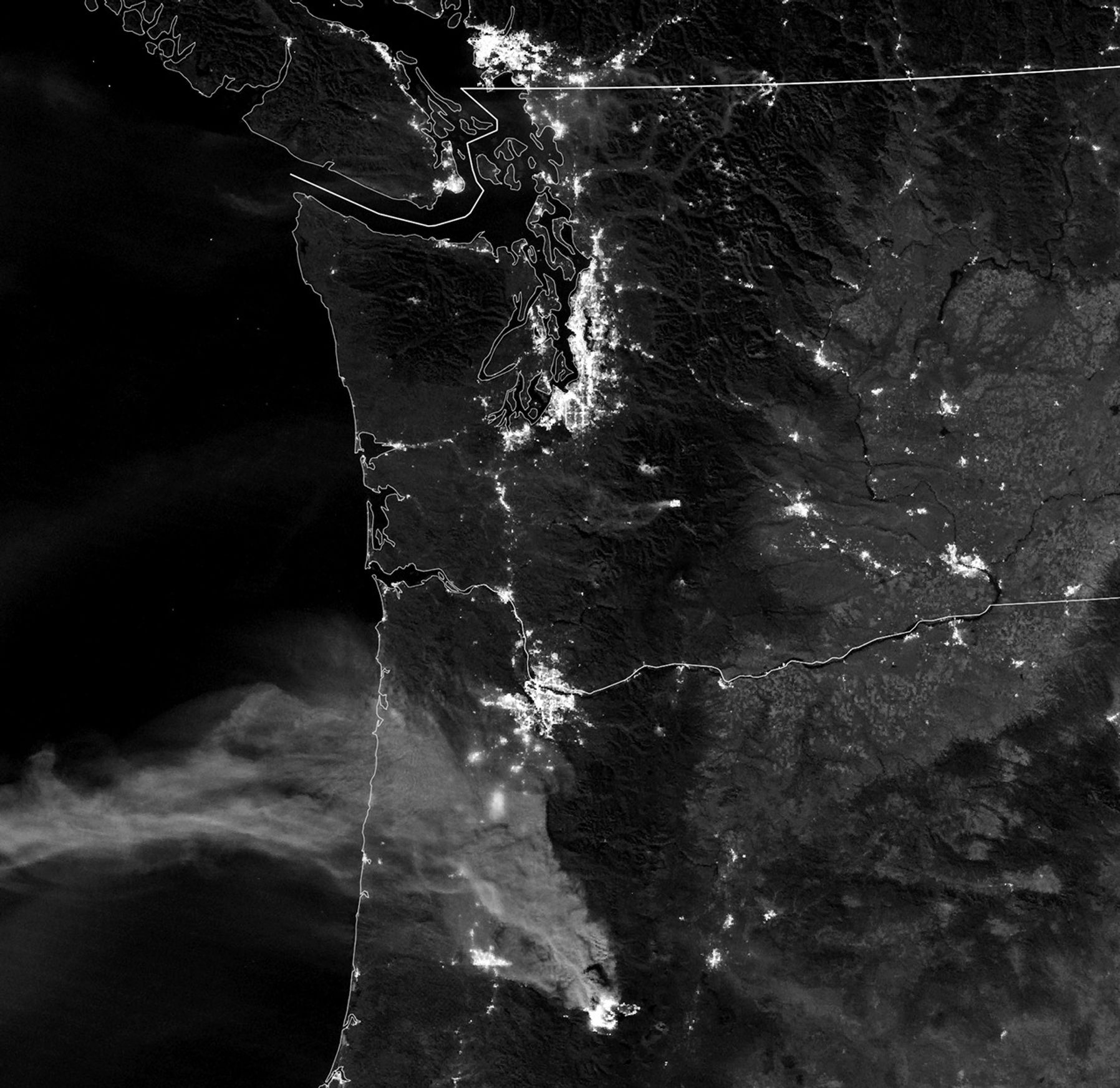
The Visible Infrared Imaging Radiometer Suite (VIIRS) on the Suomi-NPP satellite acquired the second image at 3:20 a.m. local time on September 10. Smoke and the fires were visible via the instrument’s day-night band, which measures nighttime light emissions and reflections. In this case, some of the smoke plumes reflected light from the full Moon.
Note that smoke from Washington’s Bolt Creek Fire is not apparent in this nighttime view. That fire ignited a few hours later and then grew quickly, spreading across 8,000 acres (32 square kilometers) by the afternoon of September 11. On that day, winds shifted direction with the approach of a low-pressure weather system from offshore, clearing some of the low-level smoke from western Washington and Oregon.
References & Resources
- Cliff Mass Weather Blog (2022, September 11) California Imports of Clouds and Smoke Aloft as Air Quality Rapidly Improves in Western Oregon and Washington. Accessed September 12, 2022.
- Cliff Mass Weather Blog (2022, September 10) Major New Fire near Stevens Pass Sending Smoke into the North Sound. Accessed September 12, 2022.
- InciWeb (2022, September 12) Cedar Creek Fire. Accessed September 12, 2022.
- InciWeb (2022, September 11) Bolt Creek Fire. Accessed September 12, 2022.
- KGW8 (2022, September 11) With fires burning across the state, much of Oregon sees hazy Saturday skies. Accessed September 12, 2022.
- NASA Earth Observatory (2022, September 11) Smoky Fires Rage in the Northwest.
- National Interagency Fire Center (2022, September 12) Statistics. Accessed September 12, 2022.
- The New York Times (2022, September 11) Wildfire in Washington Blows Toxic Air to Seattle and Surrounding Areas. Accessed September 12, 2022.
NASA Earth Observatory images by Lauren Dauphin, using MODIS data from NASA EOSDIS LANCE and GIBS/Worldview and VIIRS day-night band data from the Suomi National Polar-orbiting Partnership . Story by Kathryn Hansen .