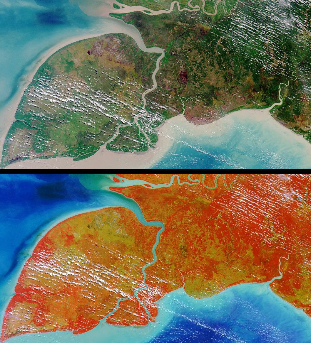
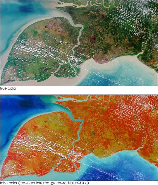
Here’s another chance to play geographical detective! These images fromthe Multi-angle Imaging SpectroRadiometer (MISR) were captured by theinstrument’s nadir camera on July 31, 2002, and show a natural-color (top)and false-color (bottom) view of a 291 kilometer x 158 kilometer area.
The false-color image includes data from the camera’s near-infraredband, and accentuates the appearance of vegetation. North is toward the top.
Below are nine statements about the large, leaf-shaped island in the lowerleft part of the image area. Only some of these statements are true. Use anyreference materials you like, and mark each statement true or false:
- The island is known by at least three different names.
- At least one language spoken on the island is not in common usage anywhereelse.
- The capital city of the province to which this island belongs is locatedwithin 200 kilometers of the northern boundary of the image area.
- The island’s shores are home to its country’s most spectacularcoral reefs.
- Due to the extreme depth of the sea floor surrounding the island, sea levelfluctuations during the Quaternary Period have not changed the horizontallocation of its coastline by more than 500 meters.
- There are no fruit bats on the island.
- The region within which the island is situated harbors a freshwater turtlethat is exceptional in its possession of an anatomical characteristic otherwisetypical of marine turtles.
- Insect control has been tested as a means of combatting an invasive aquaticweed that threatens wetland habitats in the island’s vicinity.
- Species of Avicennia are found in the island’s coastal regions.
Full rules and guidelines are available at MISR's Where on Earth...? page.
References & Resources
Image courtesy NASA/GSFC/LaRC/JPL, MISR Team.