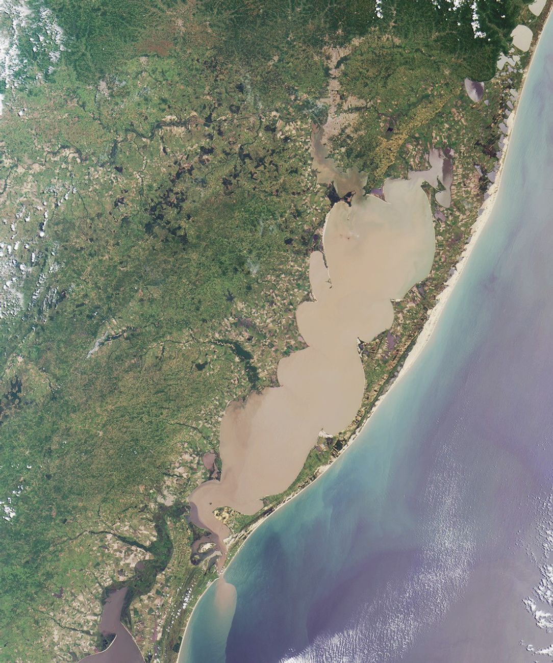
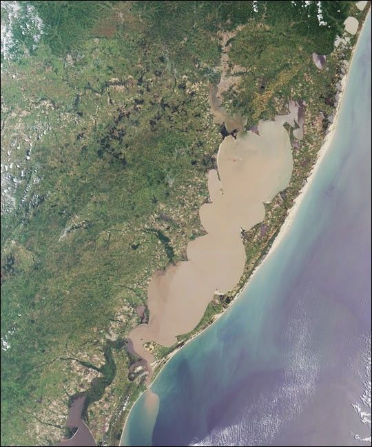
Here’s another chance to play geographical detective! This Multi-angleImaging SpectroRadiometer (MISR) image covers an area of about 298kilometers x 358 kilometers, and was captured by the instrument’svertical-viewing (nadir) camera on December 27, 2001. Use any referencematerials you like and answer the following five questions:
- The large lagoon in the image is named for a particular type of bird.Name the bird.
- Note the sediment plume emanating from the southern end of thelagoon. Sailors in the 16th century imagined this outlet to be the mouthof a large river. What did they call the river?
- A series of wave-like points and curls form “cusps” on the innershores of the lagoon. Which ONE of the following is most responsible forthe formation of these cusps?
- Violent storm impacts on erosion andaccretion
- Wind and tide-driven sediment transport and circulation
- Tectonic folding associated with nearby mountain ridges
- Bathymetric effects of dredging operations
- Ruppia maritima
- Chelonia mydas
- Tapirus bairdii
- Microcystis aeruginosa
E-mail your answers, name (initials are acceptable if you prefer), andyour hometown by Tuesday, February 19, 2002 tosuggestions@mail-misr.jpl.nasa.gov.
Answers will be published on the MISR web site in conjunction with the next weekly imagerelease. The names and home towns of respondents who answer allquestions correctly by the deadline will also be published in the orderresponses were received. The first 3 people on this list who are notaffiliated with NASA, JPL, or MISR and who did not win a prize in thelast quiz will be sent a print of the image.
A new “Where on Earth...?” mystery appears as the MISR “image of theweek” approximately once per month. A new image of the week is releasedevery Wednesday at noon Pacific time on the MISR home pagehttp://www-misr.jpl.nasa.gov.The image also appears on the AtmosphericSciences Data Center home page, http://eosweb.larc.nasa.gov, thoughusually with a several-hour delay.
References & Resources
Image courtesy NASA/GSFC/LaRC/JPL, MISR Team.