


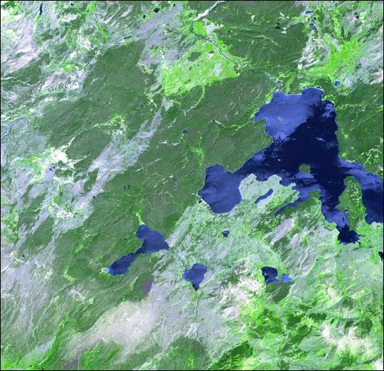
Thirteen years after devastating forest fires burned more than 1.6 million acres in Yellowstone National Park, the scars are still evident. In this simulated natural color ASTER image, burned areas appear gray in contrast to the dark green of unburned forests. This scene covers an area of 60 by 63 kilometers, and it was acquired on July 2, 2001, by the Advanced Spaceborne Thermal Emission and Reflection Radiometer (ASTER) on NASA’s Terra satellite.
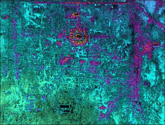
With its 14 spectral bands from the visible to the thermal infrared wavelength region and its high spatial resolution of 15 to 90 meters (about 50 to 300 feet), ASTER will image Earth for the next six years to map and monitor the changing surface of our planet. The instrument was built by Japan’s Ministry of Economy, Trade, and Industry. A joint U.S./Japan science team is responsible for validation and calibration of the instrument and the data products.
The broad spectral coverage and high spatial resolution of ASTER will provide scientists in numerous disciplines with critical information for surface mapping and monitoring dynamic conditions and temporal change.
References & Resources
Image courtesy NASA/GSFC/METI/ERSDAC/JAROS, and U.S./Japan ASTER Science Team


