


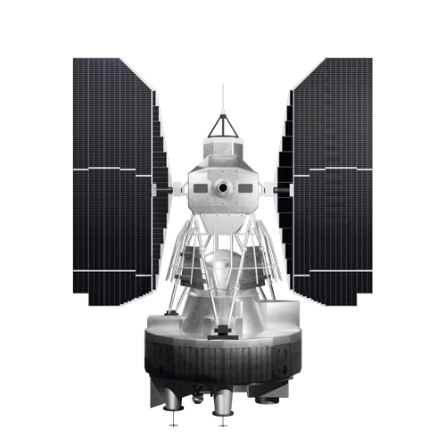
Landsat 1
Launched as the Earth Resources Technology Satellite (ERTS-1), Landsat 1 became the first satellite mission dedicated to monitoring Earth's land surfaces. This groundbreaking mission provided unprecedented insights into managing Earth's limited resources and understanding environmental changes. Its data revolutionized fields including agriculture, forestry, geology, mineral exploration, hydrology, geography, cartography, environmental monitoring, oceanography, and meteorology.
Mission Objective
Partner
LaunchED
decommissioned
| Quick Facts | |
|---|---|
| Sensors: RBV, MSS | Spatial Resolution: 80 m |
| Spectral Resolution: 4 bands | Temporal Resolution: 18 days |
| Radiometric Resolution: 6-bit | Image Data: 147 scenes per day |
| Scene size: 170 km (106 mi) x 185 km (115 mi) | Swath Width: 185 km (115 mi) |
| Global Reference Grid System: WRS-1 | Altitude: 917 km (570 mi) |
| Inclination: 99.2° | Orbit: Polar, sun-synchronous |
| Equatorial Crossing Time: Nominally 9:42 AM mean local time (descending node) | Period of Revolution: 103 minutes; ~14 orbits/day |
| Design Life: 1 year |
Overview
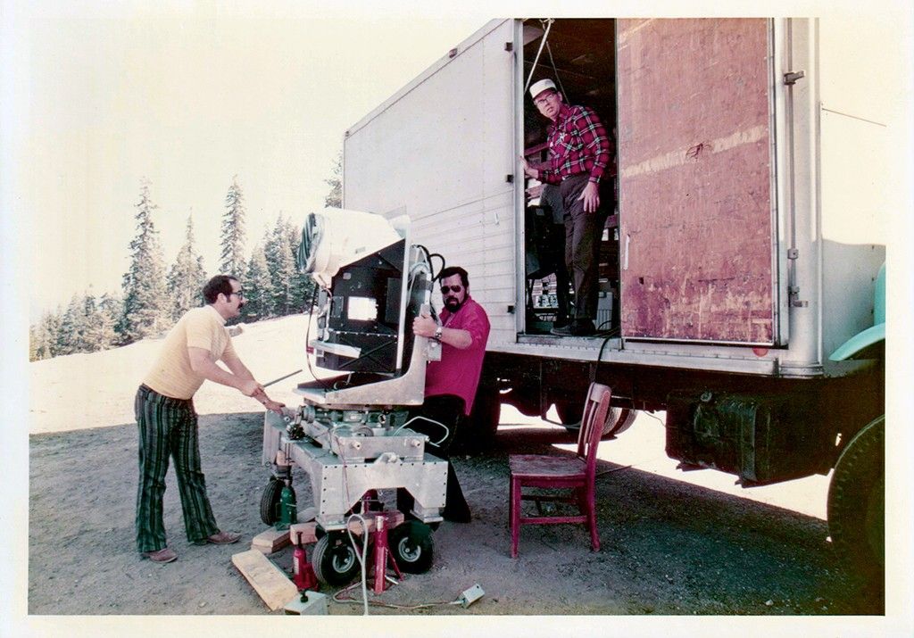
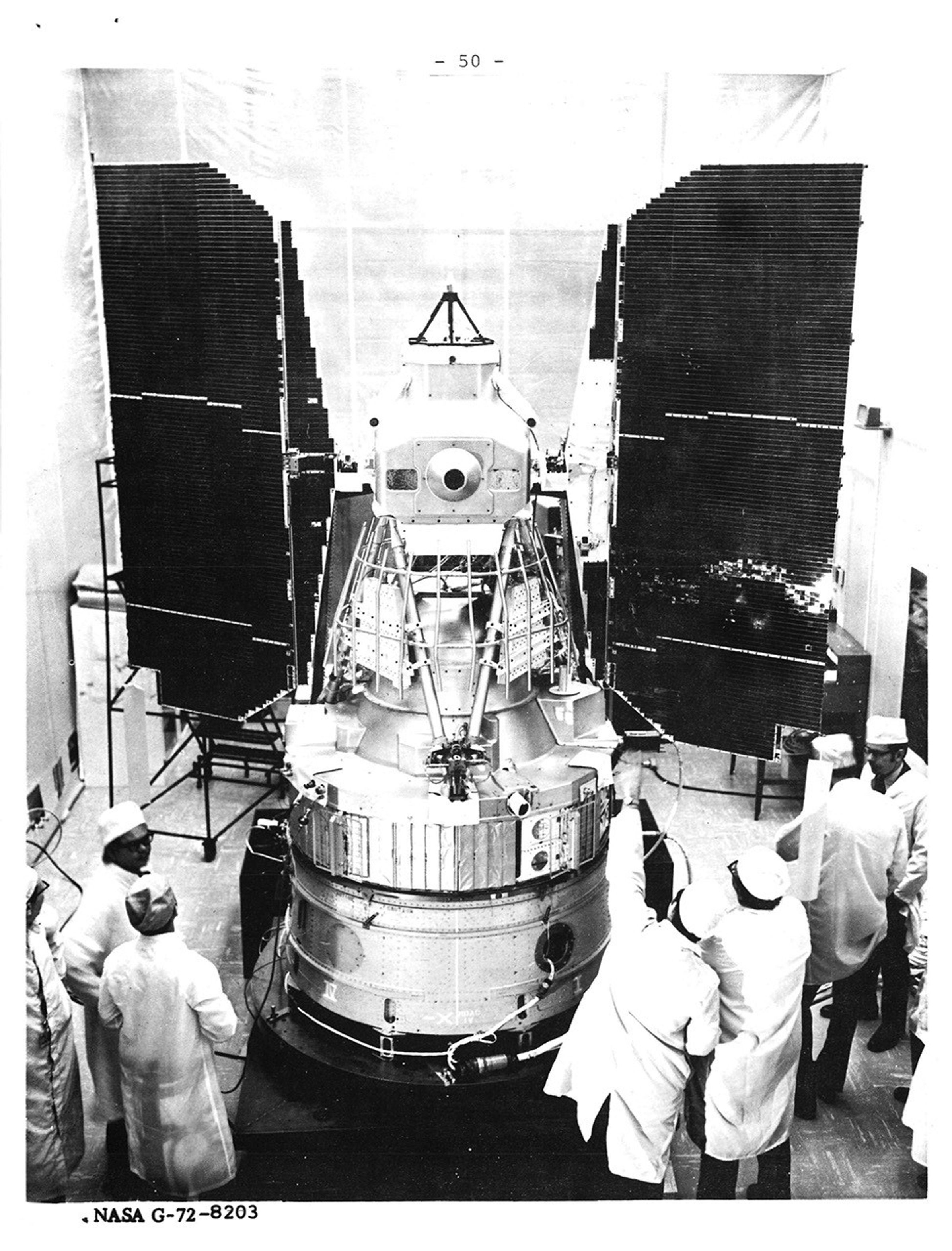
Landsat 1 (originally ERTS-1) launched on July 23, 1972, marking the beginning of the world's longest-running Earth observation satellite program. The spacecraft orbited the entire planet every 18 days and carried two instruments: the Return Beam Vidicon (RBV) and the Multispectral Scanner System (MSS).
The RBV, initially considered the primary sensor, was based on analogue television camera tube technology developed in the 1960s for weather satellites. However, a defective power-switching circuit caused power surges just days after launch and the RBV was shut down. The MSS instrument—an experimental, secondary instrument—became the primary instrument. Its digital scanning technology and 80-meter resolution proved superior to traditional analog camera systems and revolutionized Earth observation.
Operating until January 6, 1978, Landsat 1 demonstrated that digital multispectral observations from space can provide economic and social value to commercial, scientific, and governmental users. It supported major agricultural programs, established international ground station networks, and collected over 300,000 scenes. The success of the mission—and in particular the MSS instrument—established the technological foundation and calibration techniques that set the standard for decades of Earth observation missions.

Spacecraft
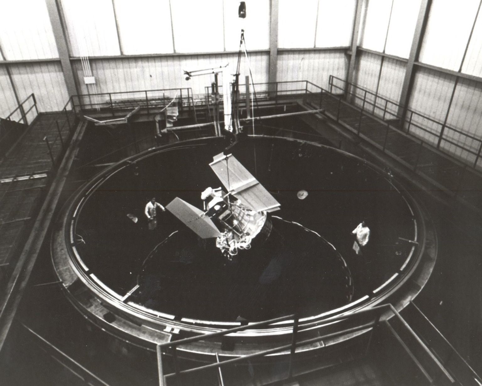
The Landsat 1 spacecraft was a modified version of the Nimbus 4 meteorological satellite. Its attitude control system was composed of horizon scanners, sun sensors, a command antenna, and a freon gas propulsion system. The stabilization and control were achieved using four reaction wheels. Reaction wheels are standard components for fine attitude control in three-axis stabilized spacecraft. This control system maintained the spacecraft's orientation within ±0.7 degrees in all three axes.
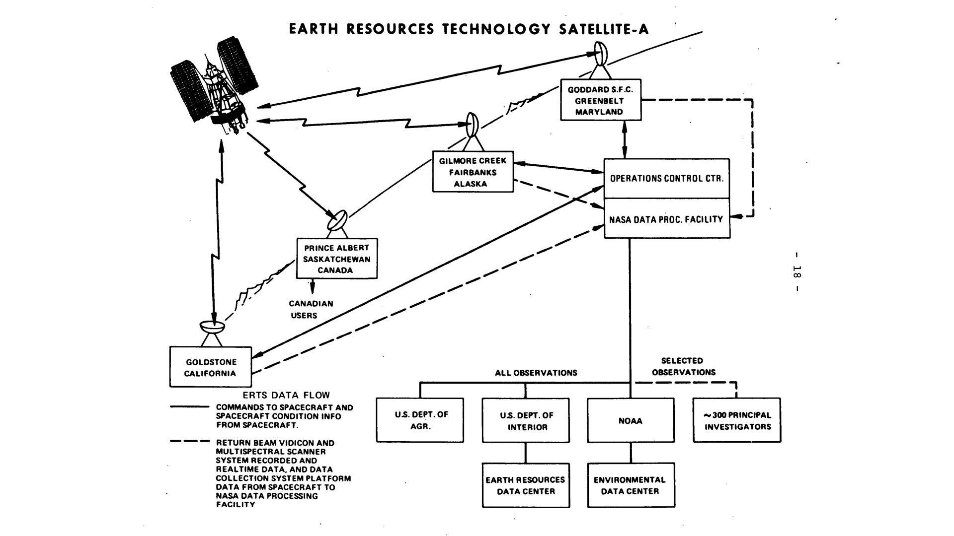
Landsat 1’s two instruments (the RBV and MSS) collected data by scanning the ground directly beneath the observatory.
The spacecraft’s data collection system (DCS) relayed measurements from remote platforms that measured soil moisture, water and air quality, and other environmental data. These data were then transmitted to Landsat as it passed overhead and relayed to central acquisition stations. This system provided in-situ measurements used in the interpretation of data from the other two sensors.
Return Beam Vidicon (RBV)
The Return Beam Vidicon (RBV) camera system was originally considered the primary Landsat imaging sensor. Built by the Radio Corporation of America (RCA), it contained three independent cameras taking pictures of Earth scenes simultaneously in three different spectral bands. It acquired 1,400 high-resolution scenes in its first two weeks. However, a major power surge associated with RBV on August 6, 1972, caused loss of attitude control pointing the spacecraft away from earth and the ground controllers were forced to turn it off.
Ground tests later identified a faulty inductor in the power-switching circuit as the root cause of the failure. Due to safety concerns, limited tape storage, and the superior performance of the MSS, the RBV was permanently deactivated just 15 days after launch.
Band 1: Blue-green (0.475 – 0.575 µm)
Band 2: Orange-red (0.580 – 0.680 µm)
Band 3: Near Infrared (0.690 – 0.830 µm)
Spatial resolution: 80 m
Data: 3.5 MHz FM video
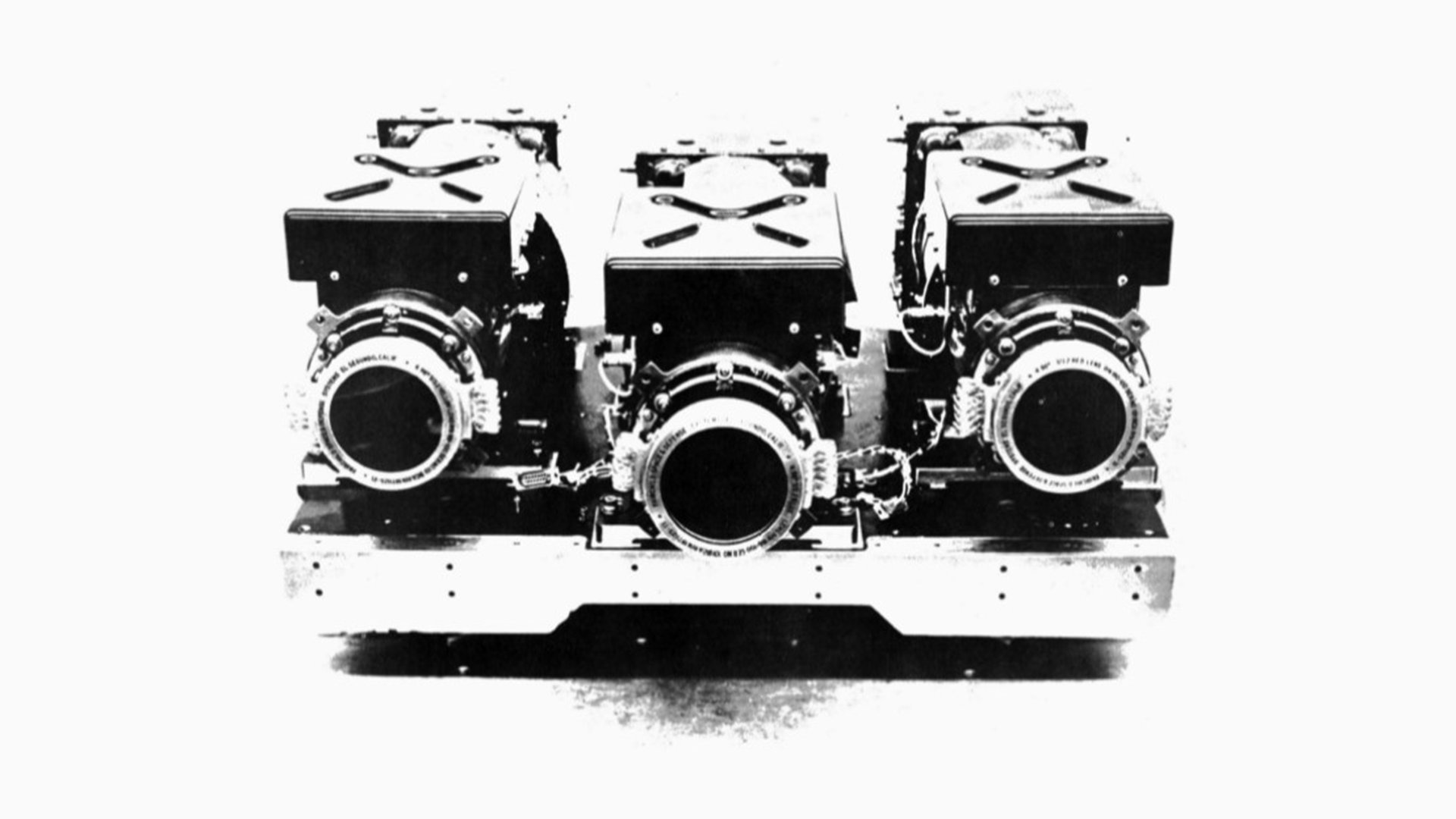
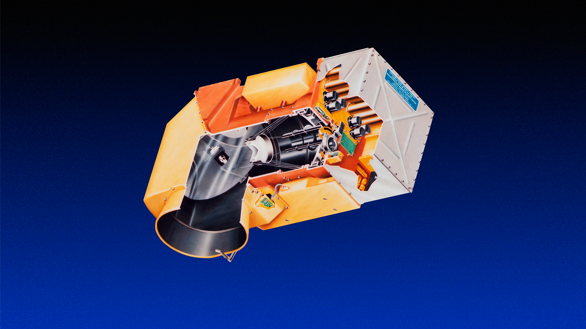
Multispectral Scanner System (MSS)
The Multispectral Scanner System (MSS) was originally proposed as an experimental sensor, but soon became the primary imaging instrument aboard Landsat 1.
Built by Hughes Aircraft Company, the MSS used an oscillating mirror that created digital images by scanning the Earth—a revolutionary approach at the time. The mirror operated at 13.62 Hz frequency with four spectral bands. Though limited to 6-bit radiometric resolution, it enabled the first practical radiometric studies of land cover. The MSS's digital number (DN) pixel approach laid the groundwork for modern Earth observations and even influenced digital camera and television development.
Band 4: Green (0.5 – 0.6 µm)
Band 5: Red (0.6 – 0.7 µm)
Band 6: Near-infrared (0.7 – 0.8 µm)
Band 7: Near-infrared (0.8 – 1.1 µm)
Spatial Resolution: 80 m (commonly resampled to 60 m)
Ground Sampling Interval (pixel size): 57 x 79 m
Scene size: 170 km x 185 km (106 mi x 115 mi)
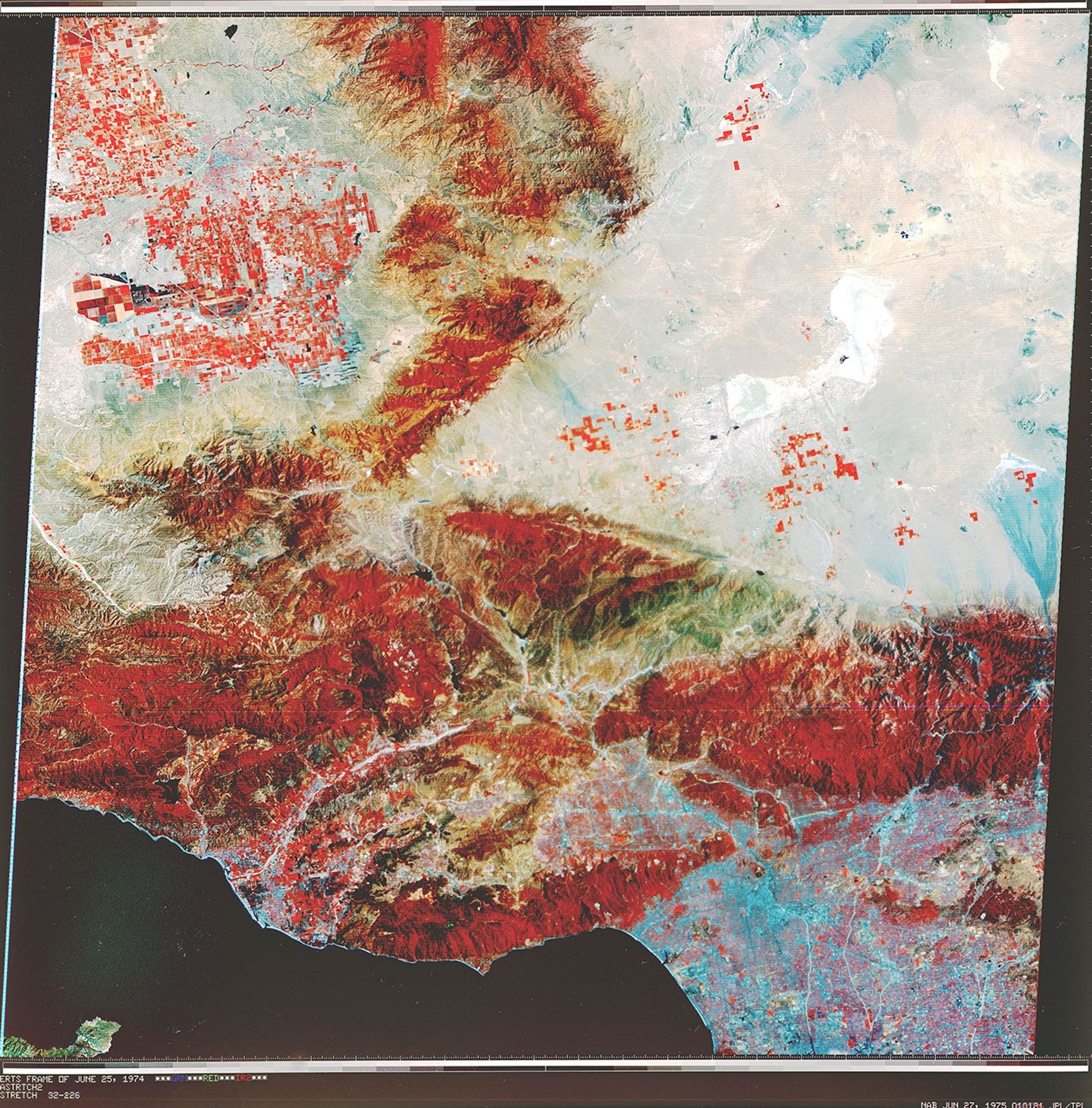
July 25, 1972
First Light
Dallas-Fort Worth, Texas
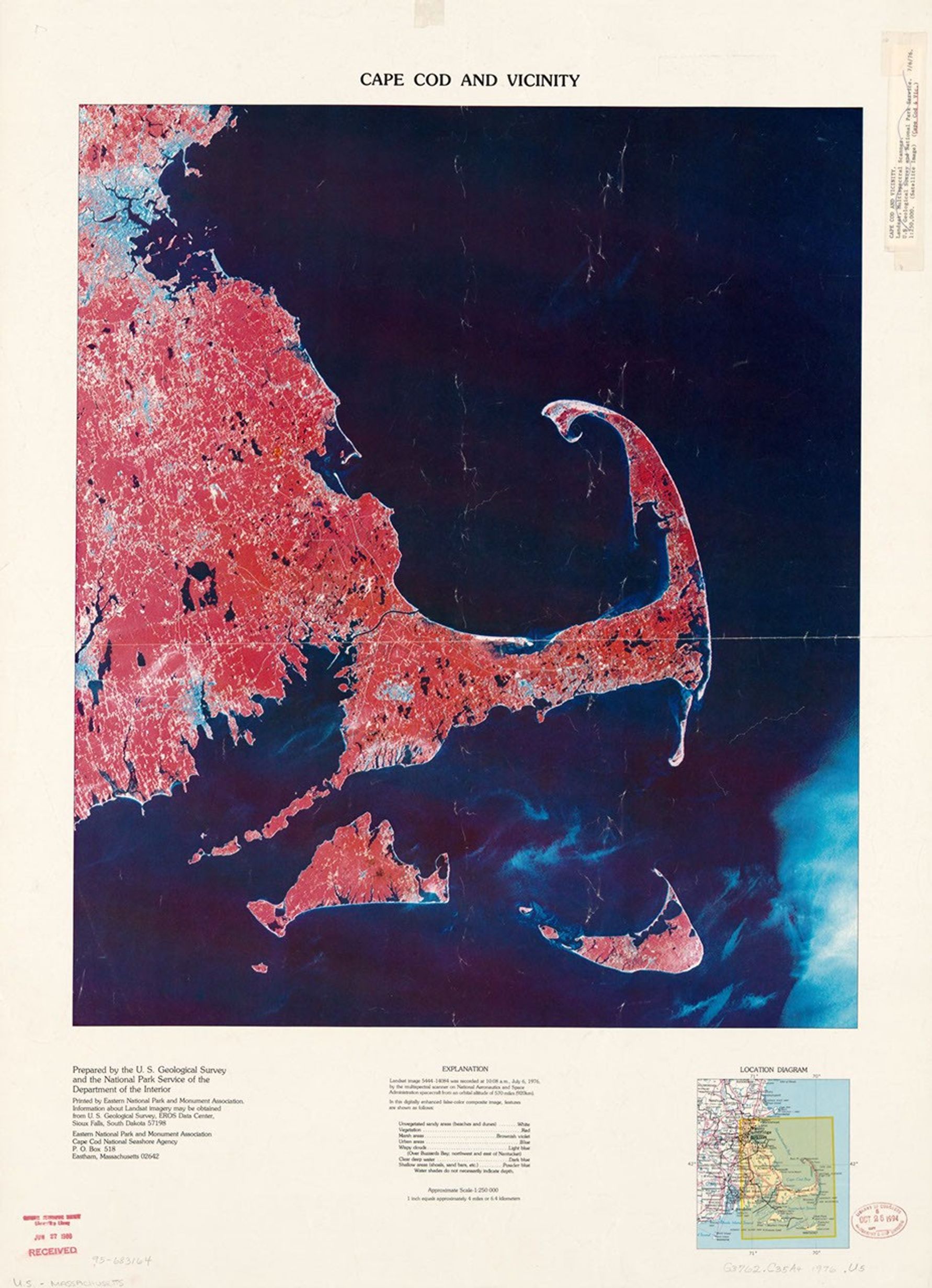
The first Landsat image revealed a multi-spectral landscape of vegetation (reds), urban and rocky surfaces (grays and whites), and reservoirs (blues) near Dallas-Fort Worth, Texas. The geometric fidelity of MSS met the needs of the mapping community and the multispectral data proved to be invaluable for agriculture, forestry, and mineral exploration.
Explore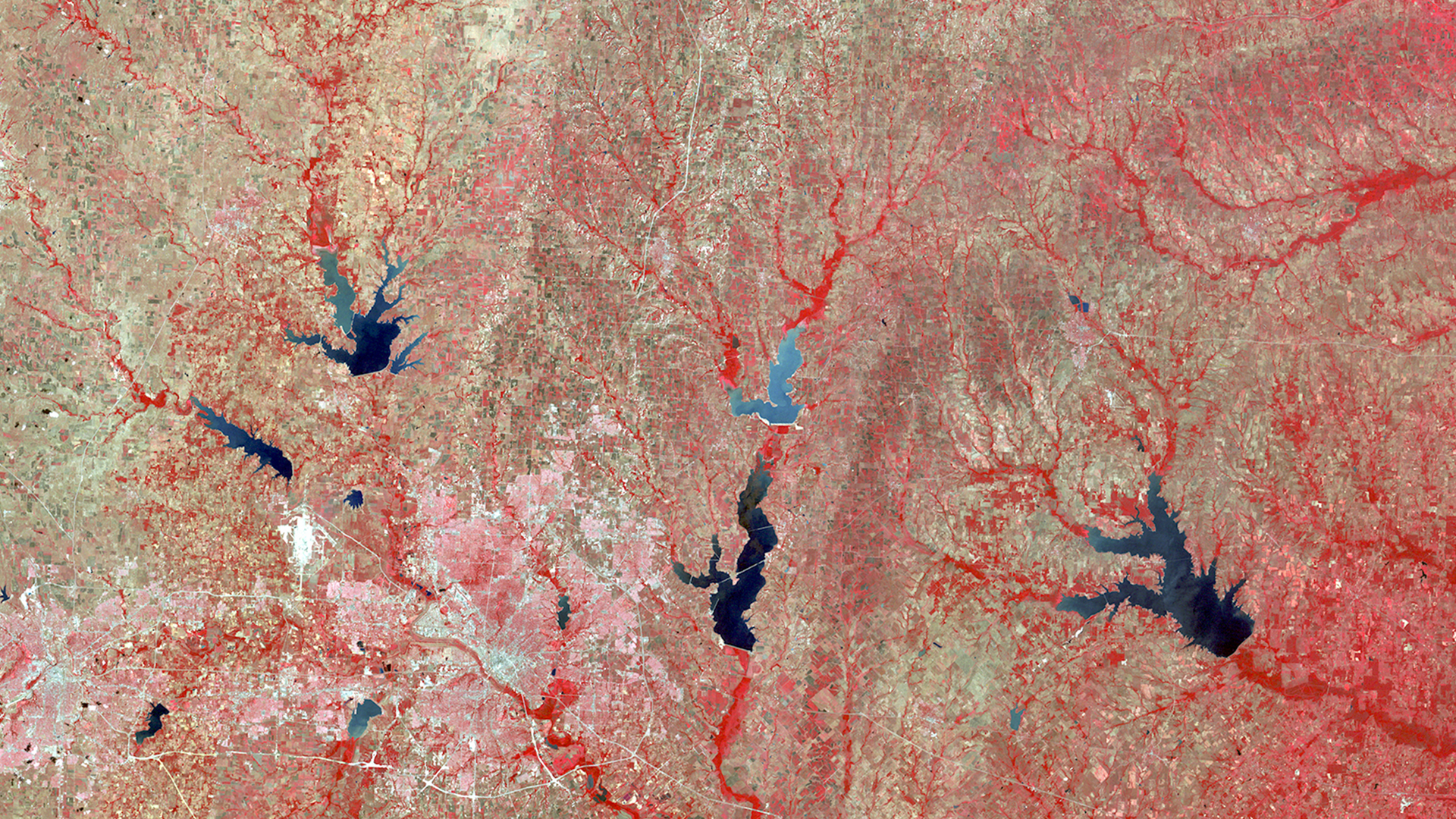
Communications
Landsat 1's communications system featured multiple frequency bands for different functions: command operations at 154.2 and 2106.4 MHz, narrow-band telemetry for spacecraft housekeeping and sensor data at 2287.5 and 137.86 MHz, RBV camera video transmission at 2265.5 MHz, and MSS data transmission at 2229.5 MHz with a 20-MHz bandwidth.
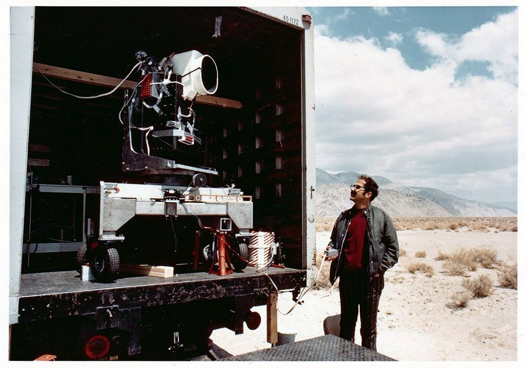
To achieve near-global coverage, the spacecraft relied on two wideband video tape recorders (WBVTRs) for data storage. Each WBVTR could store 30 minutes (3.75 gigabytes) of data from both sensors simultaneously and transmit two channels of wideband data at once. These advanced recorders operated at dramatically higher speeds than typical space tape systems—2,000 inches per second compared to the standard 30 inches per second. These recorders were also used for playback, as the spacecraft was frequently out of range of the three ground stations.
Mission Objectives
-
Prove Satellite Effectiveness
Demonstrate that repetitive, synoptic, multispectral space observations provide economic and social value to commercial, scientific, and governmental users.
-
Test Integrated Systems
Evaluate combined data acquisition and interpretation techniques across multiple Earth science disciplines including agriculture, forestry, geology, and hydrology.
-
Establish Practical Applications
Identify specific Earth resources management problems where space technology offers beneficial solutions.
-
Advance Remote Sensing Capabilities
Develop sensor technologies and data processing techniques for comprehensive Earth observation.
The Earth-resources program is going to pay for itself many, many times over, in terms of benefits to people not just in this country but also throughout the world.
James Fletcher
Former NASA Administrator
Virginia Norwood and the Little Scanner that Could
Virginia T. Norwood, now recognized as the Mother of Landsat, designed the first space-based multispectral scanner instrument that flew on Landsat 1 and made the mission a success. This pioneering technology—developed in collaboration with NASA, USGS, and university researchers—made regular digital imaging of Earth from space possible.
ExploreMission Results
-
Data Collection
Landsat 1’s Multispectral Scanner System (MSS) collected over 175,000 scenes during its five and a half years in orbit. The instrument provided consistent 80-meter resolution imagery over 185-kilometer (100-nautical-mile) swaths.
By the end of 1973, Landsat 1 had captured nearly complete global land coverage, much of it with minimal cloud cover.
After tape recorder failures in 1972 and 1974, the mission relied solely on real-time data downlinks, but continued to deliver high-quality imagery to U.S. and international ground stations through 1978.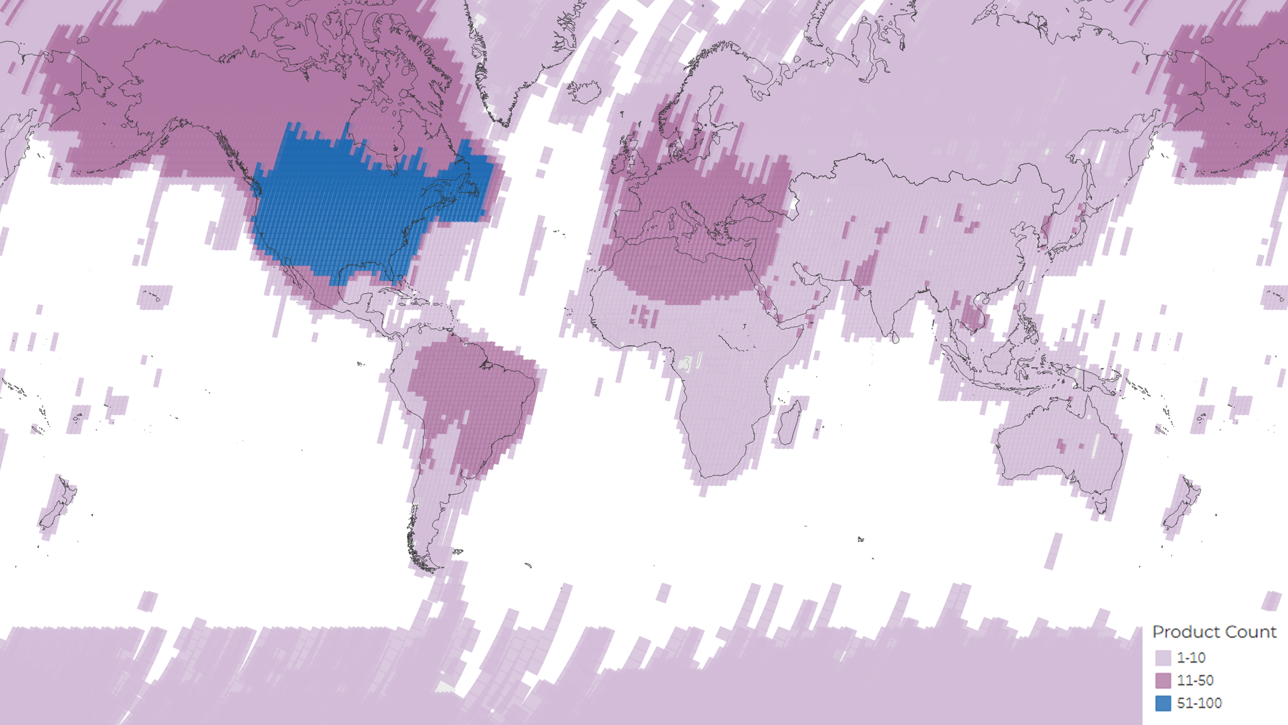 A density map showing the distribution of the total 174,955 MSS scenes acquired and archived during the lifetime of the Landsat 1 mission. The colors represent the number of products per Path/Row.USGS
 -
Recharting the Planet
In 1972, less than half of Earth’s surface was accurately mapped and only about 40 percent of the United States was mapped at the standard USGS 1:250,000 scale. Scientists used Landsat 1 data to reveal how out-of-date existing maps were and to chart large regions of Africa, Asia, and South America.
MSS far exceeded cartographer’s expectations, allowing them to create and refine maps with better geometric accuracy than with RBV data or existing aerial imagery. Landsat revolutionized the ability to map remote regions, establishing itself as a major cartographic tool.
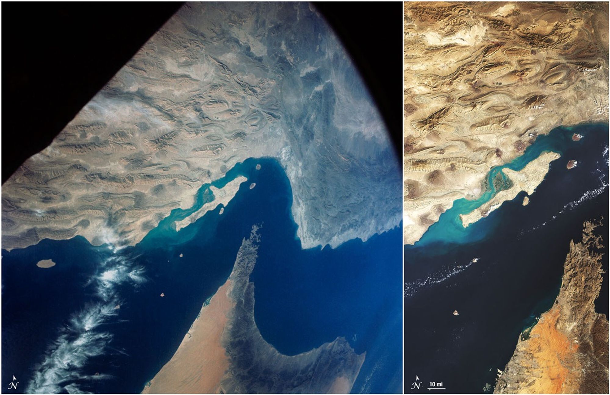
Landsat’s comparatively large geographic coverage allowed researchers to study more of the Earth’s surface easier and faster. MSS data helped scientists to redraw 1,200 miles of Antarctic coastline, update the position and courses of many Amazon tributaries, create a baseline record of the world’s glaciers, map global sand seas, and create the first large-scale land cover inventory of Alaska. Early Landsat imagery exposed many errors in contemporary nautical charts. The second (left) and third (right) editions of Defense Mapping Agency chart 61610. The third edition, released on August 28, 1976, shows the newly discovered Colvocoresses Reef and the adjusted position of Speakers Bank. Landsat provided the information needed for both chart adjustments.Defense Mapping Agency/NSA
 -
Finding Fault Lines from Space
Landsat 1's Multispectral Scanner (MSS) revolutionized geological exploration and analysis by providing imagery that showed Earth's features in unprecedented ways. The satellite's morning acquisition time observed low sun angles that accentuated topographic shadows, revealing major geological structures including linear fracture traces, faults, and boundaries. Collectively known as lineaments, these structures are often obscured by other features or are so large that they are not recognizable from the ground or aerial photographs.
Petroleum companies analyzed MSS images for crustal fault lines to guide oil and gas exploration, as significant mineral deposits and fossil fuel reserves typically occur along these lineaments. This proved to be a faster, more cost-effective method for identifying drilling locations than traditional methods using aerial photography and in situ techniques.
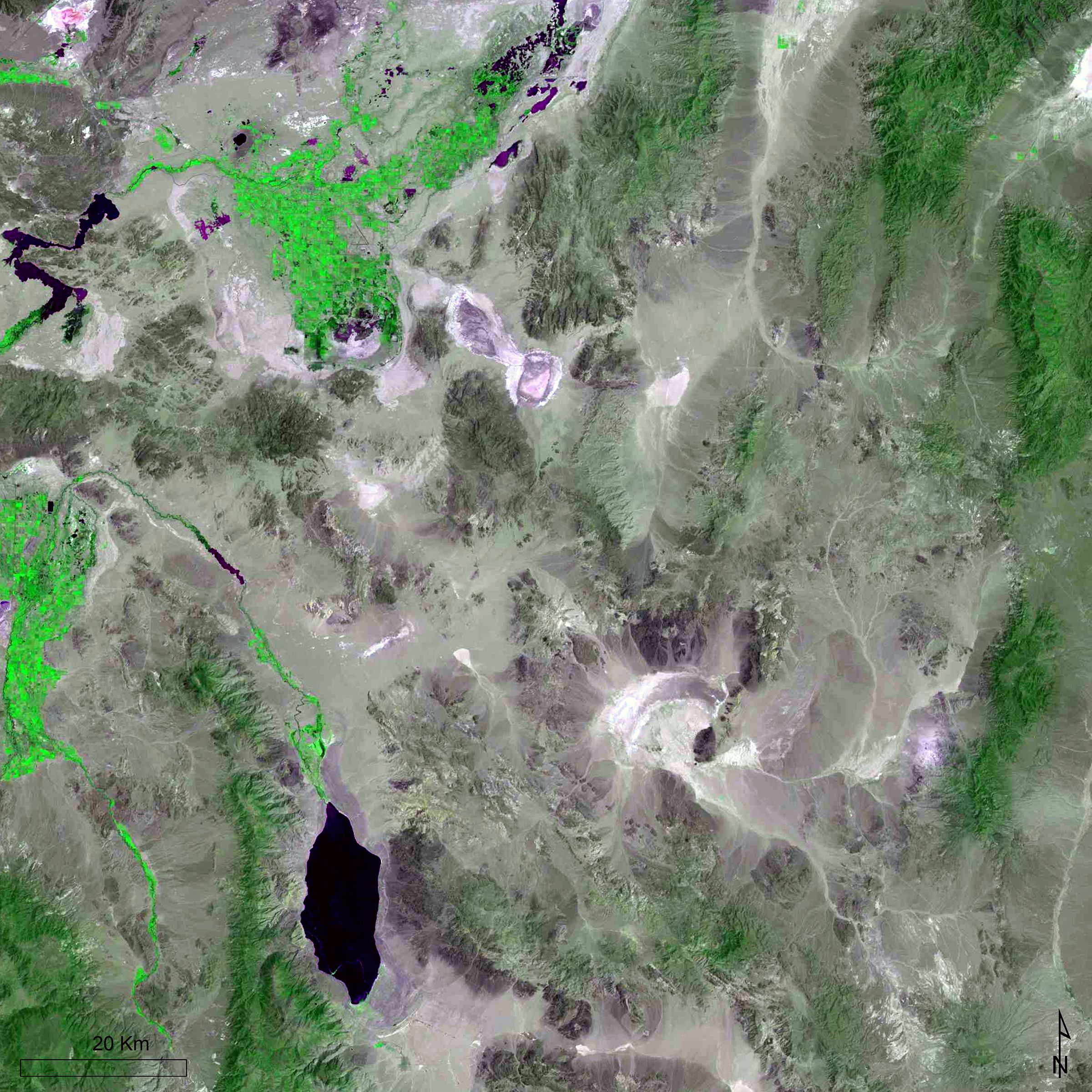
These geological structures also correlate to areas of seismic activity. The global coverage provided by Landsat 1 facilitated the discovery of unknown fault lines in remote, previously inaccessible regions. Cornell University geologists used MSS imagery to redraw maps of Central Asia, transforming our understanding of the continent’s tectonic history. These discoveries provided critical visual evidence supporting the 1967 theory of plate tectonics.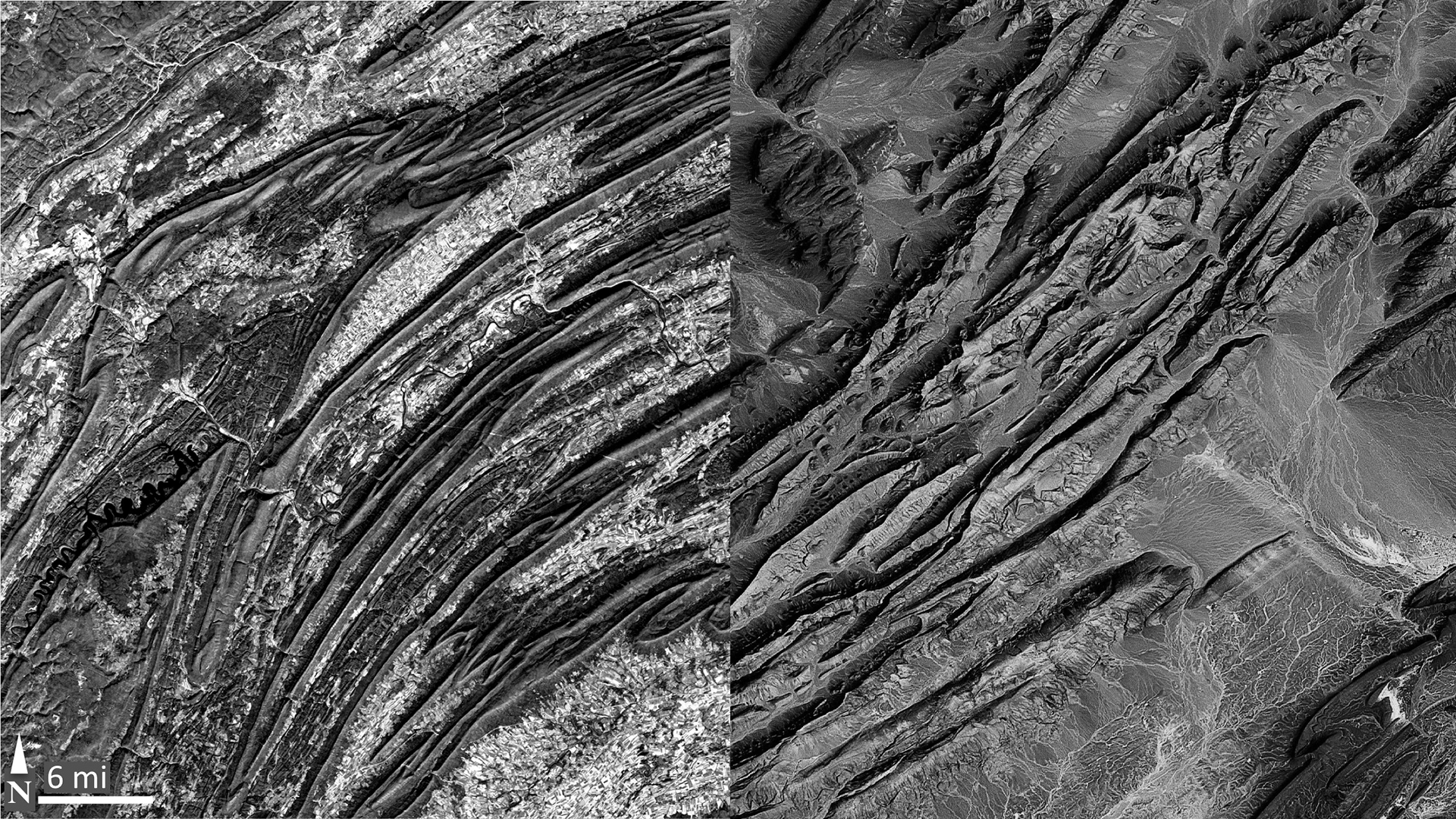 A comparison of MSS imagery of central Pennsylvania (left), and southwestern Morocco (right) show similar ridge-and-valley landforms connecting similar geologic features on opposite sides of the Atlantic. These images provide visual evidence supporting the theory of plate tectonics.NASA Goddard Space Flight Center
NASA Landsat - From the Archives
In this 2012 video, NASA compiled archival footage of the 1972 ERTS launch and the early days of the Landsat program. Featured in this video are Nicholas Short, a senior geologist at NASA, and Robert Simpson and David Lindgren, researchers at Dartmouth College.
ExploreLegacy
-
The Great Grain Robbery
In the early 1970s, the United States grew a surplus of wheat. Unaware of a worldwide shortage, the U.S. sold 15 million tons of wheat to the Soviet Union at a large discount. This massive purchase, later named the “Great Grain Robbery,” created an extreme domestic shortage and wheat prices skyrocketed.
Following the Great Grain Robbery, the U.S. government recognized the need for an accurate, up-to-date system to track crops globally and avoid being caught off-guard again. They turned to the newly-launched Landsat 1. Johnson Space Center (JSC) coordinated the Crop Identification Technology Assessment for Remote Sensing (CITARS) project to use Landsat 1 data to evaluate the existing automated procedures for crop identification. The results from CITARS highlighted the broader potential of Landsat data for agricultural monitoring. -
From Experimental to Essential
The MSS was the first space-based instrument to digitally encode, record, and transmit Earth data. This innovative technology ushered in the era of digital Earth observation, transforming remote sensing from an analog, photographic discipline into a quantitative science. Eventually, the flood of digital multispectral information demanded entirely new approaches to data handling and interpretation. Pioneering laboratories such as the Environmental Research Institute of Michigan (ERIM) and Purdue's Laboratory for Applications of Remote Sensing (LARS) developed numerical, multivariate, and statistical interpretation techniques that created many new landcover classification methods still used today.
These early digital processing methods made their way into commercial image processing software packages and, more recently, into open source code that powers today's big data era of satellite image analysis. The MSS's digital legacy thus extends far beyond its original Earth observation mission, establishing the technological foundation for modern computational approaches to analyze our planet from space. -
Setting the Gold Standard
Landsat 1 pioneered calibration protocols and became the first Earth observation satellite specifically designed to obtain calibration data in orbit. This calibration process ensures the consistency of Landsat data—maintaining both radiometric and geometric accuracy—which enables reliable comparisons and the detection of surface changes over time. Today, Landsat is recognized as the “gold standard” for medium-resolution satellite imagery.
Featured Story
Celebrating 53 Years Since Landsat 1’s Launch
With a swarm of satellites now circling the Earth, it’s easy to take for granted the unique value of monitoring our home planet from space. In the 1970s, however, the idea was still novel. When the Earth Resources Technology Satellite (ERTS-1)—what we now call Landsat 1—launched in 1972, it posed the following question: could we manage our natural resources using remotely–sensed data? The answer, 53 years on, is a resounding “yes.”
Explore about Celebrating 53 Years Since Landsat 1’s Launch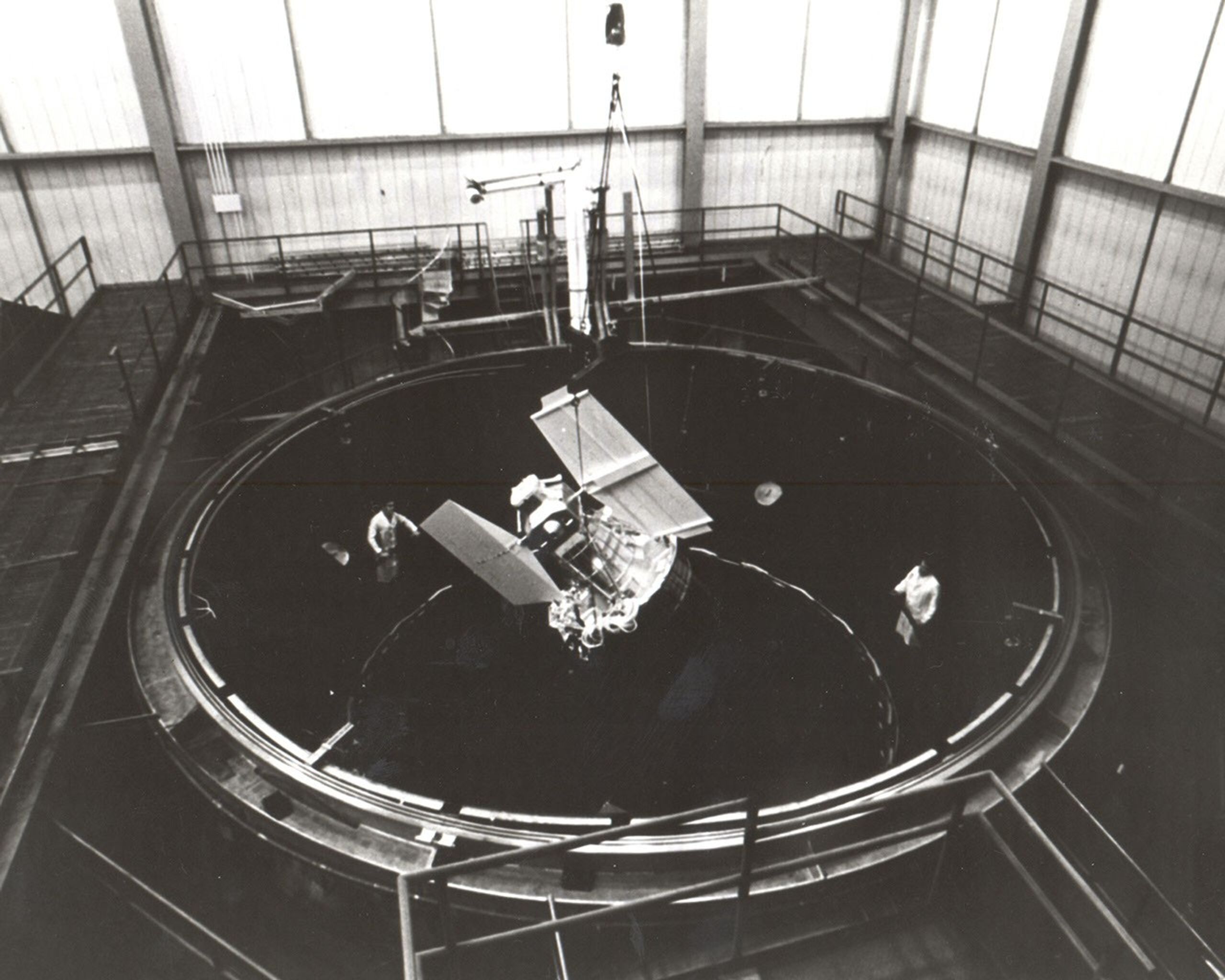
Project and Program Management
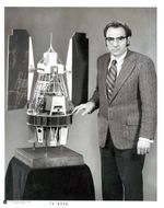
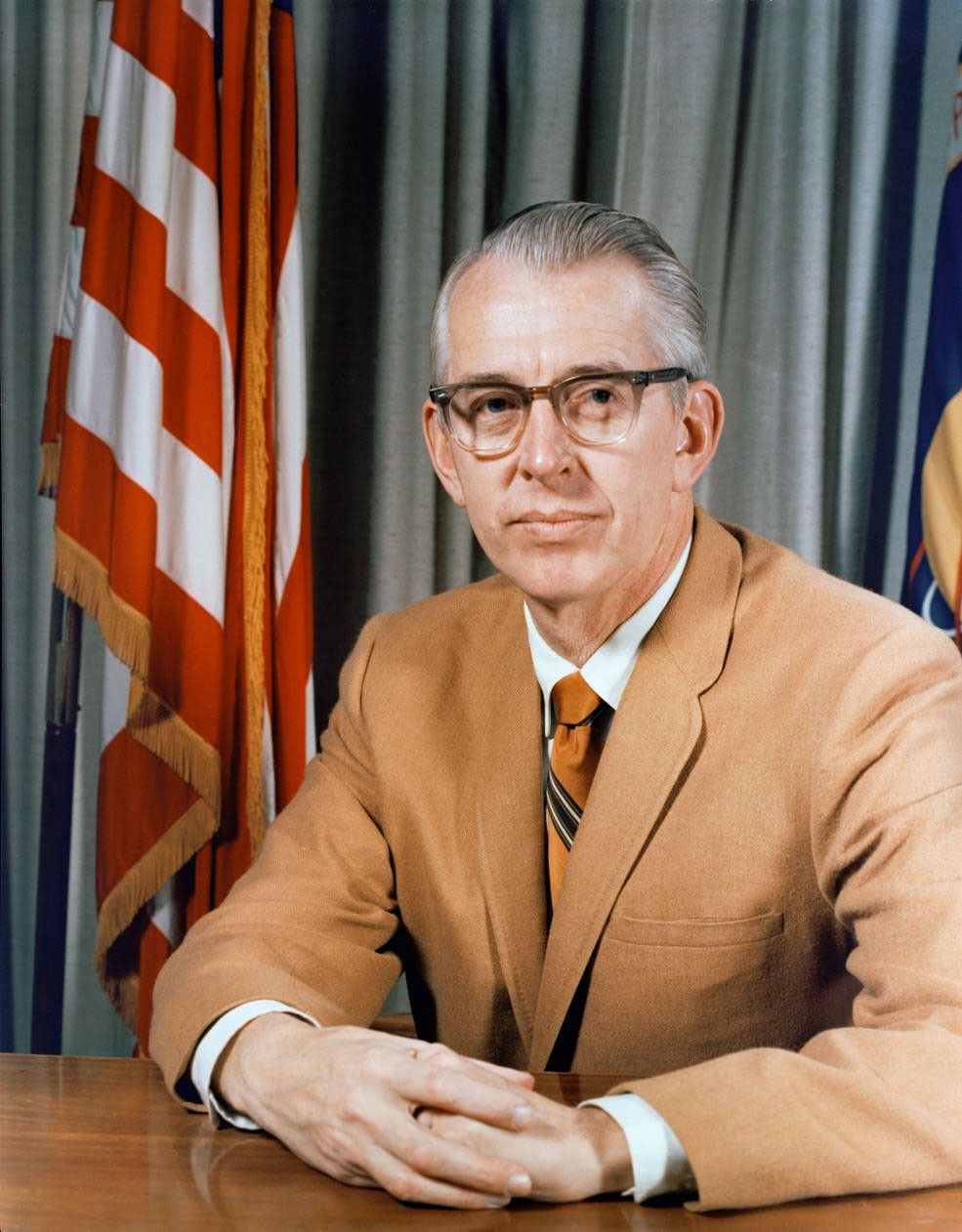
Stanley C. Freden
Landsat 1 Project Scientist
William Nordberg
Former Landsat 1 Project Scientist
Wilfred E. Scull
Landsat 1 Project Manager

Stanley Weiland
Landsat 1 Deputy Project Manager
Featured Image
Frozen Chesapeake Bay
In 1977, the Chesapeake Bay area experienced subfreezing temperatures which froze large portions of the bay. On February 10, the temperatures rose rapidly and the ice began to thaw. Landsat 1 captured cloud-free images just two days before the thaw. This image demonstrates Landsat’s capability to record temporal phenomena such as maximum ice coverage. Similar maps were produced to help demonstrate Landsat 1’s new-found ability to document and communicate important geographic phenomena to the American public.
Explore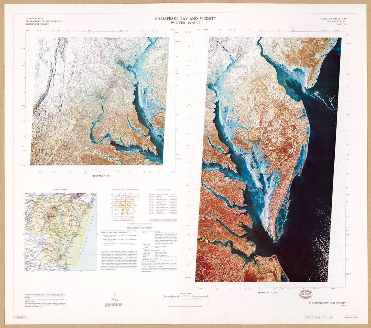
Landsat 1 Graphics Library

Related Resources
Explore additional Landsat 1 resources for more background information about the development, launch, and history of the mission.

ERTS-A Press Kit
This document introduces NASA's first Earth Resources Technology Satellite, detailing its purpose and objectives.
USGS Landsat 1 StoryMap
This interactive story narrates the launch, history, and applications of the world's first Earth-observing satellite.

Small Steps, Giant Leaps: Episode 82, NASA’s Role in Agriculture
NASA Water Resources and Agriculture Program Manager Brad Doorn discusses how NASA satellites help monitor global food production and water resources, supporting farmers and food security worldwide.


