Worldwide Reference System (WRS)
The Worldwide Reference System (WRS) organizes Landsat imagery into a global grid, providing a consistent, reliable framework for locating, comparing, and analyzing data over time and across sensors.

Overview
The Worldwide Reference System (WRS) is a global notation system used to organize Landsat data. It enables a user to locate satellite imagery over any portion of the world by specifying a nominal scene center designated by path and row numbers. The system was created in 1972 by the Canada Centre for Remote Sensing (CCRS) to catalog Landsat imagery collected over Canada. The United States Geological Society (USGS) adopted and expanded the system to cover the entire globe, defining a grid based on the satellite’s 18-day temporal cycle.
The WRS grid is composed of paths (defined by Landsats’ orbits) and rows (drawn parallel to latitude). Each intersection of a path and row identifies the center point of a unique Landsat scene in order to catalog the imagery. Each scene is classified in the notation [path number]/[row number]. For example, the notation 016/033 in WRS-1 indicates that Washington D.C. is located in Path 016 and Row 033. Every location on Earth belongs to a unique WRS frame, making the system invaluable for using Landsat data.
Landsats 1–3 use the original grid system, known as WRS-1. Landsats 4-9 use the revised WRS-2, which was introduced with the launch of Landsat 4 in 1982. Landsat 10 will use the new WRS-3.
WRS-1
The first Worldwide Reference System, WRS-1, established the framework used to map and organize imagery from Landsats 1–3. WRS-1 consists of 251 paths and 119 rows which were chosen to align with the satellite’s 917-kilometer orbit and field of view (FOV).
- Paths represent the ground tracks of the satellite’s orbit from north to south and start at 001 for the first track, crossing the equator at 65.48° W.
- Rows represent the latitudinal center line of a Landsat scene from east to west and range from 001 near 80° N to 119 near 80° S, with Row 060 centered on the equator.
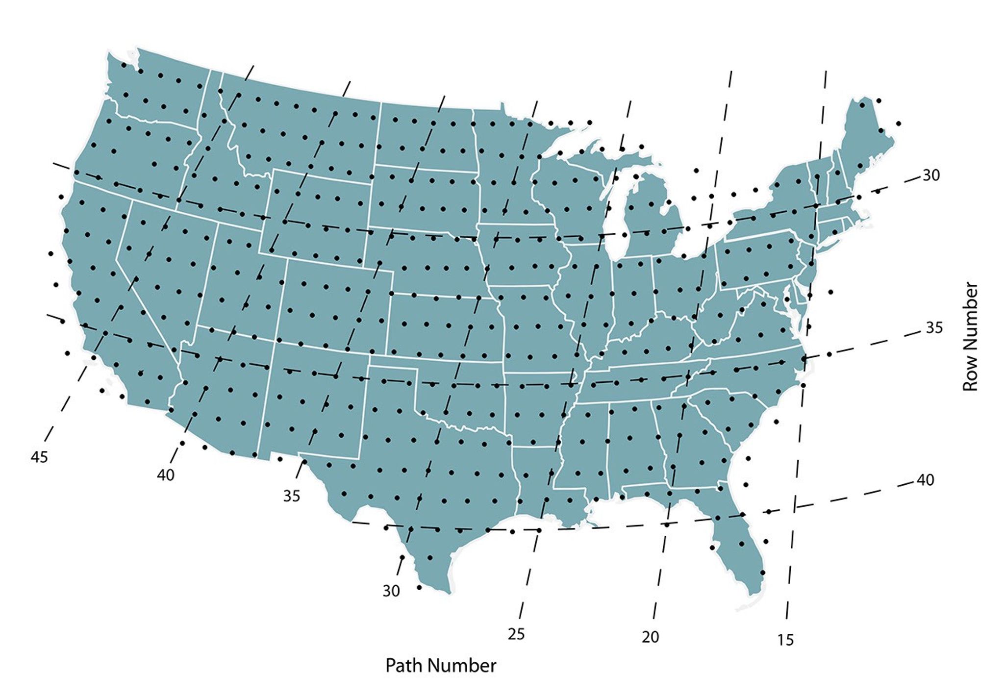
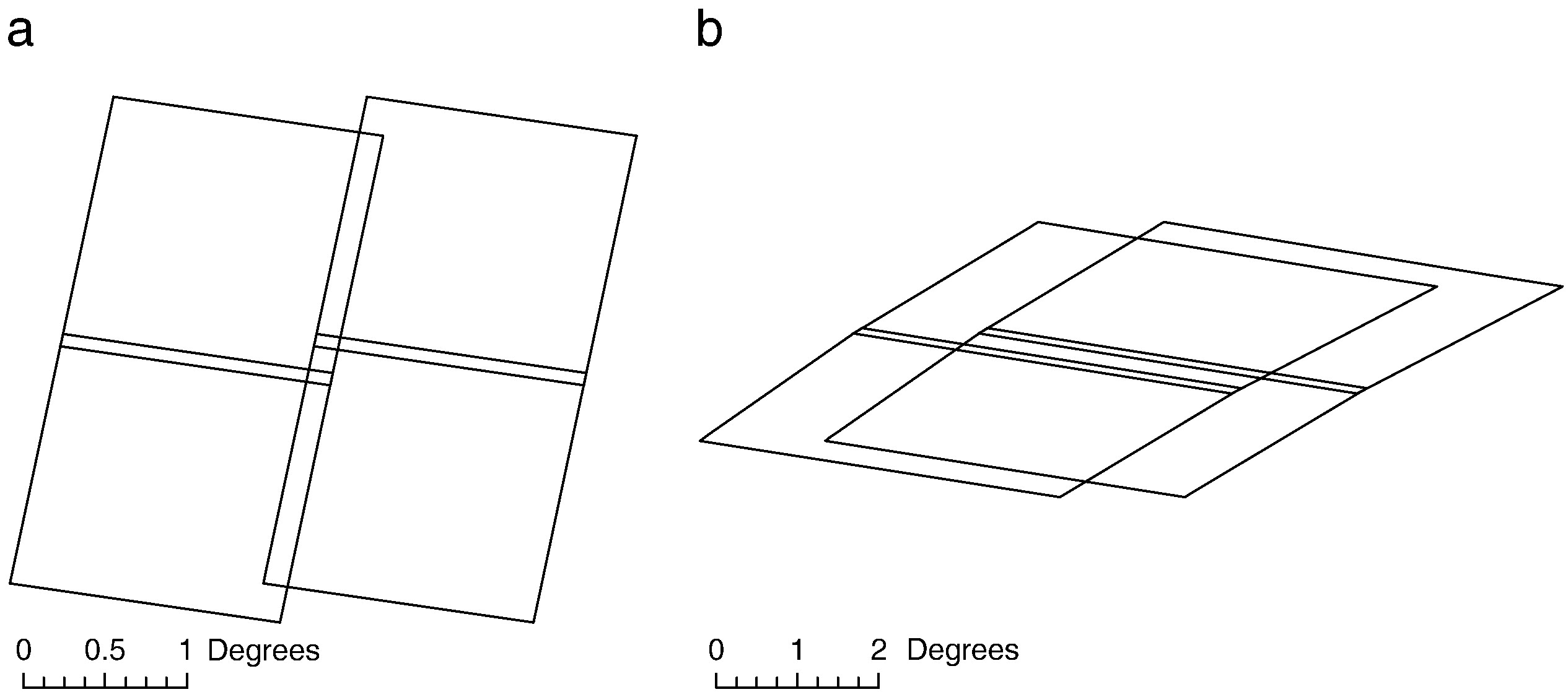
For Landsats 1–3, scene centers were spaced at roughly 25-second intervals of spacecraft time on either side of the equator. Each scene covered about 163 kilometers (101 miles) on Earth’s surface, with an additional in-track overlap of about 10 percent for Landsats 1–2 and 5 percent for Landsat 3, applied during ground processing to ensure continuous coverage.
The geometry of the WRS-1 grid was specific to the early Landsat orbits and sensor configurations.
WRS-2
The Worldwide Reference System-2 (WRS-2) is an updated version of WRS-1. When Landsat 4 was launched in 1982, it was placed into a lower orbit to accommodate servicing by NASA space shuttle astronauts. Plans to launch the space shuttle into polar orbits were abandoned after the Challenger accident and the space shuttle was never used to service a Landsat satellite. However, its different altitude and sensor field of view required a new reference system, WRS-2, which has been used for all subsequent missions.
The Worldwide Reference System-2 (WRS-2) is an updated version of WRS-1. WRS-2 consists of 233 paths and 248 rows to align with the lower-altitude (705 km/438 mi) orbits of Landsats 4-9.
- Paths represent the ground tracks of the satellite’s orbit from north to south and start at 001 for the first track, crossing the equator at 64.60° W.
- Rows represent the latitudinal center line of a Landsat scene from east to west and range from 001 near 80.78° N to 119 near 81.85° S, with Row 060 centered on the equator.
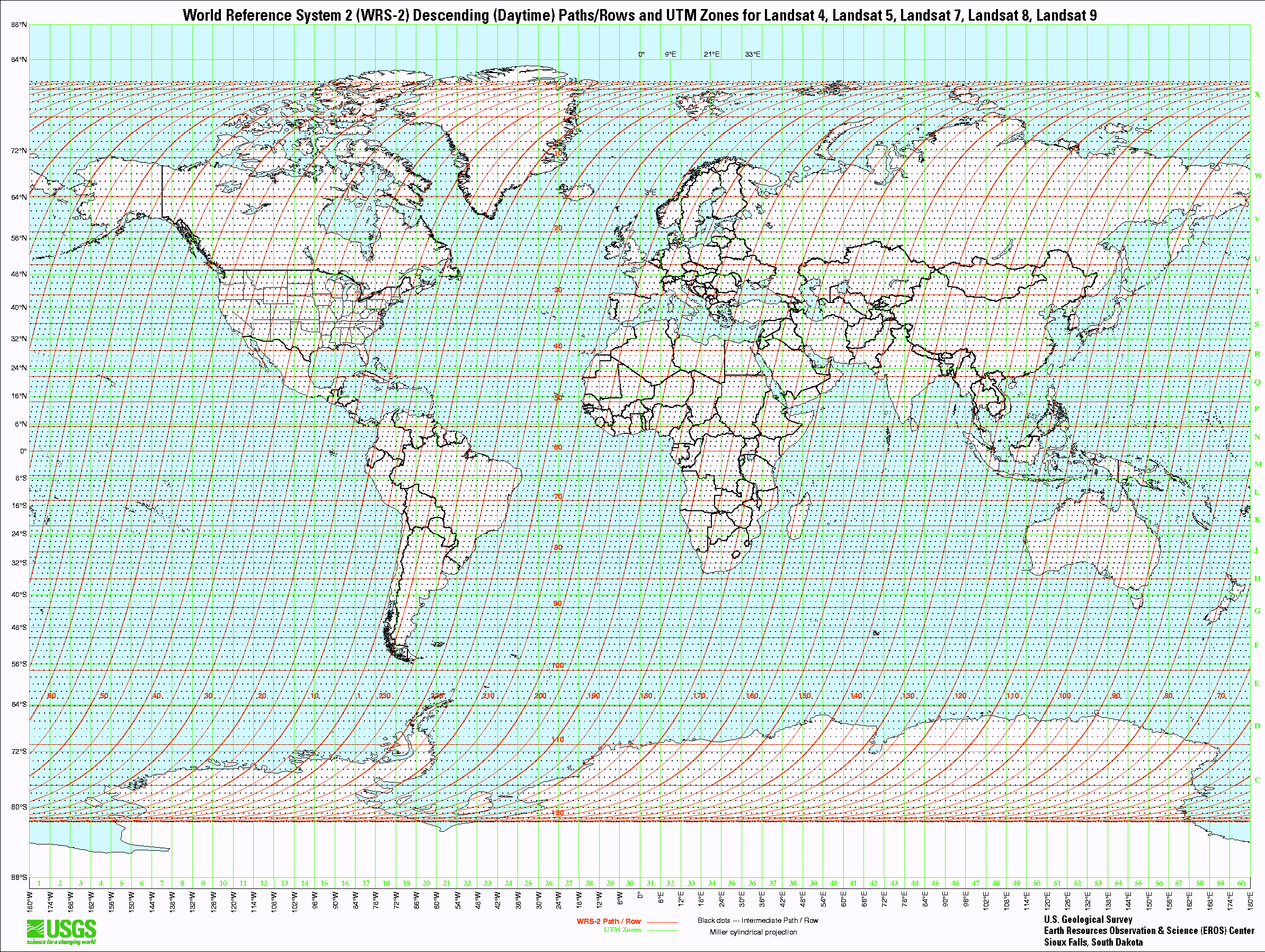
For Landsats 4-9, scene centers were spaced at 23.92-second increments of spacecraft time in both directions calculated from the equator. Each scene covers about 185 kilometers (115 miles) with an additional in-track overlap ranging from 7 percent at the equator to approximately 85 percent at extreme latitudes to ensure consistent coverage.
WRS-3
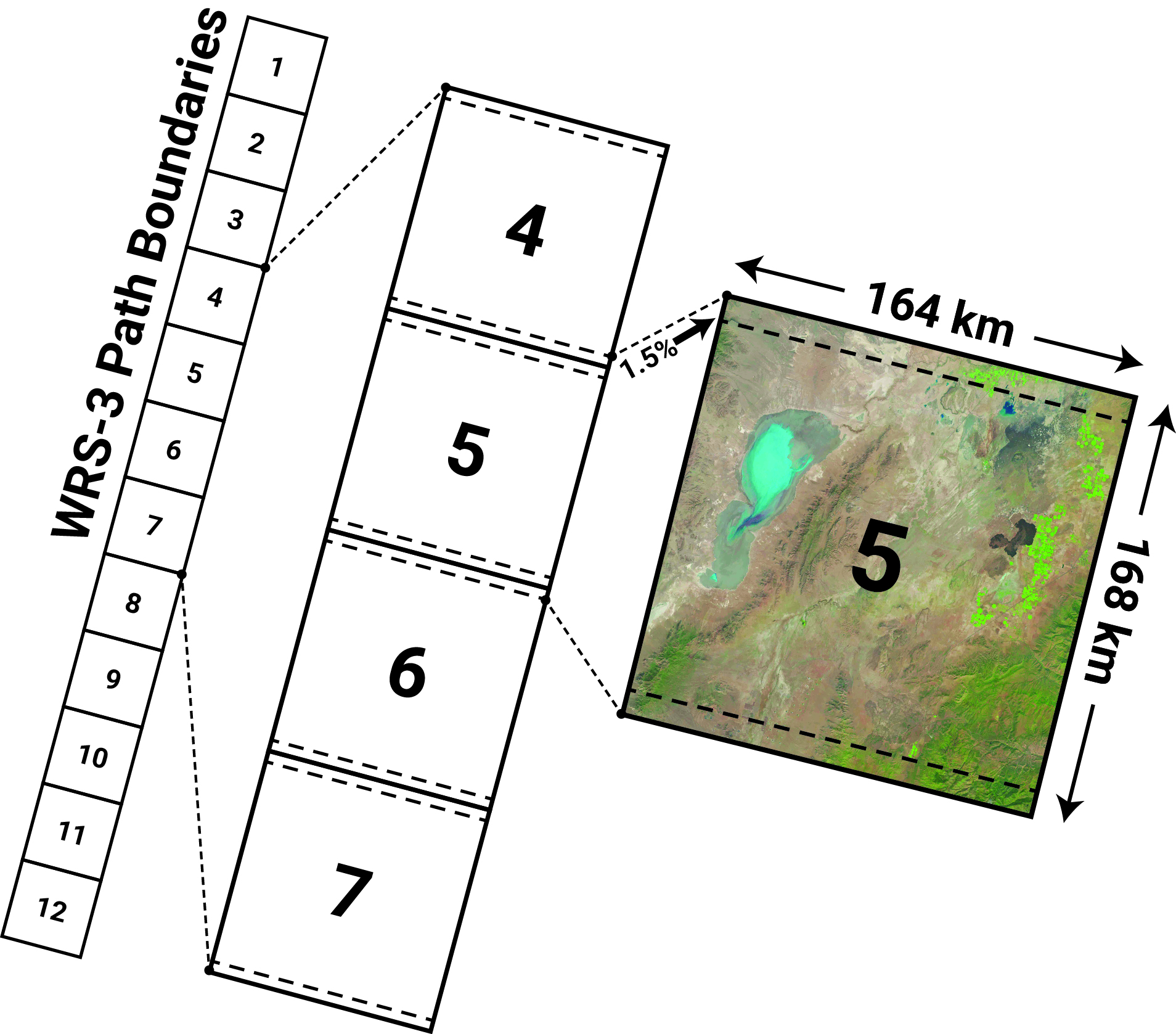
The Worldwide Reference System 3 (WRS-3) is a new global grid reference system established to catalog and distribute scenes for the Landsat 10 mission and accommodate a repeating ground track and revised global revisit cycle. Preserving the previous global reference system and heritage view angle geometry was considered less critical to the overall Landsat 10 mission architecture, since science applications are increasingly moving from scene- to pixel-based analysis using BRDF-normalized data.
Under WRS-3, global acquisitions will be completed in 265 orbits (or paths), compared to the 233 orbits associated with WRS-2. The orbits are numbered sequentially with path numbers increasing from east to west. The row indexing system will be the same as WRS-2, with the orbital paths being segmented into 248 equally spaced scene centers based on lines of latitude, but the swath size will be slightly narrower. The rows are indexed so that the numbers of the descending (daytime) path increase in the along-track direction.
The number of unique ground tracks means that adjacent tracks are approximately 151 kilometers (94 miles) apart at the equator. Therefore, the minimum swath width, after adding 10 kilometers for ground track error and 3 kilometers for margin, is 164 kilometers (102 miles). The along-track scene length, which includes a combined 3% in-track overlap with adjacent scenes, is 168 kilometers (104 miles).