


Landsat 5
Originally designed for a three-year mission, Landsat 5 far exceeded expectations by operating for nearly 30 years. It became one of the most important environmental monitoring satellites in history, creating a record-breaking archive of Earth observations.
Mission Objective
Partners
LaunchED
Decommissioned
| Quick Facts | |
|---|---|
| Sensors: TM, MSS | Spatial Resolution: 30 meters (VNIR), 120 meters (thermal) |
| Spectral Resolution: 7 bands | Temporal Resolution: 16 days |
| Image Data: 147 scenes/day | Scene size: 170 km (106 mi) x 183 km (114 mi) |
| Swath Width: 183 km (114 mi) | Global Reference Grid System: WRS-2 |
| Altitude: 705 km (438 mi) | Inclination: 98.2 degrees |
| Orbit: Polar, sun-synchronous | Equatorial Crossing Time: Nominally 9:45 am ± 15 minutes local time (descending node) |
| Period of Revolution: 99 minutes; ~14.5 orbits/day | Design Life: 3 years |
Overview
Launched on March 1, 1984, Landsat 5 became one of the most productive Earth-observing satellites ever flown. Together, its Thematic Mapper (TM) and Multispectral Scanner System (MSS) instruments collected approximately 3.8 million scenes, delivering continuous, calibrated observations for nearly 29 years. Landsat 5’s multispectral data enabled researchers to track agricultural expansion, monitor water resources, map natural disasters, and document urban growth worldwide. It captured both natural and human-driven land change during a period when the global population grew from under 5 billion to more than 7 billion.
Landsat 5 operated in concert with Landsat 4 for its first decade and with Landsat 7 for its final 14 years. By serving as a bridge between two other vital Landsat missions, Landsat 5 increased the amount of data available to users, supported cross-calibration between sensors, and ensured a continuous record of Earth’s land surface.
Landsat 5 was decommissioned on June 5, 2013 after operating nearly 10 times longer than its planned three-year design life. To this day, its record remains an essential resource for understanding long-term trends of environmental change.
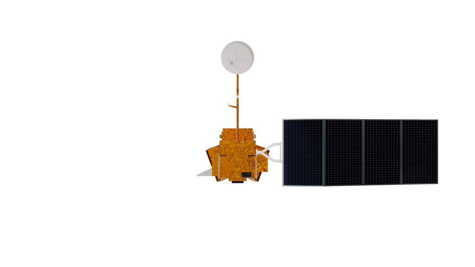
Spacecraft
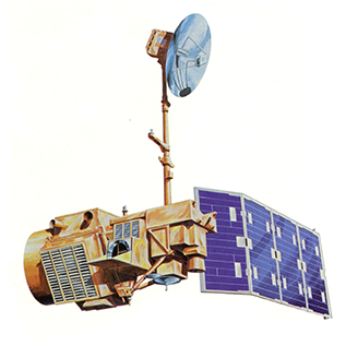
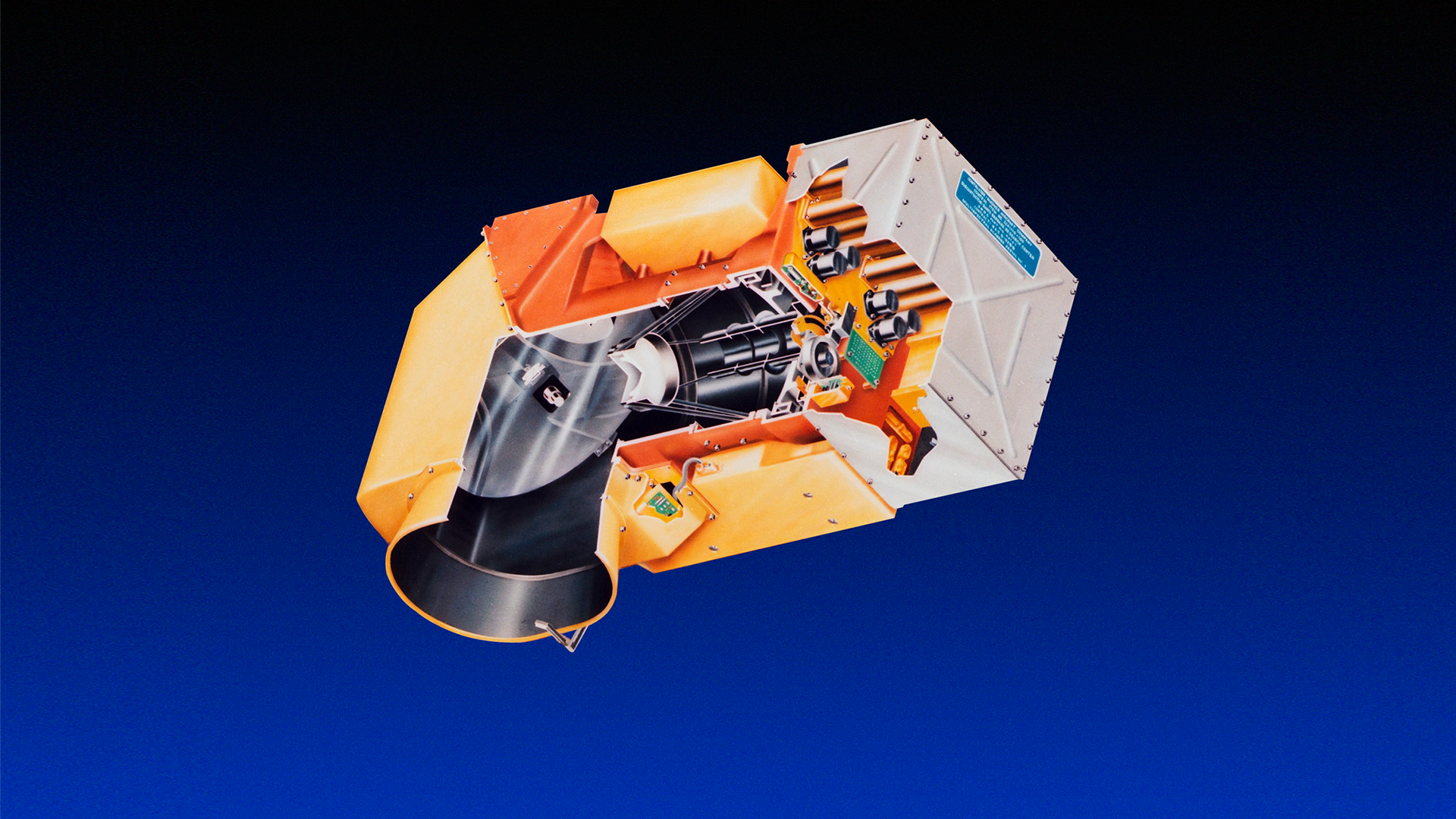
Landsat 5 was designed and built alongside Landsat 4 and carried the same payload: the Multispectral Scanner System (MSS) and the Thematic Mapper (TM). Its spacecraft bus followed the Multimission Modular Spacecraft (MMS) design used for Landsat 4 but incorporated upgrades for longer-term reliability, including a 3-axis stabilization system with gyroscopes for redundancy, a hydrazine propulsion system for orbit control, and a Ku-band antenna (mounted on a 12.5-foot boom) for high-bandwidth data transmission to the tracking and data relay satellite system (TDRSS).
When first built, Landsat 5 was named Landsat D-prime and placed in storage for Landsat 4’s first two years of operation. The spacecraft was launched in 1984 as Landsat 5.

Thematic Mapper (TM)
The Thematic Mapper (TM) was the primary sensor aboard Landsat 5 and its design was identical to Landsat 4’s TM. It collected data in seven bands: three visible, one near-infrared, two shortwave-infrared, and one thermal-infrared. These bands maintained data continuity with Landsat 4 acquisitions and allowed scientists to detect subtle variations in surface materials, vegetation health, and temperature.
In November 2011, the TM failed due to an electronic problem that could not be repaired.
Band 1: Visible Blue (0.45 - 0.52 µm)
Band 2: Visible Green (0.52 - 0.60 µm)
Band 3: Visible Red (0.63 - 0.69 µm)
Band 4: Near-infrared (0.76 - 0.90 µm)
Band 5: Shortwave-infrared (1.55 - 1.75 µm)
Band 6: Thermal-infrared (10.40 - 12.50 µm)
Band 7: Shortwave-infrared (2.08 - 2.35 µm)
Spatial Resolution: 30 m (VMIR), 120 m (thermal)
Scene size: 170 km x 185 km (106 mi x 115 mi)
Radiometric Resolution: 8-bit
Multispectral Scanner System (MSS)
The Multispectral Scanner System (MSS) was added to Landsat 5 as a backup instrument and provided a valuable continuity link to earlier Landsats. It captured imagery in four spectral bands with 80-meter resolution, suitable for vegetation, soil, and land cover studies.
MSS operations were suspended in 1995 after the TM took over primary imaging duties. Following the failure of the TM in 2011, the MSS was reactivated and resumed collecting data over the U.S.
Band 4: Visible Green (0.5 – 0.6 µm)
Band 5: Visible Red (0.6 – 0.7 µm)
Band 6: Near-infrared (0.7 – 0.8 µm)
Band 7: Near-infrared (0.8 – 1.1 µm)
Spatial Resolution: 80m (commonly resampled to 60 m)
Ground Sampling Interval (pixel size): 57 m x 79 m
Scene size: 170 km x 185 km (106 mi x 115 mi)
Radiometric Resolution: 6-bit (delivered as 8-bit unsigned integers)
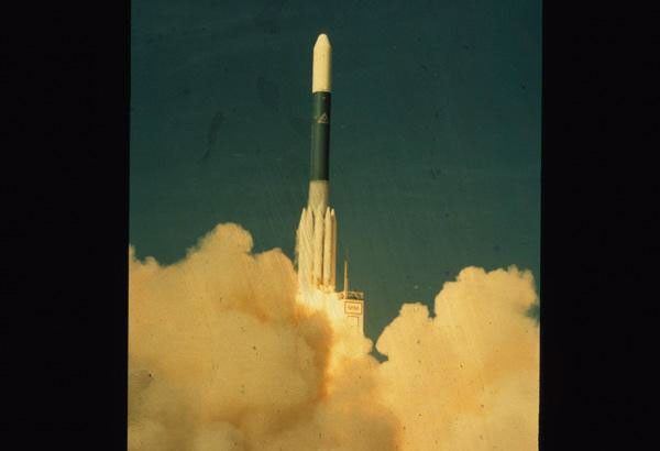
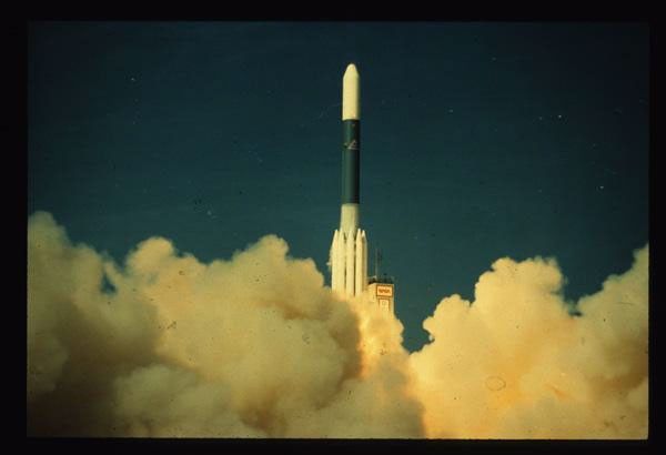
March 6, 1984
First Light
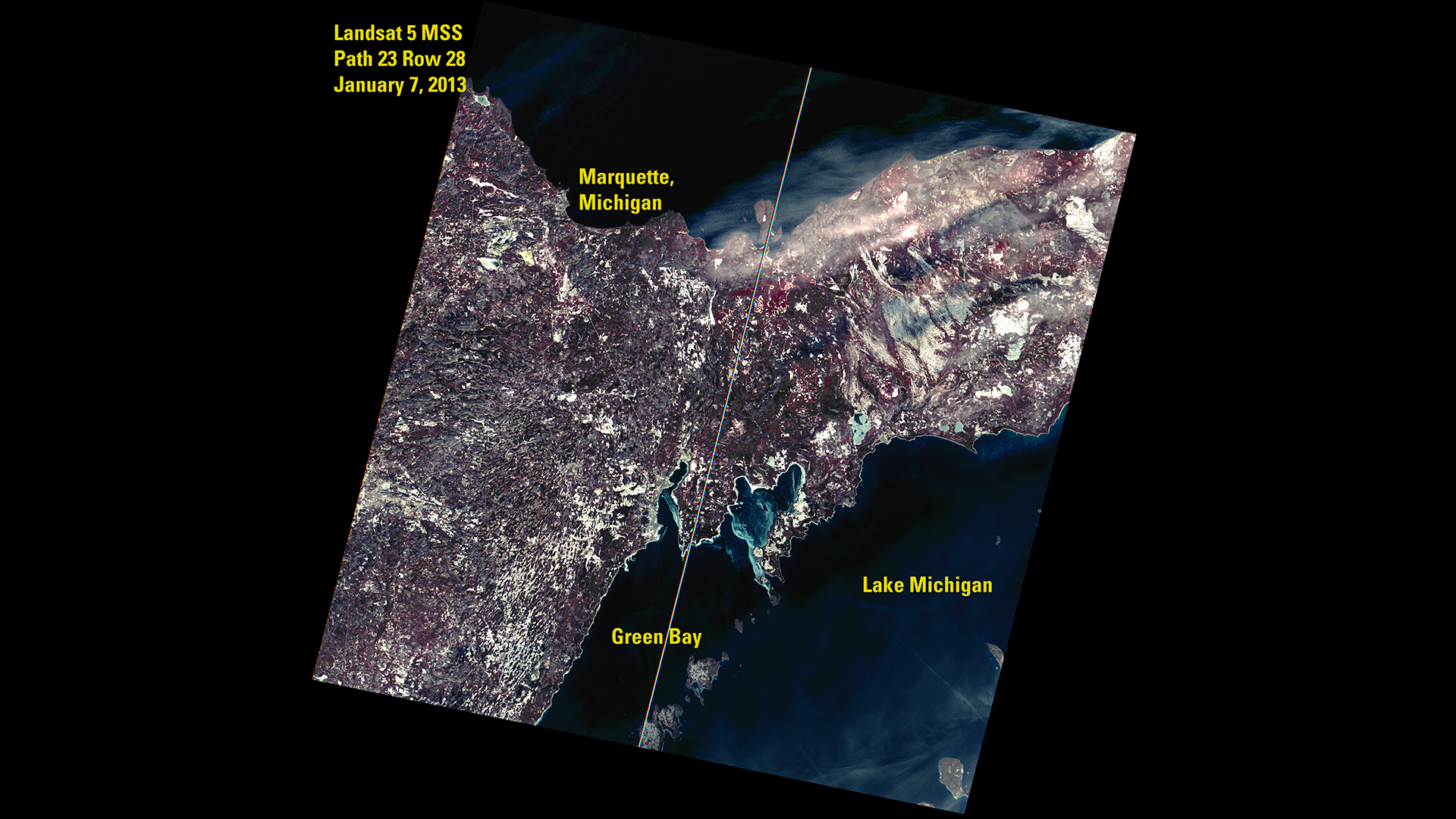
Lake Superior
One of the first clear images acquired by Landsat 5 shows icy Lake Superior, northern Minnesota, and Wisconsin’s Apostle Islands. The Thematic Mapper (TM) collected the image on March 6, 1984, just five days after launch. A combination of near-infrared, red, and green bands (4-3-2) help distinguish ice from surrounding land features.
Learn MoreMission Objectives
-
• Provide continuing Earth remote sensing information and encourage continued national and international participation in land remote sensing programs.
• Assess the capabilities of the new Thematic Mapper sensing system and to exploit new areas of the infrared and visible light spectrum at higher resolution.
• Establish a technical and operational proficiency which can be used to help define the characteristics necessary for potential future operational land remote sensing systems.
Mission Results
-
Data Collection
Landsat 5 acquired close to 4 million scenes during its lifetime—2,925,827 TM scenes and 944,446 MSS scenes—making it the most productive Earth observation satellite of its time.
Its extended operations provided uninterrupted multispectral coverage, enabling detailed long term analysis of environmental and land surface changes. A density map showing the distribution of the total 3,870,273 MSS and TM scenes acquired and archived during the lifetime of the Landsat 5 mission. The colors represent the number of products per Path/Row.USGS
 -
A Record-breaking Satellite
Landsat 5 holds a Guinness World Record for the longest-operating Earth observation satellite mission in history.
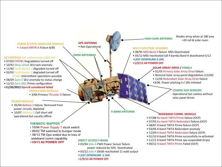
An abundance of fuel and superior spacecraft design contributed to the longevity of the mission. Landsat 5 was built with a large auxiliary fuel tank, originally intended to allow the satellite to maneuver to a lower orbit for on-orbit repairs. However, the satellite-repairing shuttle program never materialized. Mission operators used the spacecraft’s significant reserves of fuel to extend Landsat 5’s operational life for decades.
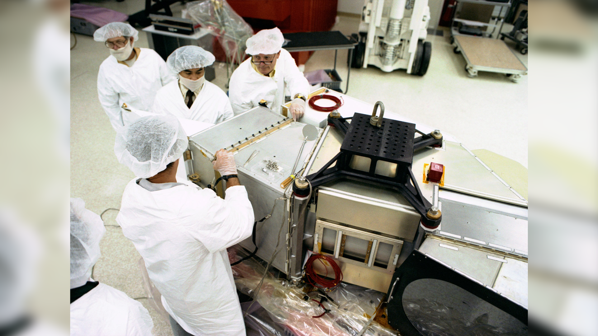
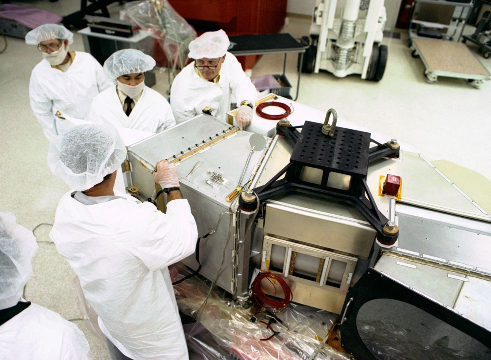
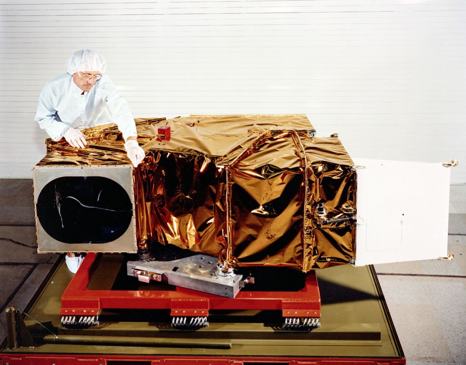
Additionally, critical components onboard were built with redundancies to sustain operations if an element failed. After a 2009 spacecraft anomaly, these redundancies allowed Landsat 5 to continue downlinking data to a global network, making the satellite an exemplar of mission resilience and data continuity.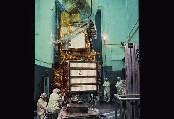 Landsat 5 instrument and spacecraft integration.USGS
Legacy
-
Program Continuity
Landsat 5 provided critical continuity in Earth observation during a period when follow-on missions faced delays or setbacks. After Landsat 6 failed to reach orbit in 1993, Landsat 5—already six years past its design life—continued its uninterrupted data collection, preventing a potential gap in the long-term record of land change. Operating alongside Landsat 4 and later alongside Landsat 7, its nearly 29 years of service solidified the Landsat program as the foundation of continuous, calibrated, multi-decadal land monitoring.
-
Operational Lessons
Landsat 5’s long operational life provided a unique opportunity to study how aging hardware performs in space and to develop strategies for maintaining continuous Earth observation despite system failures. With innovative workarounds and international support, engineers adapted to transmitter anomalies and spacecraft control problems. For example, when the primary Ku-band Tracking and Data Relay Satellite System (TDRSS) transmitter failed in 1988 and the backup transmitter failed in 1992, engineers averted a total loss of global downlink capability by leveraging an EOSAT antenna in Oklahoma to maintain coverage over the lower 48 states.
The TM took over as the primary instrument after the MSS was turned off in August 1995 due to the failure of band 4 (near-infrared). When the TM failed in 2012, the MSS was turned back on and new ground processing methods were implemented to recover additional MSS observations. Developing these solutions in real time informed mission planning, ground operations, and instrument redundancy that continue to benefit Earth-observing missions today.
Project and program management

Vincent Salomonson
Landsat 5 Project Scientist

Darrel Williams
Landsat 5 Deputy Project Scientist
Landsat 5 saved the Landsat program. This satellite’s longevity preserved the Landsat program through the loss of Landsat 6 in 1993, preventing the specter of a data gap before the launch of Landsat 7 in 1999.
Jim irons
Former Landsat 8 Project Scientist
The First 25 Years of Landsat 5
Landsat 5 operated more than two decades beyond its planned mission lifetime. During that time, it charted urban growth in Las Vegas, monitored fire scars in Yellowstone National Park, and tracked the retreat of a Greenland glacier.
ExploreLandsat 5 Graphics Library


-resize.jpg?w=600&h=582&fit=clip&crop=faces%2Cfocalpoint)

Related Resources
Explore additional Landsat 5 resources for more background information about the development, history, and results of the mission.


