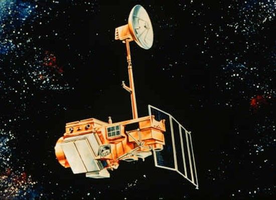
Landsat 6
Landsat 6 was the only commercial launch of the Landsat program. Its failure to achieve orbit provided valuable operational lessons for Landsat 7 and beyond.
Mission Objective
Partners
LaunchED
Mission END
Overview
Landsat 6 was envisioned to build on the legacy of Landsats 4 and 5. Its improved data was to broaden the user base and enhance the study of applications including environmental monitoring, natural resource exploration, and urban planning. However, on October 5, 1993, Landsat 6 failed to achieve orbit.
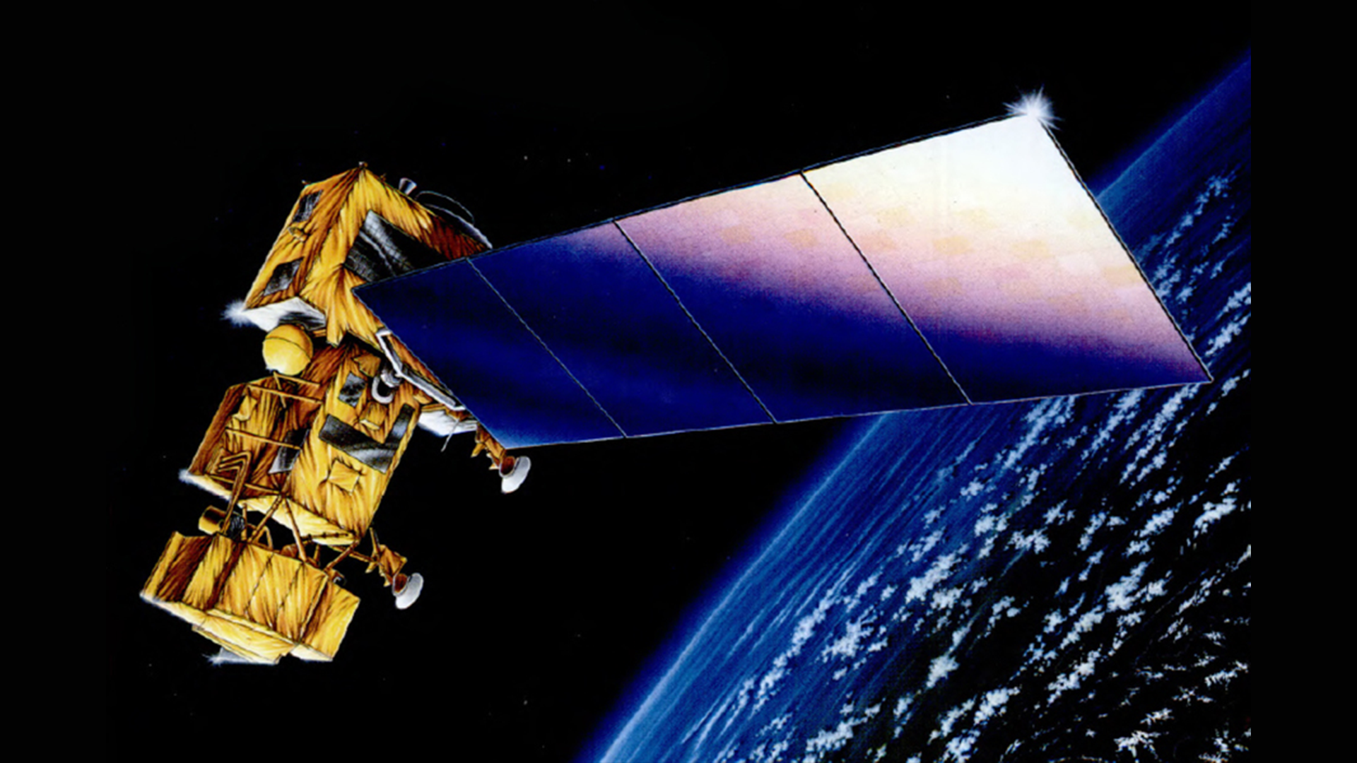
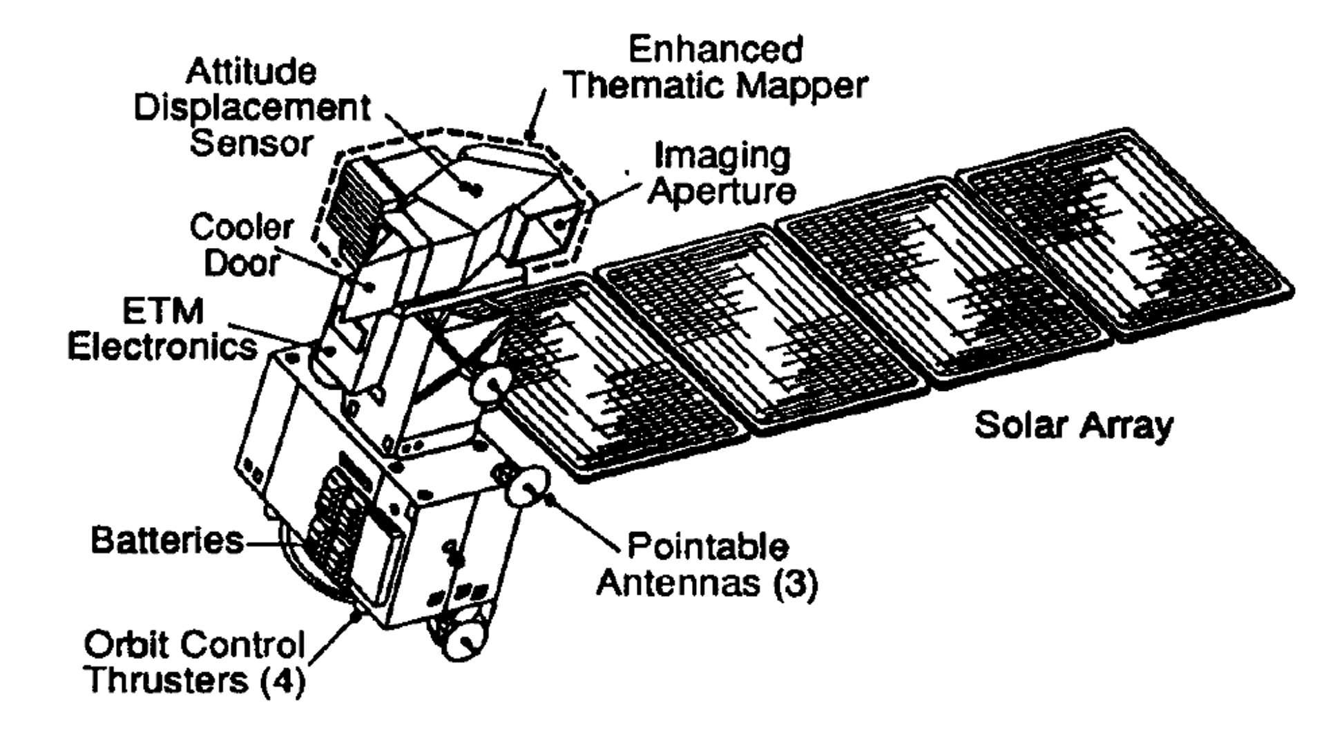
The spacecraft was developed and owned by Earth Observation Satellite Company (EOSAT), making it the only commercial launch in the Landsat program’s history. The satellite was the first in the Landsat series to carry only one remote sensing instrument. The Enhanced Thematic Mapper (ETM) was an improved version of the Thematic Mapper (TM) on Landsats 4 and 5, featuring a new 15-meter panchromatic band.
| Planned Specifications | |
|---|---|
| Sensors: ETM | Spatial Resolution: 30 meters (VNIR and SWIR), 15 meters (panchromatic), 120 meters (thermal) |
| Spectral Resolution: 8 bands | Temporal Resolution: 16 days |
| Scene Size: 170 km (106 mi) x 183 km (114 mi) | Swath Width: 183 km (114 mi) |
| Global Reference Grid System: WRS-2 | Altitude: 705 km (448 mi) |
| Inclination: 98.2 degrees | Orbit: Near-polar, sun-synchronous |
| Equatorial Crossing Time: Nominally 9:45 am ± 15 minutes local time (descending node) | Period of Revolution: 99 minutes; ~14.5 orbits/day |
| Design Life: 5 years |
Lessons Learned from Landsat 6
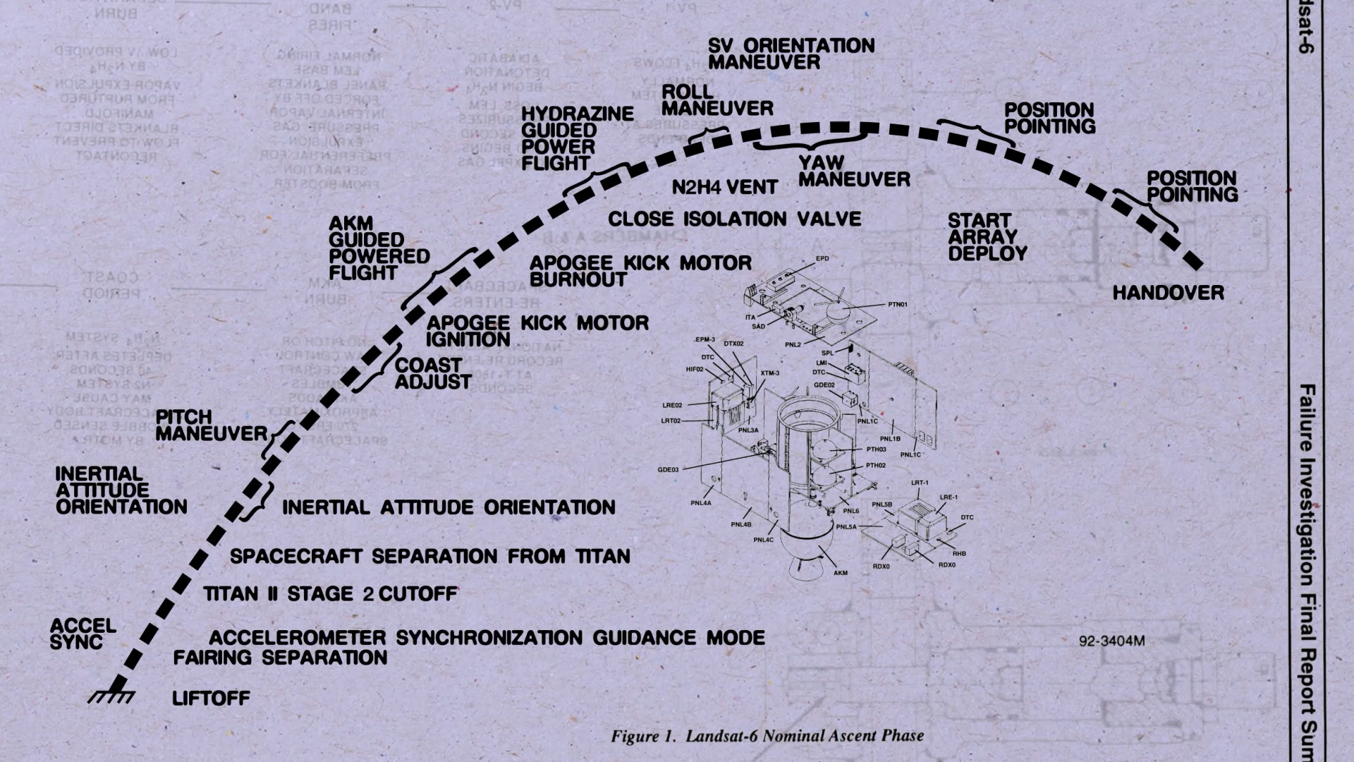
After Landsat 6 failed to achieve orbit on October 5, 1993, NOAA convened a review board to analyze what had gone wrong. NOAA worked alongside the Martin Marietta Corporation, who built the satellite. Through separate investigations, the boards reached the same conclusion: the spacecraft separated from the booster at the appropriate time and location, but encountered problems during the apogee kick motor (AKM) burn, the final step to get the satellite into its proper orbit. The problem, NOAA determined, was a ruptured hydrazine manifold that prevented fuel from reaching the engines. Without fuel, the satellite was unable to maintain attitude control during the AKM burn. Instead, the spacecraft tumbled and lacked the energy to achieve orbit.
To prevent similar issues occurring in the future, NOAA and the Martin Marietta Corporation recommended a task force to study how to build safer hydrazine fuel systems.
Landsat 6: Why Space is Hard
Working in space is really hard. Landsat 6 never made it to orbit, an important reminder that failures can be opportunities to learn and grow. Shortly after the unsuccessful launch, engineers got to work on Landsat 7, which collected data for over 25 years.
Learn MoreSpacecraft
Landsat 6 was the first mission to carry only one remote sensing instrument: the Enhanced Thematic Mapper. The spacecraft lost contact with ground stations shortly after launch. The satellite did not achieve orbit because of a ruptured hydrazine manifold, which prevented the fuel from reaching an apogee kick motor.
The Landsat 6 spacecraft, built by GE Astro Space, was based on RCA's Advanced TIROS-N/DMSP spacecraft design.
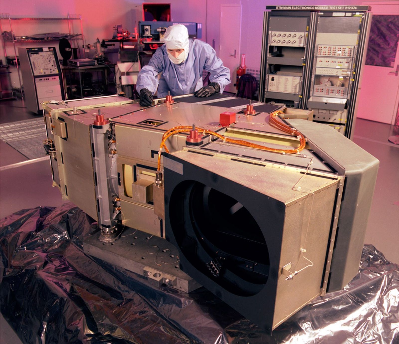
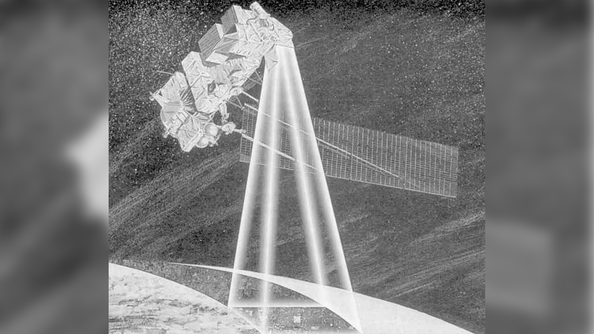
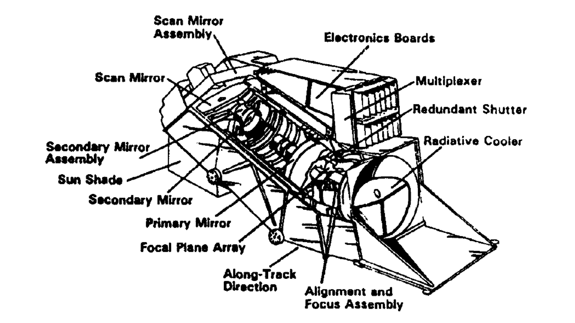
Enhanced Thematic Mapper (ETM)
The ETM sensor is a scanning optical radiometer and would have collected data in the same seven spectral bands and at the same spatial resolutions as the Thematic Mapper (TM) on Landsats 4 and 5. It added a 15-meter panchromatic band. It was designed and built by Santa Barbara Research Center, a unit of GM Hughes Electronics.
Band 1: Visible Blue (0.45 - 0.52 µm)
Band 2: Visible Green (0.52 - 0.60 µm)
Band 3: Visible Red (0.63 - 0.69 µm)
Band 4: Near-infrared (0.76 - 0.90 µm)
Band 5: Near-infrared (1.55 - 1.75 µm)
Band 6: Thermal-infrared (10.40 - 12.50 µm)
Band 7: Mid-infrared (2.08 - 2.35 µm)
Band 8: Panchromatic (0.52 - 0.90 µm)
Spatial resolution: 30 m (VNIR), 15 m (panchromatic), 120 m (thermal)
Data: 8-bit integers
.png?w=1920&h=1080&fit=clip&crop=faces%2Cfocalpoint)
Mission Objectives
-
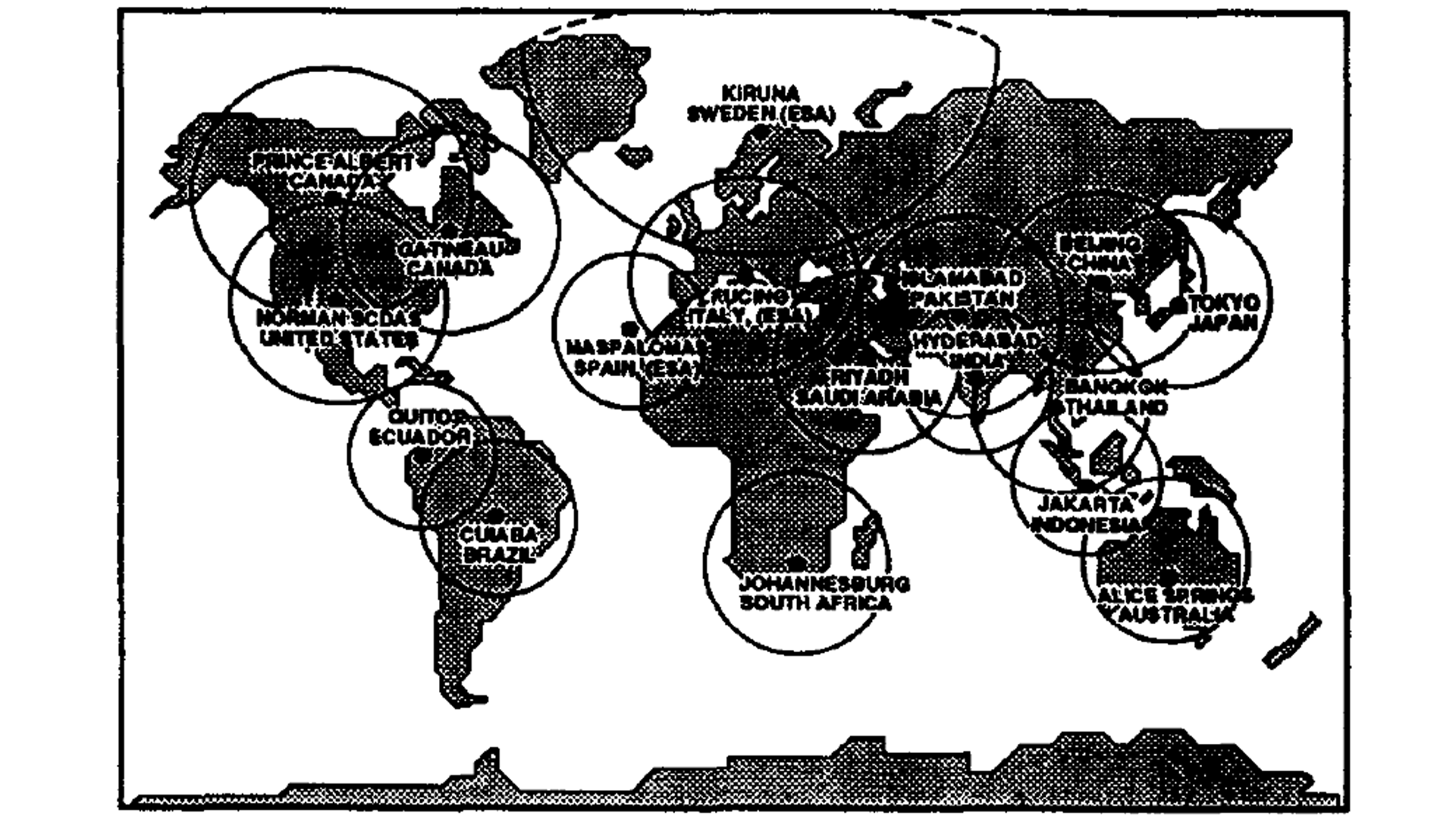
Global Coverage
Provide the repetitive global coverage necessary to support both domestic and international image data applications.
-
Data Quality
Deliver image data quality equal to or better than that obtained with the present on-orbit assets.
-
Mission Longevity
Achieve a five-year mission life.
Era of Privatization
Landsat 6 was the first satellite in the series launched when operations were privatized. In 1984, nine years before Landsat 6’s launch, the Land Remote Sensing Commercialization Act determined that land satellites could be privatized. NOAA, the agency in charge of all Landsat operations, selected Earth Observation Satellite Company (EOSAT) as the commercial vendor for Landsat data. EOSAT was a joint venture partnership of the General Electric Company and Hughes Aircraft Company.
EOSAT took over Landsat 4 and 5 operations, assuming responsibility for archiving, collecting, and distributing the data. They also set out to build, launch, and operate Landsat 6 and 7 with government subsidies. Even before Landsat 6’s failure at launch, EOSAT faced struggles as sales of Landsat data never reached predicted levels. NOAA and then EOSAT restricted distribution of Landsat images and raised prices from $650 to a high of $4400 per scene. This 600% price increase priced out many data users, who began to rely on free, low-resolution land data from meteorological satellites. In 1986, a French Landsat-like satellite launched, breaking the U.S. monopoly on moderate resolution land data.
Landsat’s coverage and quality standards suffered during the commercialization era. Instead of collecting global data between 1984 and 1999, Landsats 4 and 5 focused only on locations where there was an obvious buyer, leading to gaps in the coverage. Data quality practices like calibration and characterization also degraded in this period.
By 1989, with two aging satellites and no operational budget, NOAA directed EOSAT to turn off the satellites. It appeared that a gap in Landsat’s data record was imminent. Facing strong protest from congress and data users, U.S. Vice President and Chairman of the National Space Council Dan Quayle intervened and saved the program. He ensured that Landsats 4 and 5 would remain operational until the launch of the next satellite.
Congress passed the Land Remote Sensing Policy Act of 1992, which instructed Landsat Program Management to build a government-owned Landsat 7. In 2001, two years after the launch of Landsat 7, Space Imaging (formerly EOSAT) returned Landsat 4 and 5 operations to the U.S. government. Space Imaging relinquished their commercial right to Landsat data, enabling the USGS to sell all Landsat 4 and Landsat 5 data at $425 per scene.
Project and Program Management
E. Moule
Project Manager,
Earth Observation Satellite (EOSAT)
David Fischel
Project Scientist,
Earth Observation Satellite (EOSAT)
Related Resources

The Landsat-6 Satellite: An Overview
This paper outlines the Landsat system, key Landsat 6 mission requirements, and the design of its Enhanced Thematic Mapper and spacecraft subsystems.
The Landsat Sensors: EOSAT’s plans for Landsats 6 and 7
This paper summarizes the design and enhancements of the Enhanced Thematic Mapper sensors for Landsats 6 and 7, including new panchromatic, thermal, and potential advanced sensor options.
NOAA Landsat 6 Failure Investigation Report
This report published in 1995 details the investigation conducted by NOAA following the failed launch of the Landsat 6 spacecraft.